Barnardsville, North Carolina

Last updated

Barnardsville
Barnardsville, North Carolina (circa 1921).jpg
Barnardsville, circa 1921
USA North Carolina location map.svg
Red pog.svg
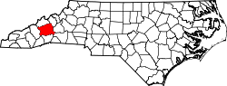
Barnardsville
Location within the state of North Carolina
Usa edcp location map.svg
Red pog.svg
Barnardsville
Barnardsville (the United States)
Coordinates: 35°46′55″N82°27′20″W / 35.78194°N 82.45556°W / 35.78194; -82.45556
CountryUnited States
State North Carolina
County Buncombe
Area
[1]
  Total
3.53 sq mi (9.14 km2)
  Land3.53 sq mi (9.14 km2)
  Water0.00 sq mi (0.00 km2)
Elevation
[2]
2,339 ft (713 m)
Population
 (2020)
  Total
559
  Density158.40/sq mi (61.16/km2)
Time zone UTC-5 (Eastern (EST))
  Summer (DST) UTC-4 (EDT)
ZIP code
28709 [3]
Area code 828
GNIS feature ID2812779 [2]

Barnardsville is an unincorporated community and census-designated place (CDP) in Buncombe County, North Carolina, United States. [2] It was first listed as a CDP in the 2020 census with a population of 559. [4]

Contents

Located on Ivy Creek, the settlement is part of the Asheville Metropolitan Statistical Area.

History

Barnard's Inn was established at the settlement by Hezekiah and Hester Barnard in the early 1800s. [5]

A post office was established in 1875. [6]

Barnardsville incorporated in 1959, and established its own police force and fire department. The town dissolved its incorporation in 1965 for financial reasons. [6] [7]

Community

Located at the settlement is an elementary school, a restaurant, a post office, many churches, and the Big Ivy Community Center, where Mountain Heritage Day is celebrated on the first Saturday of October.

Demographics

Historical population
CensusPop.Note
2020 559
U.S. Decennial Census [8]
2020 [9]

2020 census

Barnardsville CDP, North Carolina – Demographic Profile
(NH = Non-Hispanic)
Race / EthnicityPop 2020 [9] % 2020
White alone (NH)50189.62%
Black or African American alone (NH)30.54%
Native American or Alaska Native alone (NH)00.00%
Asian alone (NH)20.36%
Pacific Islander alone (NH)00.00%
Some Other Race alone (NH)101.79%
Mixed Race/Multi-Racial (NH)305.37%
Hispanic or Latino (any race)132.33%
Total559100.00%

Note: the US Census treats Hispanic/Latino as an ethnic category. This table excludes Latinos from the racial categories and assigns them to a separate category. Hispanics/Latinos can be of any race.

References

  1. "ArcGIS REST Services Directory". United States Census Bureau. Retrieved September 20, 2022.
  2. 1 2 3 U.S. Geological Survey Geographic Names Information System: Barnardsville, North Carolina
  3. "Barnardsville NC ZIP Code". zipdatamaps.com. 2023. Retrieved February 17, 2023.
  4. "Barnardsville CDP, North Carolina". United States Census Bureau . Retrieved April 7, 2022.
  5. Ruscin, Terry (2016). A History of Transportation in Western North Carolina: Trails, Roads, Rails and Air. Arcadia. ISBN   978-1-4396-5824-6.
  6. 1 2 Powell, William S.; Hill, Michael (2010). The North Carolina Gazetteer, Second Edition. University of North Carolina Press. p. 25. ISBN   978-0-8078-9829-1.
  7. Lawrence, Brian (2014). Firefighting in Buncombe County. Arcadia. p. 31. ISBN   978-1-4396-4690-8.
  8. "Decennial Census of Population and Housing by Decades". US Census Bureau.
  9. 1 2 "P2 HISPANIC OR LATINO, AND NOT HISPANIC OR LATINO BY RACE – 2020: DEC Redistricting Data (PL 94-171) – Barnardsville CDP, North Carolina". United States Census Bureau .