Related Research Articles
Thornfield is an unincorporated community in Ozark County, Missouri, United States. It is located 15 miles (24 km) northwest of Gainesville, on Route 95 at the Little North Fork of the White River on the edge of the Mark Twain National Forest between Wasola to the northeast and Longrun to the southwest. Hammond, the site of the historic Hammond Mill, lies on the Little North Fork 2.5 miles (4.0 km) southeast of Thornfield. Thornfield has a post office with ZIP code 65762.
Burris Fork Township is an inactive township in Moniteau County, in the U.S. state of Missouri.
Barren Fork is a tributary of the Eleven Point River in Oregon County in the Ozarks of southern Missouri.
Mill Creek is a stream in Oregon County in the Ozarks of southern Missouri. It is a tributary of Barren Fork.
Althea is an extinct town in eastern Ozark County, in the Ozarks of southern Missouri, United States. The GNIS classifies it as a populated place. The location is on the North Fork River at the crossing of Missouri Route H, at an elevation of 623 feet. It is approximately five miles northeast of Tecumseh.
Dillia is an extinct town in Ozark County, in the U.S. state of Missouri. The GNIS classifies it as a populated place. However, the location coordinates place it within the waters of Bull Shoals Lake on the Barren Fork Branch of the Little North Fork White River, approximately four miles south-southeast of the Hammond mill site and four miles northeast of Theodosia.
Locust is an unincorporated community in Ozark County, Missouri, United States. The community is located on South Fork Bratten Spring Creek, approximately one mile east of a northeast arm of Bull Shoals Lake. Access is via a county road south from U.S. Route 160, southwest of Gainesville.
Pondfork is an unincorporated community in northwest Ozark County, Missouri, United States. Pondfork lies on the Hay Hollow tributary to Pond Fork Creek, which lies to the west. The community is approximately three miles west-southwest of Thornfield. Access is via Missouri Route D, from Missouri Route 95 to the southeast. Pondfork lies within the Mark Twain National Forest.
Thuroy is an unincorporated community in Ozark County, Missouri, United States. The village was located on a northward-flowing tributary to Barren Creek, approximately one-half mile from the Missouri-Arkansas border and Missouri State Highway 101. Bakersfield is about four miles to the northeast. Barren Creek flows into Norfork Lake in Arkansas, approximately four miles to the southwest.
Big Creek Township is an inactive township in Ozark County, in the U.S. state of Missouri.
Dawt Township is an inactive township in Ozark County, in the U.S. state of Missouri.
Jackson Township is an inactive township in Ozark County, in the U.S. state of Missouri.
Lick Creek Township is an inactive township in Ozark County, in the U.S. state of Missouri.
Longrun Township is an inactive township in Ozark County, in the U.S. state of Missouri.
Richland Township is an inactive township in Ozark County, in the U.S. state of Missouri.
Spring Creek Township is an inactive township in Ozark County, in the U.S. state of Missouri.
Thornfield Township is an inactive township in Ozark County, in the U.S. state of Missouri.
Bayou I Township is an inactive township in Ozark County, in the U.S. state of Missouri.
Bayou II Township is an inactive township in Ozark County, in the U.S. state of Missouri.
Pontiac Township is a township in Ozark County, in the U.S. state of Missouri.
References
- ↑ U.S. Geological Survey Geographic Names Information System: Barren Fork Township, Ozark County, Missouri
- ↑ "Ozark County Place Names, 1928–1945". The State Historical Society of Missouri. Archived from the original on June 24, 2016. Retrieved November 27, 2016.
Municipalities and communities of Ozark County, Missouri, United States | ||
|---|---|---|
| City |  | |
| Villages | ||
| Townships | ||
| CDPs | ||
| Other communities | ||
| Ghost towns | ||
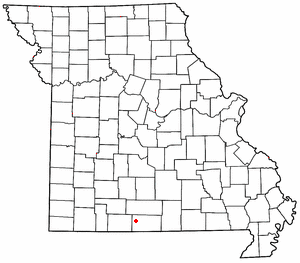
36°43′44″N92°30′12″W / 36.7289°N 92.5033°W
| | This Ozark County, Missouri state location article is a stub. You can help Wikipedia by expanding it. |