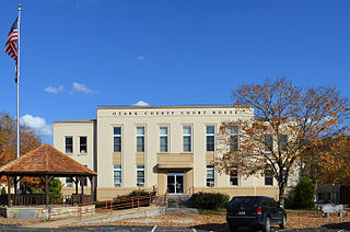
Ozark County is a county in the southern portion of the U.S. state of Missouri. As of the 2020 census, the population was 8,553. The largest city and county seat is Gainesville. The county was organized as Ozark County, named after the Ozark Mountains, on January 29, 1841. It was renamed Decatur County, after Commodore Stephen Decatur, from 1843 to 1845, after which the name Ozark County was restored.
Udall is an unincorporated community in the Bayou I Township of Ozark County, in southern Missouri, United States, located approximately 12 miles southeast of Gainesville and eight miles west of Bakersfield on Missouri Route O. One and one-half miles west of Udall, the road ends at a park and landing on Norfork Lake.
Almartha is an unincorporated community in northern Ozark County, Missouri, United States. It is located approximately thirteen miles north of Gainesville and four miles southeast of Wasola on Route 95. The village is located in a valley on a tributary of Spring Creek. Several homes are located there. The old mill and current fish hatchery of Rockbridge lies downstream on Spring Creek, about six miles to the east.
Isabella is an unincorporated community in Ozark County, Missouri, United States. It is located approximately thirteen miles west of Gainesville and two miles east of Theodosia and Bull Shoals Lake along U.S. Highway 160. Isabella has a post office with the ZIP code 65676.
Tecumseh is an unincorporated community in eastern Ozark County in southern Missouri, United States. It is located on the North Fork River at the north end of Norfork Lake, approximately ten miles east of Gainesville and 32 miles west of West Plains on U.S. Highway 160. Tecumseh has a post office with ZIP code 65760.

Sycamore is an unincorporated community in eastern Ozark County in the Ozarks of southern Missouri, United States. It is located on Route 181, approximately fourteen miles northeast of Gainesville. The old townsite is located on a ridge on the west side of Bryant Creek, a major tributary of the North Fork River. The old Hodgson Mill and spring lie on Bryant Creek 0.8 mi (1.3 km) to the northeast. The mill was nominated to the National Register of Historic Places as Aid-Hodgson Mill in 2001.
Souder is an unincorporated community on Spring Creek in northern Ozark County, Missouri, United States. It is thirteen miles north of Gainesville and is located on county road 142, north of Route 95.
Romance is an unincorporated community in Ozark County, Missouri, United States. It is located approximately nine miles north of Gainesville. Romance is located in a valley at the confluence of two smaller streams with Ludecker Creek. It lies on state route Y, 2 miles (3.2 km) east of Missouri Route 5 and 2.3 miles (3.7 km) north of Willhoit. The Romance fire tower sits atop a knob at 1,490 feet (450 m), about 2.5 miles east.
Noble is a small unincorporated community in Ozark County, Missouri, United States. It is located on a ridge along Route A, one mile west of Route 5 and twelve miles northwest of Gainesville.

Howards Ridge is an unincorporated community in southeastern Ozark County in the southern Missouri Ozarks, United States. It is located seven miles southeast of Gainesville and 2.15 miles north of the Arkansas border, at the intersection of Ozark County routes J and T. The community is at an elevation of 880 feet and lies two and a half miles west of Norfork Lake.
Hardenville is an unincorporated community in eastern Ozark County in southern Missouri, United States. It is located on U.S. Highway 160, approximately five miles east of Gainesville and five miles west of Tecumseh, which is at the north end of Norfork Lake. The community is located on an Ozark ridge at an elevation of 963 feet (294 m).
Dora is an unincorporated community in Ozark County, in the U.S. state of Missouri. The ZIP Code for Dora is 65637.
Foil is an unincorporated community in northern Ozark County, Missouri, United States. It is located approximately sixteen miles south of Ava on county roads 953 and 955. Wasola is about four miles northeast on Missouri Route 5 and Thornfield approximately three miles southwest on Missouri Route JJ. The community is on the banks of Little Creek, a tributary of Little North Fork White River.
Elijah is an unincorporated community in eastern Ozark County, Missouri, United States. It is located approximately twenty-two miles west of West Plains on Missouri Supplemental Route V, one mile south of U.S. Route 160. The community is located on North Bridges Creek, with Spoon Spring within the village.
Toledo is an unincorporated community in Ozark County, in the U.S. state of Missouri. Toledo is located in the valley of the Little North Fork White River, approximately four miles north of Thornfield and Missouri Route 95.
Dawt is an unincorporated community in Ozark County, in the U.S. state of Missouri. Dawt or Dawt Mill is located on the east bank of the North Fork River just north (upstream) of Tecumseh. The Dawt Mill Resort, which offers float trips on the river, is located at the mill.
Fay is an unincorporated community in southeastern Ozark County, in the Ozarks of south-central Missouri, United States. The community is located along Missouri Route J, approximately 2.5 miles south of U.S. Route 160. The Fay Cemetery lies just west of Route J and north of the Lick Creek - Sweeten Creek junction.
Locust is an unincorporated community in Ozark County, Missouri, United States. The community is located on South Fork Bratten Spring Creek, approximately one mile east of a northeast arm of Bull Shoals Lake. Access is via a county road south from U.S. Route 160, southwest of Gainesville.
Oak Mound is an unincorporated community in eastern Ozark County, in the Ozarks of south-central Missouri, United States. The community was located on Bond Ridge and the Oak Mound Cemetery lies adjacent to the south side of Missouri Route KK. The North Fork of the White River lies just over one mile west of the site.
Prestonia is an unincorporated community in Ozark County, Missouri, United States. The Prestonia site lies on a ridge above East Pidgeon Creek and is southwest of Howards Ridge. The Missouri-Arkansas border is approximately one mile to the south and Norfork Lake is about four miles to the east. Access is from Missouri Route J via county road J529.

