Langtang South is a Local Government Area in Plateau State, Nigeria. Its headquarters are in the town of Mabudi.
Oyigbo also known as Obigbo is a Local Government Area located in Rivers State, Nigeria. It is a town, 30 kilometers from the Port city of Port Harcourt, 25km from the city of Aba. It's predominantly inhabited by the Asa people an indigenous Igbo people who are also found in Ukwa west L.G.A in Abia state and the Ndoki people who are also found in Ukwa East L.G.A of Abia state and Ukanafun L.G.A of Akwa ibom state

Yola South is a Local Government Area of Adamawa State, Nigeria.
Ahoada East is a Local Government Area of Rivers State, Nigeria, located northwest of Port Harcourt. Its seat is in the city of Ahoada. Towns in Ahoada East include Odiabidi, Edeoha, Ogbo, Abarikpo, Ihugbogo, etc
Umuahia North is a Local Government Area of Abia State, Nigeria. Its headquarters is in the city of Umuahia.
Kolokuma/Opokuma is a Local Government Area of Bayelsa State, Nigeria. Its headquarters are in the town of Kaiama. Much of the area of the LGA is occupied by the Bayelsa National Forest.

Askira/Uba is a Local Government Area of Borno State, Nigeria. Its headquarters are in the town of Askira.
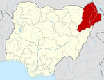
Damboa is a Local Government Area of Borno State, Nigeria. Its headquarters are in the town of Damboa. It has an area of 6,219 km² and had a population of 233,200 at the 2006 census.
Guzamala is a Local Government Area of Borno State, Nigeria. Its headquarters are in the town of Gudumbali. It's located approximately 125 kilometres north of the state capital, Maiduguri. It has an area of 2,517 km2 and a population of 95,648 at the 2006 census.

Hawul is a Local Government Area of Borno State, Nigeria. It's located in the southern part of the state.
Jere is a local government area of Borno State, Nigeria. It has its headquarters in the town of Khaddamari. London ciki is a community in Jere under maimusari ward.
Kaga is a Local Government Area of Borno State, Nigeria. Its headquarters are in the town of Benisheikh.
Kwaya Kusar is a Local Government Area of Borno State, Nigeria. Its headquarters are in the town of Kwaya Kusar.
Magumeri is a Local Government Area of Borno State, Nigeria. Its headquarters are in the town of Magumeri.
Monguno is one of the local government areas of Borno State, in northeastern Nigeria.
Shani is a Local Government Area of Borno State, Nigeria. Its headquarters are in the town of Shani.
Bali is a Local Government Area in Taraba State, Nigeria.
Sokoto South is a Local Government Area in Sokoto State, Nigeria. Its headquarters is in Sarkin Zamfara.
Jos North is a local government area in Plateau State, Nigeria. Its headquarters are in the city center of Jos.The postal code of the area is 930.
Akuku-Toru is a Local Government Area in Rivers State, Nigeria. Its headquarters are in the town of Abonnema.