Route 18 is a 42.8-mile-long (68.9 km) state highway in the US state of New Jersey. It begins at an intersection with Route 138 in Wall Township and ends at Interstate 287 (I-287) in Piscataway. Much of the route is a limited-access freeway, including the entire portion in Monmouth County and much of the northern end through New Brunswick and Piscataway. The remainder of the route is a multi-lane divided highway. Route 18 was designated in 1939 as a proposed freeway from Old Bridge to Eatontown. The section west of Old Bridge was formerly designated as part Route S28, a prefixed spur of State Highway Route 28 from Middlesex to Matawan. The designation, assigned in the 1927 renumbering, remained until a second renumbering in 1953. At that point, Route S28 was redesignated as Route 18, though the section from Old Bridge to Matawan was signed as TEMP 18, as this section would be decommissioned when the Route 18 freeway was built.

The Millstone River is a 38.6-mile-long (62.1 km) tributary of the Raritan River in central New Jersey in the United States.

Rocky Brook is a tributary of the Millstone River in Monmouth and Mercer counties, New Jersey in the United States.

Stony Brook is a tributary of Green Brook in central New Jersey in the United States.

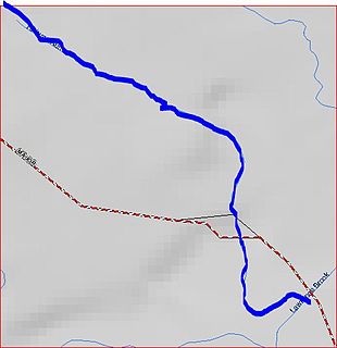
Lawrence Brook is a tributary of the Raritan River in Middlesex County, New Jersey in the United States.

Six Mile Run is a tributary of the Millstone River that drains a large area in central Franklin Township in Somerset County and as well western portions of North Brunswick and South Brunswick Townships in Middlesex County, New Jersey in the United States.

Peters Brook is a tributary of Stony Brook in Mercer and Hunterdon counties, New Jersey in the United States.

Oakeys Brook is a tributary of Lawrence Brook, a branch of the Raritan River in Middlesex County, New Jersey in the United States.

Nine Mile Run, known as Ninemile Run according to the USGS GNIS, is a moderately large tributary of the Six Mile Run, one of the branches of the Millstone River, in central New Jersey in the United States.

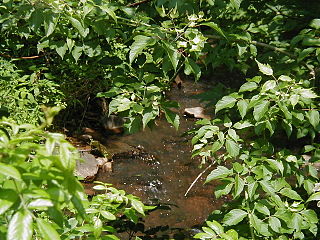
Sucker Brook is a tributary of Lawrence Brook in central New Jersey in the United States.
Middlebush Brook is a tributary of Six Mile Run in Somerset County, New Jersey in the United States.

Sawmill Brook is a tributary of Lawrence Brook in northwestern East Brunswick, New Jersey in the United States.
Ireland Brook is a tributary of Lawrence Brook in Middlesex County, New Jersey in the United States.

Cross Brook is a tributary of Six Mile Run in Somerset and Middlesex Counties, New Jersey in the United States.

Ten Mile Run is a tributary of the Millstone River, draining an area in southern South Brunswick and southern Franklin Park, New Jersey in the United States.

The Cow Yard Brook is a small tributary of the Oakeys Brook, in central South Brunswick, New Jersey in the United States.

Devils Brook is a tributary of the Millstone River in central New Jersey in the United States.
Terhune Run is a tributary of Lawrence Brook in eastern South Brunswick, New Jersey in the United States.

Great Ditch is a drainage ditch that drains areas of the Pigeon Swamp State Park in New Jersey in the United States.

Pike Run, also known as North Pike Run, is a tributary of Beden Brook in Somerset County, New Jersey in the United States. It is the namesake for the nearby residential development of Pike Run in Belle Mead, New Jersey.
