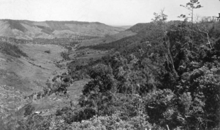
The Town of Victoria Park is a local government area of Western Australia. It covers an area of 17.62 km² in metropolitan Perth, the capital of Western Australia. It had a population of approximately 35,000 as at the 2016 census.

The City of Lismore is a local government area in the Northern Rivers region of New South Wales, Australia. The seat of the local government area is Lismore, a major regional centre of the state.
Lansdowne is a rural village on the Mid North Coast near Taree in New South Wales, Australia.

Burringbar is a village south-east of Murwillumbah in the Northern Rivers region of New South Wales, Australia.
Dunbible is a town located in north-eastern New South Wales, Australia, in the Tweed Shire and it is on the lands of the Bundjalung people.

Kagaru is a rural locality split between Scenic Rim Region and City of Logan, Queensland, Australia. In the 2021 census, Kagaru had a population of 19 people.

Allenview is a rural locality in the Scenic Rim Region, Queensland, Australia. In the 2021 census, Allenview had a population of 209 people.

Allandale is a rural locality in the Scenic Rim Region, Queensland, Australia. In the 2021 census, Allandale had a population of 69 people.
Geraldton is the central suburb of the City of Greater Geraldton in the Mid West region of Western Australia.
Arumbera is an outer suburb of the town of Alice Springs, in the Northern Territory, Australia. It is on the traditional Country of the Arrernte people.
Keilira is a locality located within the Kingston District Council in the Limestone Coast region of South Australia.

South Ballina is a locality located in the Northern Rivers Region of New South Wales - bounded by the Richmond River to the north, the Tasman Sea to the east, and Keith Hall to the south and west. Across the river to the north, is the town of Ballina and it is a popular spot for recreational fishing. It is on the lands of the Bundjalung Nation and it falls within the Jali Aboriginal Land Council.
Ewingar is a locality located in the Northern Rivers Region of New South Wales.

Flying Fox is a rural locality in the Scenic Rim Region, Queensland, Australia. In the 2021 census, Flying Fox had a population of 61 people.
Adams Estate is a small town located in Bass Coast Shire in Victoria, Australia.
Crabbes Creek is a town located in north-eastern New South Wales, Australia, in the Tweed Shire.
Anthony is a rural locality in the Scenic Rim Region, Queensland, Australia. In the 2021 census, Anthony had a population of 133 people.
Morwincha is a rural locality in the Scenic Rim Region, Queensland, Australia. In the 2021 census, Morwincha had a population of 35 people.
Cossack is a suburb of the town of Katherine, Northern Territory, Australia. It is within the Katherine Town Council local government area. The area was officially defined as a suburb in April 2007, adopting the name from white émigré farmers who settled in the area.
Kynnumboon is a locality in the Tweed Shire of New South Wales, Australia. It had a population of 109 as of the 2021 census.
This page is based on this
Wikipedia article Text is available under the
CC BY-SA 4.0 license; additional terms may apply.
Images, videos and audio are available under their respective licenses.


