Berlin, Alabama

Last updated

Berlin, Alabama
USA Alabama location map.svg
Red pog.svg
Berlin
Location in Alabama
Coordinates: 34°10′53″N86°44′32″W / 34.18139°N 86.74222°W / 34.18139; -86.74222
CountryUnited States
State Alabama
County Cullman
Incorporated 2018
Government
  Type Mayor-council government
   Mayor Patrick Bates
  Town ClerkKeirstyn Montgomery
   Councilmember Donald Gunter
James Sanford
Tony Duke
Don Bates
Keith Hardman
Area
[1]
  Total1.419 sq mi (3.675 km2)
  Land1.415 sq mi (3.665 km2)
  Water0.004 sq mi (0.011 km2)
Elevation
[2]
846 ft (258 m)
Population
 (2020) [3]
  Total476
  Estimate 
(2022) [4]
506
  Density372/sq mi (143.6/km2)
Time zone UTC–6 (Central (CST))
  Summer (DST) UTC–5 (CDT)
ZIP Code
35058
Area code(s) 256 and 938
FIPS code 01-05812
GNIS feature ID0157889 [2]
Website berlinal.gov

Berlin is a town in Cullman County, Alabama, United States. The population was 476 at the 2020 census. [3] It is located roughly five miles east of the city of Cullman in northern Alabama. U.S. Route 278 and Cullman County Road 747 intersect at Walker's Corner, considered to be the center of Berlin. The Berlin Community Center is located on U.S. Route 278, just west of the crossroads.

Contents

History

The town was originally known as Hobart, possibly named after Garret Hobart, a New Jersey Congressman who served as vice-president under William McKinley. A post office was established in the town in 1895, but was closed in 1903. The name was changed circa 1914 to honor the capital of Germany, the former homeland of many of the town's ethnic German residents. The new name was selected by John (Kritner) Kreitner. [5] The town was incorporated in 2018.

The historic Lidy Walker Covered Bridge was located just north of Berlin at the farm of Winford I. "Lidy" Walker on Lidy's Lake from 1958 until its collapse in 2001. Originally called the Big Branch Covered Bridge, it was built near Blountsville in Blount County in 1926 and moved to Berlin 32 years later.

Residents of Berlin voted 45-23 to incorporate in 2018. [6]

Geography

Berlin is located in Cullman County at 34°10′53″N86°44′32″W / 34.18139°N 86.74222°W / 34.18139; -86.74222 (34.181389, -86.742222).

According to the United States Census Bureau, the town has a total area of 1.419 square miles (3.68 km2), of which 1.415 square miles (3.66 km2) is land and 0.004 square miles (0.010 km2), is water. [1]

Demographics

Historical population
CensusPop.Note
2020 476
2022 (est.)506 [4] 6.3%
U.S. Decennial Census [7]
2020 Census [3]

2020 census

Triana racial composition [8]
RaceNumberPercent
White (non-Hispanic)382%
Black or African American (non-Hispanic)3%
Native American 4%
Asian 00.00%
Pacific Islander 1%
Other/Mixed 19%
Hispanic or Latino 67%

As of the 2020 census, there were 476 people, 191 households, and 142 families residing in the town. [9] There were 206 housing units.

Education

Berlin is in the Cullman County School District. [10]

Related Research Articles

<span class="mw-page-title-main">Blount County, Alabama</span> County in Alabama, United States

Blount County is a county located in the U.S. state of Alabama. As of the 2020 census, the population was 59,134. Its county seat is Oneonta.

<span class="mw-page-title-main">Winston County, Alabama</span> County in Alabama, United States

Winston County is a county of the U.S. state of Alabama. As of the 2020 census, the population was 23,540. Its county seat is Double Springs. Known as Hancock County before 1858, the county is named in honor of John A. Winston, the fifteenth Governor of Alabama.

<span class="mw-page-title-main">Cullman County, Alabama</span> County in Alabama, United States

Cullman County is a county located in the north central portion of the U.S. state of Alabama. As of the 2020 census, the population was 87,866. Its county seat and largest city is Cullman. Its name is in honor of Colonel John G. Cullmann.

<span class="mw-page-title-main">Marshall County, Alabama</span> County in Alabama, United States

Marshall County is a county of the state of Alabama, United States. As of the 2020 census the population was 97,612. Its county seat is Guntersville. A second courthouse is in Albertville. Its name is in honor of John Marshall, famous Chief Justice of the United States. Marshall County is a dry county, with the exception of the five cities of Albertville, Arab, Grant, Guntersville, and Boaz. Marshall County comprises the Albertville, AL Micropolitan Statistical Area, which is also included in the Huntsville-Decatur-Albertville, AL Combined Statistical Area.

<span class="mw-page-title-main">Walker County, Alabama</span> County in Alabama, United States

Walker County is a county located in the central portion of the U.S. state of Alabama. As of the 2020 census, the population was 65,342. Its county seat is Jasper. Its name is in honor of John Williams Walker, the first U.S. senator elected from Alabama.

<span class="mw-page-title-main">Garden City, Alabama</span> Town in Alabama, United States

Garden City is a town in Cullman and Blount counties in the U.S. state of Alabama. At the 2020 census, the population was 528. Garden City was founded by Johann Cullmann, namesake of Cullman County in 1873 after founding Cullman, Alabama. It was located in Blount County and was incorporated in 1878. Cullman County was created in 1877. Garden City was annexed by Cullman County with a shift in county borders until 1901. After a lapse in its incorporation, it was re-incorporated in 1950.

<span class="mw-page-title-main">Arab, Alabama</span> City in Alabama, United States

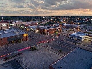
Arab is a city in Marshall County in the northern part of the U.S. state of Alabama, located 10 miles (16 km) from Guntersville Lake and Guntersville Dam, and is included in the Huntsville-Decatur Combined Statistical Area. The population was 8,461 at the 2020 census.

<span class="mw-page-title-main">Baileyton, Alabama</span> Town in Alabama, United States

Baileyton is a town in Cullman County, Alabama, United States. At the 2020 census, the population was 649.

<span class="mw-page-title-main">Cullman, Alabama</span> City in and county seat of Cullman County, Alabama

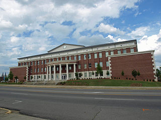
Cullman is the largest city and county seat of Cullman County, Alabama, United States. It is located along Interstate 65, about 50 miles (80 km) north of Birmingham and about 55 miles (89 km) south of Huntsville. As of the 2020 census it had a population of 18,213, with an estimated population of 19,251 in 2022.

<span class="mw-page-title-main">Dodge City, Alabama</span> Town in Alabama, United States

Dodge City is a town in Cullman County, Alabama, United States. At the 2020 census, the population was 548. It was incorporated in 1993.

<span class="mw-page-title-main">Fairview, Alabama</span> Town in Alabama, United States

Fairview is a town in Cullman County, Alabama, United States. At the 2010 census the population was 446, down from 522 in 2000. It incorporated in 1968.

<span class="mw-page-title-main">Holly Pond, Alabama</span> Town in Alabama, United States

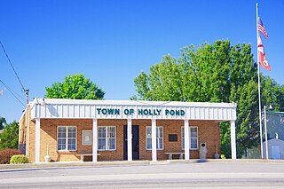
Holly Pond is a town in Cullman County, Alabama, United States. As of the 2010 census the town's population was 798. The town was incorporated in 1906.

<span class="mw-page-title-main">South Vinemont, Alabama</span> Town in Alabama, United States

South Vinemont is a town in Cullman County, Alabama, United States. At the 2010 census the population was 749, up from 425 in 2000.

<span class="mw-page-title-main">West Point, Alabama</span> Town in Alabama, United States

West Point is a town in Cullman County, Alabama, United States. The population was 584 at the 2020 census. West Point was incorporated on October 15, 1977.

<span class="mw-page-title-main">Blaine Township, Pennsylvania</span> Township in Pennsylvania, United States

Blaine Township is a township in Washington County, Pennsylvania, United States. The population was 619 at the 2020 census.

<span class="mw-page-title-main">Tehuacana, Texas</span> A town in Texas

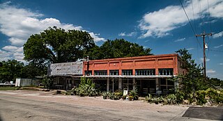
Tehuacana is a town near the Tehuacana Hills in Limestone County, Texas, United States. The population was 283 at the 2010 census. From 1869 until 1902, the town was home to Trinity University.

<span class="mw-page-title-main">McMillan, Wisconsin</span> Town in Wisconsin, United States

McMillan is a town in Marathon County, Wisconsin, United States. It is part of the Wausau, Wisconsin Metropolitan Statistical Area. The population was 1,968 at the 2010 census. The unincorporated community of McMillan is located in the town. A section of the Mead Wildlife Area is also located in the town.

<span class="mw-page-title-main">Edgewater, Wisconsin</span> Town in Wisconsin, United States

Edgewater is a town in Sawyer County, Wisconsin, United States. The population was 586 at the 2000 census. The unincorporated communities of Edgewater and Wooddale are located in the town. The unincorporated community of Yarnell is also located partially in the town.

<span class="mw-page-title-main">Joppa, Alabama</span> Census-designated place in Alabama, United States

Joppa is a census-designated place (CDP) and unincorporated community in Cullman and Marshall counties, Alabama, United States. As of the 2020 census, its population was 556.

The Lidy Walker Covered Bridge, formerly known as the Big Branch Covered Bridge, was a privately owned wood-&-metal combination style covered bridge which spanned the outlet to Lidy's Lake in Cullman County, Alabama, United States. It was located in the Berlin community at a pasture near the lake off Cullman County Road 1616 near U.S. Route 278, 6 miles east of the city of Cullman.

References

Footnotes

  1. 1 2 "2023 U.S. Gazetteer Files". United States Census Bureau. Retrieved March 3, 2024.
  2. 1 2 U.S. Geological Survey Geographic Names Information System: Berlin, Alabama
  3. 1 2 3 "Explore Census Data". United States Census Bureau . Retrieved March 3, 2024.
  4. 1 2 "City and Town Population Totals: 2020–2022". United States Census Bureau. March 3, 2024. Retrieved March 3, 2024.
  5. Foscue, Virginia. Place Names in Alabama. University: U of Alabama Press, 1989.
  6. "Berlin community in Cullman County becomes Alabama's newest city". WVTM . Associated Press. February 14, 2018. Retrieved February 19, 2020.
  7. "Census of Population and Housing". United States Census Bureau. Retrieved June 4, 2015.
  8. "Explore Census Data". data.census.gov. Retrieved March 3, 2024.
  9. "US Census Bureau, Table P16: Household Type". United States Census Bureau. Retrieved March 3, 2024.
  10. "GreatSchools: See what school district you are in or moving to using our interactive map". See What School District You Are In. Retrieved February 19, 2020.

Sources

34°10′53″N86°44′32″W / 34.18139°N 86.74222°W / 34.18139; -86.74222