Blountsville, Alabama

Last updated
Blountsville, Alabama
Blountsville-Main-St-al.jpg
Main Street (U.S. Route 231)
Blount County Alabama Incorporated and Unincorporated areas Blountsville Highlighted 0107456.svg
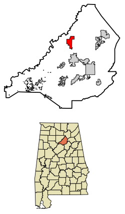
Location of Blountsville in Blount County, Alabama.
Coordinates: 34°4′54″N86°35′19″W / 34.08167°N 86.58861°W / 34.08167; -86.58861
Country United States
State Alabama
County Blount
Area
[1]
  Total5.49 sq mi (14.22 km2)
  Land5.42 sq mi (14.04 km2)
  Water0.07 sq mi (0.18 km2)
Elevation
712 ft (217 m)
Population
 (2020)
  Total1,826
  Density336.84/sq mi (130.06/km2)
Time zone UTC-6 (Central (CST))
  Summer (DST) UTC-5 (CDT)
ZIP code
35031
Area codes 205, 659
FIPS code 01-07456
GNIS feature ID0114510
Website blountsvilleal.com

Blountsville is a town in Blount County, Alabama, United States. As of the 2010 census it had a population of 1,684. [2]

Contents

Blount County was created by the Alabama territorial legislature on February 6, 1818, from land ceded to the federal government by the Creek Nation on August 9, 1814. It was named for Gov. Willie G. Blount of Tennessee, who provided assistance to settlers in Alabama during the Creek War of 1813–14. It lies in the northeastern section of the state, generally known as the mineral region.

History

What became Blountsville appears on an 1819 map as the mixed Creek/Cherokee Native American village of "Wassausey" (meaning Bear Meat Cabin, the name of an Indian translator who lived there). The town was established by Caleb Fryley and Johnny Jones in 1816 [3] as Bear Meat Cabin. It became a popular stop for westward-bound settlers who streamed into the area at the end of the Creek War. [4] The post office was opened as Blountsville on October 20, 1825, and incorporated on December 13, 1827. [3] It was the county seat until 1889 [3] when the government was moved to Oneonta.

There were many schools in the town in the early years: The Academy, Blount College and the District Agricultural School, plus the public schools. The Blount County Courthouse and jail was built in 1833 [3] and remained there until it was moved to Oneonta. A major crossroads in early Alabama, Blountsville became a Confederate depot for the cavalry. Confederate forces led by General Nathan Bedford Forrest and Union forces led by General Abel Streight skirmished briefly in the town on May 1, 1863, [3] and Major General Lovell H. Rousseau and his Union cavalry occupied the town in July 1864. [3] Blount College was in the building that was originally the courthouse. It was established in 1890. [3] The beautiful Blountsville United Methodist Church was established in 1818 and is the oldest building in Blountsville and is still in use today. Another old building in Blountsville was once known as the Barclift House. Built in 1834 as Hendricks Tavern, it is now owned and is being restored by the Ortiz family.

Geography

Blountsville is located in northern Blount County, in the Blountsville Valley at the intersection of County Highway 26 and U.S. Highway 231. Route 231 leads south 6 miles (10 km) to Cleveland and 14 miles (23 km) to Oneonta, the county seat, and north 50 miles (80 km) to Huntsville. Alabama Highway 79 runs through the southern corner of Blountsville, leading northeast to Guntersville and southwest to Birmingham.

According to the U.S. Census Bureau, Blountsville has a total area of 5.5 square miles (14.2 km2), of which 5.4 square miles (14.0 km2) is land and 0.077 square miles (0.2 km2), or 1.27%, is water. [2]

Demographics

Historical population
CensusPop.Note
1880 222
1890 28829.7%
1910 287
1920 42748.8%
1930 4689.6%
1940 57623.1%
1950 69520.7%
1960 672−3.3%
1970 1,25486.6%
1980 1,50920.3%
1990 1,5271.2%
2000 1,76815.8%
2010 1,684−4.8%
2020 1,8268.4%
U.S. Decennial Census [5]
2013 Estimate [6]

2020 census

Blountsville racial composition [7]
RaceNum.Perc.
White (non-Hispanic)1,33573.11%
Black or African American (non-Hispanic)110.6%
Native American 110.6%
Asian 231.26%
Other/Mixed 482.63%
Hispanic or Latino 39821.8%

As of the 2020 United States census, there were 1,826 people, 702 households, and 486 families residing in the town.

2010 census

As of the census [8] of 2010, there were 1,684 people, 654 households, and 439 families residing in the town. The population density was 311 inhabitants per square mile (120/km2). There were 791 housing units at an average density of 143.8 per square mile (55.5/km2). The racial makeup of the town was 87.3% White, 0.7% Black, 1.0% Native American, 0.4% Asian, 0.9% Pacific Islander, 8.8% from other races, and 1.0% from two or more races. 15.3% of the population were Hispanic or Latino of any race.

There were 654 households, out of which 30.7% had children under the age of 18 living with them, 48.0% were married couples living together, 14.1% had a female householder with no husband present, and 32.9% were non-families. 29.2% of all households were made up of individuals, and 14.9% had someone living alone who was 65 years of age or older. The average household size was 2.57 and the average family size was 3.16.

In the town, the population was spread out, with 25.8% under the age of 18, 9.6% from 18 to 24, 25.4% from 25 to 44, 24.5% from 45 to 64, and 14.7% who were 65 years of age or older. The median age was 37.6 years. For every 100 females, there were 94.5 males. For every 100 females age 18 and over, there were 101.8 males.

The median income for a household in the town was $25,238, and the median income for a family was $41,042. Males had a median income of $23,839 versus $24,940 for females. The per capita income for the town was $15,372. About 13.0% of families and 18.2% of the population were below the poverty line, including 16.0% of those under age 18 and 20.1% of those age 65 or over.


Education

J.B. Pennington High School (PHS) and Blountsville Elementary School (BES), the town's only two schools, are located in the center of Blountsville. They are both in the Blount County School District.

Attractions

The Freeman House, built circa 1825, was damaged by a storm, and the two-story brick dwelling was rebuilt, using the same bricks, into a one story. The porches face the historic Meat Cabin Road, and the other porch faces U.S. Highway 231. The structure has been renovated by the Blountsville Historical Society and now serves as a museum and visitors' center. Several other buildings of the period have been added to the park and are furnished with period furnishings. The park is open to the public for tours.

The Thomas Nation House, circa 1835, is now a ruin due to a storm that took all but one and one half walls down in 1998 before the house could be stabilized. The ruins can still be seen from U.S. Highway 231.

Blountsville is also home to the Spring Valley Beach Water Park, one of the few water parks in the lower Sand Mountain area. Spring Valley Beach contains one of the largest swimming pools in the South and seven water slides. It is also home to the 360 Rush water slide, the only one of its kind in the world.

Related Research Articles

<span class="mw-page-title-main">Blount County, Alabama</span> County in Alabama, United States

Blount County is a county located in the U.S. state of Alabama. As of the 2020 census, the population was 59,134. Its county seat is Oneonta.

<span class="mw-page-title-main">Cullman County, Alabama</span> County in Alabama, United States

Cullman County is a county located in the north central portion of the U.S. state of Alabama. As of the 2020 census, the population was 87,866. Its county seat and largest city is Cullman. Its name is in honor of Colonel John G. Cullmann.

<span class="mw-page-title-main">Talladega County, Alabama</span> County in Alabama, United States

Talladega County is one of the sixty-seven counties located in the east central portion of the U.S. state of Alabama. As of the 2020 census, the population was 82,149. Its county seat is Talladega.

<span class="mw-page-title-main">Allgood, Alabama</span> Town in Alabama, United States

Allgood, formerly known as Chepultepec, is a town in Blount County, Alabama, United States. At the 2020 census, the population was 548.

<span class="mw-page-title-main">Altoona, Alabama</span> Town in Alabama, United States

Altoona is a town in Etowah County in the U.S. state of Alabama. It is part of the Gadsden Metropolitan Statistical Area. At the 2020 census, the population was 948.

<span class="mw-page-title-main">Cleveland, Alabama</span> Town in Alabama, United States

Cleveland is a town in Blount County, Alabama, United States. At the 2020 census, the population was 1,245.

<span class="mw-page-title-main">Highland Lake, Alabama</span> Town in Alabama, United States

Highland Lake is a town in Blount County, Alabama, United States. At the 2020 census, the population was 412.

<span class="mw-page-title-main">Locust Fork, Alabama</span> Town in Alabama, United States

Locust Fork is a town in Blount County, Alabama, United States. At the 2010 census the population was 1,186 people, up from 1,016 in 2000.

<span class="mw-page-title-main">Nectar, Alabama</span> Town in Alabama, United States

Nectar is a town in Blount County, Alabama, United States. At the 2020 census, the population was 379.

<span class="mw-page-title-main">Oneonta, Alabama</span> City in Alabama, United States

Oneonta is a city in Blount County, Alabama, United States. At the 2020 census, the population was 6,938. The city is the county seat of Blount County. Oneonta is home to the Covered Bridge Festival.

<span class="mw-page-title-main">Rosa, Alabama</span> Town in Alabama, United States

Rosa is a town in Blount County, Alabama, United States. At the 2020 census, the population was 376.

<span class="mw-page-title-main">Snead, Alabama</span> Town in Alabama, United States

Snead is a town in Blount County, Alabama, United States. At the 2020 census, the population was 1,032.

<span class="mw-page-title-main">Susan Moore, Alabama</span> Town in Alabama, United States

Susan Moore is a town in Blount County, Alabama, United States. At the 2020 census, the population was 787. It is one of two towns in Alabama to have the first and last name of an individual; the other is Phil Campbell.

<span class="mw-page-title-main">Arab, Alabama</span> City in Alabama, United States

Arab is a city in Marshall county in the northern part of the U.S. state of Alabama, located 10 miles (16 km) from Guntersville Lake and Guntersville Dam, and is included in the Huntsville-Decatur Combined Statistical Area. As of the 2020 census, the population of the city was 8,461.

<span class="mw-page-title-main">Blountsville, Indiana</span> Town in Indiana, United States

Blountsville is a town in Stoney Creek Township, Henry County, Indiana, United States. The population was 98 at the 2020 census.

<span class="mw-page-title-main">Maryland, New York</span> Town in New York, United States

Maryland is a town in Otsego County, New York, United States. The population was 1,897 at the 2010 census. It was named for the U.S. state of the same name. The Town of Maryland is on the county's southern border. It is northeast of the City of Oneonta.

Worcester is a town in Otsego County, New York, United States. The population was 2,220 at the 2010 census. Worcester is on the southeastern border of the county and is northeast of Oneonta. The Worcester Central School District presently has 369 students enrolled in grades K-12.

<span class="mw-page-title-main">Goetz, Wisconsin</span> Town in Wisconsin, United States

Goetz is a town in Chippewa County in the U.S. state of Wisconsin. The population was 762 at the 2010 census.

<span class="mw-page-title-main">Seymour, Tennessee</span> CDP in Tennessee, United States

Seymour is a census-designated place (CDP) and unincorporated community in Blount and Sevier counties in the U.S. state of Tennessee. The CDP population was 14,705 at the 2020 U.S. census. It is included in the Knoxville, Tennessee Metropolitan Statistical Area.

<span class="mw-page-title-main">Laurens, New York</span> Town in New York, United States

Laurens is a town in Otsego County, New York, United States. The population was 2,424 at the 2010 census.

References

  1. "2020 U.S. Gazetteer Files". United States Census Bureau. Retrieved October 29, 2021.
  2. 1 2 "Geographic Identifiers: 2010 Demographic Profile Data (G001): Blountsville town, Alabama". U.S. Census Bureau, American Factfinder. Archived from the original on February 12, 2020. Retrieved September 17, 2013.
  3. 1 2 3 4 5 6 7 "Blountsville Court Square Timeline". Historical Marker Database. Retrieved 25 September 2015.
  4. .Claire M. Wilson, "Blountsville," Encyclopedia of Alabama, 2012.
  5. "U.S. Decennial Census". Census.gov. Retrieved June 6, 2013.
  6. "Annual Estimates of the Resident Population: April 1, 2010 to July 1, 2013". Archived from the original on May 22, 2014. Retrieved June 3, 2014.
  7. "Explore Census Data". data.census.gov. Retrieved 2021-12-18.
  8. "U.S. Census website". United States Census Bureau . Retrieved 2015-07-09.

Further reading

34°04′55″N86°35′20″W / 34.081911°N 86.588778°W / 34.081911; -86.588778