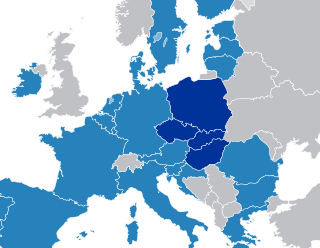
The Visegrád Group is a cultural and political alliance of four Central European countries: the Czech Republic, Hungary, Poland, and Slovakia. The alliance aims to advance co-operation in military, economic, cultural and energy affairs, and to further their integration with the EU. All four states are also members of the European Union (EU), the North Atlantic Treaty Organization (NATO), and the Bucharest Nine (B9).

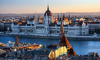
Budapest is the capital and most populous city of Hungary. It is the ninth-largest city in the European Union by population within city limits and it was the largest city on the Danube river; today it is the second largest one. The city has an estimated population of 1,752,286 over a land area of about 525 square kilometres. Budapest, which is both a city and municipality, forms the centre of the Budapest metropolitan area, which has an area of 7,626 square kilometres and a population of 3,303,786. It is a primate city, constituting 33% of the population of Hungary.

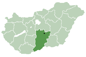
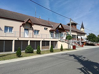
Dávod is a village in Bács-Kiskun county, in the Southern Great Plain region of Hungary.

Dombiratos is a village in Békés County, in the Southern Great Plain region of south-east Hungary.
Csökmő is a large village in Hajdú-Bihar county, in the Northern Great Plain region of eastern Hungary.

Csanádalberti is a village in Csongrád County, in the Southern Great Plain region of southern Hungary.

Sándorfalva is a town in Csongrád-Csanád County, in the Southern Great Plain region of southern Hungary.

Bordány is a village in Csongrád County, in the Southern Great Plain region of southern Hungary.
Cserkeszőlő is a village in Jász-Nagykun-Szolnok county, in the Northern Great Plain region of central Hungary.
Jászfelsőszentgyörgy is a village in Jász-Nagykun-Szolnok county, in the Northern Great Plain region of central Hungary.
Botpalád is a village in Szabolcs-Szatmár-Bereg county, in the Northern Great Plain region of eastern Hungary.

Császló is a village in Szabolcs-Szatmár-Bereg county, in the Northern Great Plain region of eastern Hungary.

Döge is a village in Szabolcs-Szatmár-Bereg county, in the Northern Great Plain region of eastern Hungary.
Győröcske is a small village in Szabolcs-Szatmár-Bereg county, in the Northern Great Plain region of eastern Hungary.

Győrtelek is a village in Szabolcs-Szatmár-Bereg county, in the Northern Great Plain region of eastern Hungary.
Őrbottyán is a town in Pest county, Hungary.

The Budapest metropolitan area is a statistical area that describes the reach of commuter movement to and from Budapest and its surrounding suburbs. Created by Hungary's national statistical office HCSO to describe suburban development around centres of urban growth, the surrounding a more densely built and densely populated urban area. As of 2014 the Budapest metropolitan area, with its 7,626 km2, extends significantly beyond Budapest's administrative region, a region also commonly referred to as Central Hungary. It had a population of 3,303,786 inhabitants at the January 2013 census, making it the tenth largest urban region in Europe. 33% of Hungary's population resides in the region.

Liptód is a village and municipality in Baranya County, Hungary.

Máriakéménd is a village and municipality in Baranya County, Hungary.

Baktalórántháza is a district in central part of Szabolcs-Szatmár-Bereg County. Baktalórántháza is also the name of the town where the district seat is found. The district is located in the Northern Great Plain Statistical Region. This district is a part of Nyírség geographical region.


