Pusztadobos | |
---|---|
Country | |
County | Szabolcs-Szatmár-Bereg |
Area | |
• Total | 16.69 km2 (6.44 sq mi) |
Population (2015) | |
• Total | 1,535 [1] |
• Density | 92/km2 (240/sq mi) |
Time zone | CET (UTC+1) |
• Summer (DST) | CEST (UTC+2) |
Postal code | 4565 |
Area code(s) | 45 |
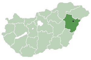
Pusztadobos is a village in Szabolcs-Szatmár-Bereg county, in the Northern Great Plain region of eastern Hungary.
A village is a clustered human settlement or community, larger than a hamlet but smaller than a town, with a population ranging from a few hundred to a few thousand. Though villages are often located in rural areas, the term urban village is also applied to certain urban neighborhoods. Villages are normally permanent, with fixed dwellings; however, transient villages can occur. Further, the dwellings of a village are fairly close to one another, not scattered broadly over the landscape, as a dispersed settlement.
The Northern Great Plain is a statistical region of Hungary. It is part of the Great Plain and North region. The Northern Great Plain includes the counties of Hajdú-Bihar, Jász-Nagykun-Szolnok, and Szabolcs-Szatmár-Bereg, with a total area of 17,749 km2 (6,853 sq mi) and a population of around 1.5 million.
In geography, regions are areas that are broadly divided by physical characteristics, human impact characteristics, and the interaction of humanity and the environment. Geographic regions and sub-regions are mostly described by their imprecisely defined, and sometimes transitory boundaries, except in human geography, where jurisdiction areas such as national borders are defined in law.
It covers an area of 16.69 km2 (6 sq mi) and has a population of 1535 people (2015). [1]
Area is the quantity that expresses the extent of a two-dimensional figure or shape, or planar lamina, in the plane. Surface area is its analog on the two-dimensional surface of a three-dimensional object. Area can be understood as the amount of material with a given thickness that would be necessary to fashion a model of the shape, or the amount of paint necessary to cover the surface with a single coat. It is the two-dimensional analog of the length of a curve or the volume of a solid.
In biology, a population is all the organisms of the same group or species, which live in a particular geographical area, and have the capability of interbreeding. The area of a sexual population is the area where inter-breeding is potentially possible between any pair within the area, and where the probability of interbreeding is greater than the probability of cross-breeding with individuals from other areas.
Drienovo is a village and municipality in the Krupina District of the Banská Bystrica Region of Slovakia.
Hostice is a village and municipality in the Rimavská Sobota District of the Banská Bystrica Region of southern Slovakia.
Padarovce is a village and municipality in the Rimavská Sobota District of the Banská Bystrica Region of southern Slovakia.
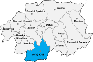
Ipeľské Predmostie is a village and municipality in the Veľký Krtíš District of the Banská Bystrica Region of southern Slovakia.
Fülöp is a village in Hajdú-Bihar county, in the Northern Great Plain region of eastern Hungary.
Benk is a village in Szabolcs-Szatmár-Bereg county, in the Northern Great Plain region of eastern Hungary.
Uszka is a village in Szabolcs-Szatmár-Bereg county, in the Northern Great Plain region of eastern Hungary.
Újkenéz is a village in Szabolcs-Szatmár-Bereg county, in the Northern Great Plain region of eastern Hungary.
Tivadar is a village in Szabolcs-Szatmár-Bereg county, in the Northern Great Plain region of eastern Hungary.
Tiszakanyár is a village in Szabolcs-Szatmár-Bereg county, in the Northern Great Plain region of eastern Hungary.
Ilk is a village in Szabolcs-Szatmár-Bereg county, in the Northern Great Plain region of eastern Hungary.
Petneháza is a village in Szabolcs-Szatmár-Bereg county, in the Northern Great Plain region of eastern Hungary.
Jéke is a village in Szabolcs-Szatmár-Bereg county, in the Northern Great Plain region of eastern Hungary.
Nyírbogát is a village in Szabolcs-Szatmár-Bereg county, in the Northern Great Plain region of eastern Hungary.
Traian Vuia is a commune in Timiș County, western Romania. It is composed of six villages: Jupani (Zsuppány), Săceni (Kisszécsény), Sudriaș, Surducu Mic (Kisszurdok), Susani (Bégaszuszány) and Traian Vuia.
Lăzăreni is a commune in Bihor County, northwestern Romania with a population of 3,233 people. It is composed of eight villages: Bicăcel (Pusztabikács), Calea Mare (Magyargyepes), Cărăndeni (Nagykáránd), Cărănzel (Kiskáránd), Gepiș (Oláhgyepes), Gruilung (Hosszúliget), Lăzăreni and Miheleu (Méhelő).
Hernádnémeti is a village in Borsod-Abaúj-Zemplén County in northeastern Hungary. It is situated on the left bank of the Hernád River, 14 kilometres (8.7 mi) from Miskolc. The village is 120 metres (390 ft) above sea level. It can be reached by car via highway 37 or by train from the Hernádnémeti–Bőcs train station, which is located in the neighboring village of Bőcs.
Ináncs is a village in Borsod-Abaúj-Zemplén County in northeastern Hungary.
Tiszaladány is a village in Borsod-Abaúj-Zemplén County in northeastern Hungary.
Taktabáj is a village in Borsod-Abaúj-Zemplén County in northeastern Hungary.
Coordinates: 48°04′N22°14′E / 48.067°N 22.233°E
A geographic coordinate system is a coordinate system that enables every location on Earth to be specified by a set of numbers, letters or symbols. The coordinates are often chosen such that one of the numbers represents a vertical position and two or three of the numbers represent a horizontal position; alternatively, a geographic position may be expressed in a combined three-dimensional Cartesian vector. A common choice of coordinates is latitude, longitude and elevation. To specify a location on a plane requires a map projection.
This Szabolcs-Szatmár-Bereg location article is a stub. You can help Wikipedia by expanding it. |