Bhetua

Last updated

Bhetua
Village
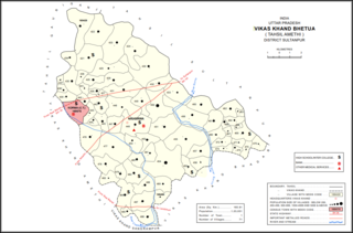
Bhetua block map.png
Map showing Bhetua (#060) in Bhetua CD block
India Uttar Pradesh location map.svg
Red pog.svg
Bhetua
Location in Uttar Pradesh, India
Coordinates: 26°09′56″N81°52′37″E / 26.165668°N 81.876862°E / 26.165668; 81.876862 [1]
CountryFlag of India.svg  India
State Uttar Pradesh
Division Faizabad division
District Amethi
Area
[2]
  Total2.881 km2 (1.112 sq mi)
Population
 (2011) [2]
  Total1,680
  Density580/km2 (1,500/sq mi)
Languages
  Official Hindi, Urdu
Time zone UTC+5:30 (IST)

Bhetua is a village in Amethi tehsil of Amethi district, Uttar Pradesh, India. [2] As of 2011, it has a population of 1,680 people, in 260 households. [2] It has one primary school and no healthcare facilities and does not host a weekly haat or permanent market. [2] Bhetua serves as the headquarters of a community development block, which includes 71 rural villages as well as the census town of Korwa. [2] It also serves as the headquarters of a nyaya panchayat that also includes 14 other villages. [3]

The 1951 census recorded Bhetua (as "Bhetwa Mafi") as comprising 20 hamlets, with a total population of 1,148 people (559 male and 589 female), in 248 households and 238 physical houses. [4] The area of the village was given as 747 acres. [4] 100 residents were literate, all male. [4] The village was listed as belonging to the pargana of Amethi and the thana of Raipur. [4]

The 1961 census recorded Bhetua (as "Bhetuwa Muafi") as comprising 14 hamlets, with a total population of 1,231 people (571 male and 660 female), in 252 households and 243 physical houses. [5] The area of the village was given as 747 acres. [5]

The 1981 census recorded Bhetua (as "Bhetuwa") as having a population of 1,747 people, in 338 households, and having an area of 307.57 hectares. [6] The main staple foods were listed as wheat and rice. [6]

The 1991 census recorded Bhetua (as "Bhetuwa") as having a total population of 2,067 people (1,052 male and 1,015 female), in 380 households and 375 physical houses. [3] The area of the village was listed as 208.00 hectares. [3] Members of the 0-6 age group numbered 372, or 18% of the total; this group was 49% male (183) and 51% female (189). [3] Members of scheduled castes numbered 399, or 19% of the village's total population, while no members of scheduled tribes were recorded. [3] The literacy rate of the village was 48% (629 men and 186 women, counting only people age 7 and up). [3] 644 people were classified as main workers (491 men and 153 women), while 59 people were classified as marginal workers (all women); the remaining 1,364 residents were non-workers. [3] The breakdown of main workers by employment category was as follows: 297 cultivators (i.e. people who owned or leased their own land); 239 agricultural labourers (i.e. people who worked someone else's land in return for payment); 0 workers in livestock, forestry, fishing, hunting, plantations, orchards, etc.; 0 in mining and quarrying; 23 household industry workers; 9 workers employed in other manufacturing, processing, service, and repair roles; 1 construction worker; 28 employed in trade and commerce; 0 employed in transport, storage, and communications; and 47 in other services. [3]

Villages

Bhetua CD block has the following 71 villages: [2]

Village nameTotal land area (hectares)Population (in 2011)
Kanak Singh Pur 425.31,524
Korari Lachchan Shah 398.51,717
Korari Heer Shah 509.11,676
Semra 592.32,357
Marerika 328.32,133
Sultanpur 135.91,339
Ghatampur 262.51,447
Bheera 26.1116
Paschim Dwara 307.81,280
Dalshah Pur 146.9887
Saruwanwa 804.24,547
Purab Dwara 138.91,280
Sanaha 208.81,251
Partosh Manik 302.8973
Tulsi Pur 111.5526
Bhu Siyanwa 249.81,901
Rangwaria 101.1385
Koryani 71.8483
Neoriya 70.7777
Narsingh Bhanpur 96.6786
Rajapur Kalyan 157.61,249
Dhanapur 68293
Dharaimafi 131.81,445
Dalao 61.8428
Sumerpur 71.9652
Manirampur 161.71,390
Katra Rani 165.6837
Bandoiya 445.61,242
Naugirwa 110.81,168
Peeparpur 258.11,025
Tikree 900.27,165
Ghorha 4221,177
Shiv Garh Jalal Pur 161.11,557
Sandeela 154.4605
Bhimi 826.15,086
Amey Maphi 614.43,593
Mayi 651.82,430
Sahri 228.81,308
Pure Kumar Shah 135383
Saraiyya Mohan 133.1708
Tikawar 312.81,566
Ghatkaur 223.91,190
Bashoo 166.91,529
Bas00 Pur 37.9365
Khadhar 99.1826
Heerapur 93.81,005
Mahnaa 112547
Parshurampur 58.7315
Madanpur 12.2231
Gairik Pur 272.41,754
Kotwaa 117.8397
Balchandra Pur 54.8273
Haripur 72.7977
Manga Gopalpur 58.5436
Uskaa 87.7739
Sakra Ramnagar 116.3360
Thaura 418.32,403
Pindoriya 657.13,744
Kadergaon 241.21,215
Laukapur 99.71,107
Arsahni 145.51,438
Gangahuwa 142.1976
Bhetuwa (block headquarters)288.11,680
Alipur 135.9439
Bhretha 326.83,032
Saraypan 66.4576
Baisra 187.21,872
Gungwachh 361.22,137
Kamsin 1991,349
Pathkhauli 159.1506
Mathkanaegiri 107.2417
Block total16,58196,527
Village nameTotal land area (hectares)Population (in 2011)

Related Research Articles

<span class="mw-page-title-main">Pindoriya</span> Village in Uttar Pradesh, India

Pindoriya is a village in Bhetua block of Amethi district, Uttar Pradesh, India. As of 2011, it has a population of 3,744 people, in 649 households. It has one primary school and no healthcare facilities and does not host a weekly haat or permanent market. It belongs to the nyaya panchayat of Bhetua.

<span class="mw-page-title-main">Gairikpur</span> Village in Uttar Pradesh, India

Gairikpur is a village in Bhetua block of Amethi district in Uttar Pradesh, India. As of 2011, its population is 1,754 people, in 275 households. It has one primary school and no healthcare facilities and does not host a permanent market or weekly haat. It serves as the headquarters of a nyaya panchayat that also includes 15 other villages.

<span class="mw-page-title-main">Bhawanshahpur</span> Village in Uttar Pradesh, India

Bhawanshahpur is a village in Gauriganj block of Amethi district, Uttar Pradesh, India. As of 2011, it has a population of 821 people, in 154 households. It has no schools and no healthcare facilities and does not host a permanent market or weekly haat. It belongs to the nyaya panchayat of Semuai.

<span class="mw-page-title-main">Dhanapur, Gauriganj</span> Village in Uttar Pradesh, India

Dhanapur is a village in Gauriganj block of Amethi district, Uttar Pradesh, India. As of 2011, it has a population of 953 people, in 159 households. It has one primary school and no healthcare facilities and does not host a permanent market or weekly haat. It belongs to the nyaya panchayat of Semuai.

<span class="mw-page-title-main">Biswan, Amethi</span> Village in Uttar Pradesh, India

Biswan is a village in Gauriganj block of Amethi district, Uttar Pradesh, India. As of 2011, it has a population of 353 people, in 55 households. It has no schools and no healthcare facilities and hosts both a permanent market and a weekly haat. It belongs to the nyaya panchayat of Semuai.

<span class="mw-page-title-main">Raghipur</span> Village in Uttar Pradesh, India

Raghipur is a village in Gauriganj block of Amethi district, Uttar Pradesh, India. As of 2011, it has a population of 1,207 people, in 231 households. It has one primary school and no healthcare facilities and hosts a permanent market but not a weekly haat. It belongs to the nyaya panchayat of Bahanpur.

<span class="mw-page-title-main">Barna Tikar</span> Village in Uttar Pradesh, India

Barna Tikar is a village in Gauriganj block of Amethi district, Uttar Pradesh, India. As of 2011, it has a population of 2,927 people, in 531 households. It has one primary school and no healthcare facilities and hosts both a permanent market and a weekly haat. It belongs to the nyaya panchayat of Katra Lalganj.

<span class="mw-page-title-main">Shahgarh, Amethi</span> Village in Uttar Pradesh, India

Shahgarh is a village and community development block headquarters in Gauriganj tehsil of Amethi district, Uttar Pradesh, India. As of 2011, it has a population of 3,201 people, in 525 households. It historically was the seat of a taluqdari estate held by a branch of the Bandhalgoti Rajputs. Today it serves as the seat of a nyaya panchayat which also includes 13 other villages.
<span class="mw-page-title-main">Jamo, Uttar Pradesh</span> Village in Uttar Pradesh, India

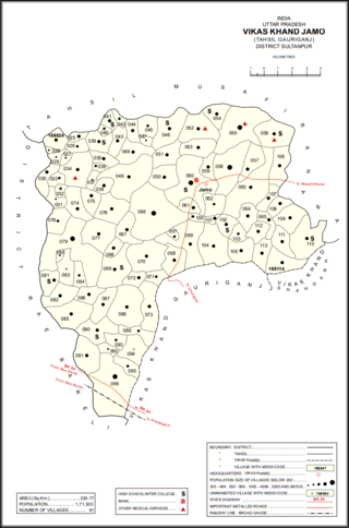
Jamo, also spelled Jamun or Jamon, is a village and community development block headquarters in Gauriganj tehsil of Amethi district, Uttar Pradesh, India. As of 2011, it has a population of 6,734 people, in 1,182 households. It was historically the capital of the pargana of Gaura Jamun. It is located at the intersection of four minor district roads, some of which are prone to flooding during the rainy season.

<span class="mw-page-title-main">Dakhinwara, Amethi</span> Village in Uttar Pradesh, India

Dakhinwara is a village in Jamo block of Amethi district, Uttar Pradesh, India. As of 2011, it has a population of 3,840 people, in 613 households. It has two primary schools and one maternity and child welfare centre and it hosts a weekly haat but not a periodic market. It belongs to the nyaya panchayat of Jamo.

<span class="mw-page-title-main">Gaura, Jamo</span> Village in Uttar Pradesh, India

Gaura is a village in Jamo block of Amethi district, Uttar Pradesh, India. The namesake of the historical pargana of Gaura Jamun, Gaura consists of a main site called Gaura khas in the northeast surrounded by several smaller hamlets. The village lands are fertile and contain many orchard groves. In the east-central part there is a large jhil which provides a convenient source of irrigation but also sometimes overflows and floods the surrounding fields. Gaura is located just north of Jamo on the Gauriganj-Jagdishpur road, and another road also leads off to Musafirkhana.

<span class="mw-page-title-main">Baraulia</span> Village in Uttar Pradesh, India

Baraulia is a village in Jamo block of Amethi district, Uttar Pradesh, India. As of 2011, it has a population of 3,878 people, in 691 households. It has one primary school and no healthcare facilities and it hosts both a regular market and a weekly haat. It belongs to the nyaya panchayat of Hardo.

<span class="mw-page-title-main">Bakhshgarh</span> Village in Uttar Pradesh, India

Bakhshgarh is a village in Jamo block of Amethi district, Uttar Pradesh, India. As of 2011, it has a population of 1,628 people, in 275 households. It has one primary school and no healthcare facilities and it does not host a weekly haat or a permanent market. It belongs to the nyaya panchayat of Mawai.

<span class="mw-page-title-main">Piparpur, Bhadar</span> Village in Uttar Pradesh, India

Piparpur is a village in Bhadar block of Amethi district, Uttar Pradesh, India. The historical capital of the pargana of Asal, Piparpur is located on the road from Amethi to Chanda, just west of the intersection with the main Allahabad-Faizabad road. Running through the village is a stream that originates in the Bhujwa jhil and flows into neighbouring Prataphgarh district where it joins with the Chamraura. The banks of this stream are well-wooded; they used to be more so, but a lot of it was cut down around the turn of the 20th century to provide materials for the railway. There is also some significant usar land, especially in the north of the village.

<span class="mw-page-title-main">Piparpur, Bhetua</span> Village in Uttar Pradesh, India

Piparpur is a village in Bhetua block of Amethi district, Uttar Pradesh, India. As of 2011, it has a population of 1,025 people, in 186 households. It has one primary school and no healthcare facilities and hosts a weekly haat but not a permanent market. It belongs to the nyaya panchayat of Amey Maphi.

<span class="mw-page-title-main">Arsahni</span> Village in Uttar Pradesh, India

Arsahni is a village in Bhetua block of Amethi district, Uttar Pradesh, India. As of 2011, it has a population of 1,438 people, in 213 households. It has one primary school and no healthcare facilities and does not host a weekly haat or permanent market. It belongs to the nyaya panchayat of Bhetua.

<span class="mw-page-title-main">Thaura</span> Village in Uttar Pradesh, India

Thaura is a village in Bhetua block of Amethi district, Uttar Pradesh, India. As of 2011, it has a population of 2,403 people, in 382 households. It has one primary school and no healthcare facilities and hosts a weekly haat but not a permanent market. It belongs to the nyaya panchayat of Bhetua.

<span class="mw-page-title-main">Tikri, Amethi</span> Village in Uttar Pradesh, India

Tikri is a village in Bhetua block of Amethi district, Uttar Pradesh, India. As of 2011, it has a population of 7,165 people, in 1,142 households. It has 3 primary schools and no healthcare facilities and does not host a weekly haat or permanent market. It belongs to the nyaya panchayat of Amey Maphi.

<span class="mw-page-title-main">Naugirwa</span> Village in Uttar Pradesh, India

Naugirwa is a village in Bhetua block of Amethi district, Uttar Pradesh, India. As of 2011, it has a population of 1,168 people, in 220 households. It has one primary school and a veterinary hospital and hosts a weekly haat but not a permanent market. It belongs to the nyaya panchayat of Darai Mafi.

<span class="mw-page-title-main">Bhadar</span> Village in Uttar Pradesh, India

Bhadar is a village and community development block headquarters in Amethi tehsil of Amethi district, Uttar Pradesh, India. As of 2011, it has a population of 2,896 people, in 465 households. It has one primary school and a veterinary hospital and it hosts a weekly haat but not a permanent market. It serves as the headquarters of a nyaya panchayat that also includes 13 other villages.

References

  1. "Geonames Search". Do a radial search using these coordinates here.
  2. 1 2 3 4 5 6 7 "Census of India 2011: Uttar Pradesh District Census Handbook - Sultanpur, Part A (Village and Town Directory)" (PDF). Census 2011 India. pp. 226–42. Retrieved 17 December 2021.
  3. 1 2 3 4 5 6 7 8 Census 1991 Series-25 Uttar Pradesh Part-XII B Village & Townwise Primary Census Abstract District Census Handbook District Raebareli (PDF). 1992. pp. xxiv–xxviii, 138–9. Retrieved 17 December 2021.
  4. 1 2 3 4 Census of India, 1951: District Census Handbook Uttar Pradesh (49 - Rae Bareli District) (PDF). Allahabad. 1955. pp. 94–5. Retrieved 17 December 2021.
  5. 1 2 Census 1961: District Census Handbook, Uttar Pradesh (44 - Sultanpur District) (PDF). Lucknow. 1965. pp. l–li. Retrieved 17 December 2021.
  6. 1 2 Census 1981 Uttar Pradesh: District Census Handbook Part XIII-A: Village & Town Directory, District Rae Bareli (PDF). 1982. pp. 106–7. Retrieved 17 December 2021.