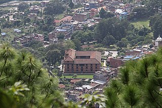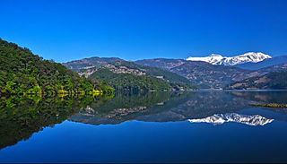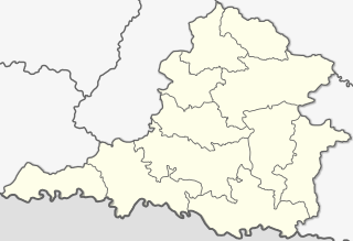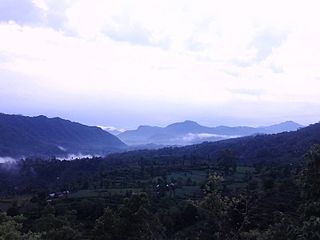
Gandaki zone was one of the fourteen zones of Nepal, located in the Western Development Region. It was named as Sapta Gandaki after the seven tributaries that makes up the Gandaki River. Pokhara served as its regional and zonal headquarter. It was also the birthplace of Bhanubhakta Acharya, first poet of Nepal.

Dhading District, a part of Bagmati Province, is one of the seventy-seven districts of Nepal. The district, with Dhading Besi as its district headquarters, covers an area of 1,926 square kilometres (744 sq mi), had a population of 338,658 in 2001 and 336,067 in 2011.

Gorkha District, a part of Gandaki Province, is one of 77 districts of Nepal, and the fourth largest district of the country in terms of area. It is historically linked with the creation of modern Nepal and the name of the legendary Gorkha soldiers. The district, with Gorkha Municipality as its district headquarters, covers an area of 3,610 km2 (1,390 sq mi) and has a population of 252,201, according to the 2021 Nepal census. Gorkha district is the site of the Manakamana Temple, as well as Gorakhnath and Gorakh Kali temples. Several major rivers—including the Chepe, Daraudi, Marsyangdi, Budi Gandaki, and Trishuli—run through the district.

Kaski District, a part of Gandaki Province, is one of the seventy-seven districts of Nepal. The name is disambiguated from Kaskikot, the ancient Kaski Kingdom.

Syangja District is a part of Gandaki Province, and is one of the seventy-seven districts of Nepal. Its headquarter is Putalibazar with a diverse population including Brahmin, Chhetri, Magar, Dalit and Gurung communities. Syangja is home to attractions like the ancient temples of Garaunsur and Akala, scenic viewpoints such as Panchase, and the historical town of Waling, making it a growing eco-tourism destination. The economy is primarily based on agriculture, with rice, maize, millet, and fruits like oranges being widely cultivated. Syangja is the leading Orange producer in nepal with 22,000 tons in 2023. The district has several educational institutions, and many residents pursue higher education in cities like Pokhara and Kathmandu. Well-connected by highways to major cities like Pokhara and Butwal, Syangja offers a blend of natural beauty, cultural diversity, and historical importance. The district covers an area of 1,164 km2 (449 sq mi) and has a population of 254,965.

Lomanthang is a rural municipality in Mustang district in Gandaki Province of western Nepal. It is located at the northern end of the district, bordering the Tibet Autonomous Region of China to the north and Dalome rural municipality of Mustang in the south.

Waling Municipality, located in the heart of Syangja, is a town and municipality in the western hilly region of [[Nepal]. It was formed on 24 January 1997 by the merging of the then three VDCs namely Waling, Dhanubase and Pekhubaaghkhor. Due to the restructuring of the local government as part of the Federal Government System on 10 March 2017, the municipality's area was expanded to include Majhakot Shiwalaye VDC, Eladi VDC, Jagat Bhanjyang VDC, Chhangchhangdi VDC, Malyangkot VDC, Tindobate VDC, Kalikakot VDC Pelakot VDC ,Thumpokhara VDC(Ward No. 13,14) and Sworek VDC. It is located in the Aadhikhola valley and is bisected by the historic Andhikhola River in Syangja District, Gandaki Province of Nepal. Waling is named the Pink City due to its practice of painting local houses pink. The Government of Nepal has recognized Waling as one of the cities with the potential for future development under the Smart City initiative. Waling received an award for the best municipality of the country and was declared the Clean City of Nepal for The fiscal year 2017.
Amppipal is a former village development committee currently located in Palungtar municipality of Gorkha District in the Gandaki Province of northern-central Nepal. At the time of the 1991 Nepal census it had a population of 5,124 and had 1060 houses in the town. The small village Amppipal belongs to this VDC.

Mirkot is a village development committee in Gorkha District in the Gandaki Zone of northern-central Nepal. It is also known as Bhirkot, Gorkha. It lies on the western side of the headquarters of Gorkha. According to the National Population and Housing Census 2011, it had a population of 5261, and had 1388 households in the village. Its neighbourhood VDCs are Gaikhur, Dhuwakot, Khoplang, Chyangli, Palumtar, Chhoprak and Deurali. Such as Kotgadi, Lakang, Mahadev Temple are the most important places of Mirkot. The central part of Mirkot VDC is called Bagdanda, Where the main office of the VDC and Mirkot Higher Secondary School are located.
Chumchet is a village development committee in Gorkha District in the Gandaki Zone of northern-central Nepal. At the time of the 1991 Nepal census it had a population of 979 and had 221 houses in the village.
Gaikhur is a former village development committee currently located in Palungtar municipality of Gorkha District in the Gandaki Province of northern-central Nepal. At the time of the 1991 Nepal census it had a population of 4,793 and had 948 houses in the town. Mirkot, Palungtar, Khoplang, Dhuwakot were the neighbouring VDCs of Gaikhur. Gaikhur lies on the western side of Gorkha Bazar.
Jaubari was a Village Development committee in Gorkha District in the Gandaki Zone of northern-central Nepal. At the time of the 1991 Nepal census it had a population of 3,398 and had 658 houses in the town. It is located at the western part of Gorkha district. Marichman Shrestha, former VDC chairperson, and social worker is from Jaubari-7, Gorkha. Freedom fighter late Rohini Dev Bhatta is also from the village as well as his daughter Dr. Madhabi Bhatta, who is a former commissioner of the Truth and Reconciliation Commission, Nepal. Jaubari is one of the major hubs for education and health in Gorkha District. Paropakar Adarsha Uccha Madhyamik Vidhalaya is located in Jaubari VDC of Gorkha.
Laprak is situated in the Dharche Rural Municipality in Gorkha District in the Gandaki Province of northern-central Nepal. Laprak is densely inhabited by Gurungs and few number of Sunars. At the time of the 1991 Nepal census it had a population of 2,165 and had 462 houses in the village.
Palumtar is a municipality in Gorkha District in the Gandaki Zone of northern-central Nepal. It was named after the former Village Development Committee which now is part of it. At the time of the 1991 Nepal census the VDC had a population of 6,982 and had 1358 houses in the town. The municipality has 23 461 inhabitants according to the census of 2011.
Taple (ताप्ले) was a village development committee in Gorkha District in the Gandaki Zone of northern-central Nepal. At the time of the 1991 Nepal census, it had a population of 4,398 and had 5000 houses in the town Hindu Muslim.
Dhikurpokhari is a suburb and former Village Development Committee in Kaski District in the Gandaki Province of northern-central Nepal. At the 1991 Nepal census, it had a population of 7,392 persons in 1,427 individual households.
Saimarang is a town and Village Development Committee in Kaski District in the Gandaki Province of Western Nepal. At the time of the 2011 Nepal census it had a population of 1,171 persons living in 309 individual households. Saimarang owns a famous Temple Bhagawati Temple and hill known as Lamtari there is a famous Devi tample called Lamtari Mai which is in front of Pokhara Valley. The Annapurna Himalayan range can be seen at the back of the village, and Begnash, Rupa and Fewa lake in the front. Also there are several adventures such as caves, rocky hills. Local people in Warchowk and Togi are working hard to make the Saimarang VDC a good place for Adventurous Tourism. The people there are very helpful.
Bhalam was a Village Development Committee, north of Pokhara in the Valam Municipality of Kaski District, situated in the Gandaki Zone of the Western Development Region, located in northern-central Nepal. In 2015, the VDC was amalgamated with Pokhara. Bhalam is located around 950 m above sea level, 5 km from the city of Pokhara.

Mirkot is a village development committee in Gorkha District in the Gandaki Zone of northern-central Nepal. It lies on the western side of the headquarters of Gorkha. According to the National Population and Housing Census 2011, it had a population of 5261, and had 1388 households in the village. Its neighbourhood VDCs are Gaikhur, Dhuwakot, Khoplang, Chyangli, Palumtar, Chhoprak and Deurali. Such as Kotgadi, Lakang, Mahadev Temple are the most important places of Mirkot. The central part of Mirkot VDC is called Bagdanda, Where the main office of the VDC and Mirkot Higher Secondary School are located.

Gandaki Province ), is one of the seven federal provinces established by the current constitution of Nepal which was promulgated on 20 September 2015. Pokhara is the province's capital city. It borders the Tibet Autonomous Region in Southwest China to the north, Bagmati Province to the east, Karnali Province to the west, and Lumbini Province and Bihar of India to the south. The total area of the province is 21,504 km2 - constituting 14.57% of Nepal's total area. According to the latest census, the population of the province was 2,479,745. The newly elected Provincial Assembly adopted Gandaki Province as the permanent name by replacing its initial name Province No. 4 on 27 April 2023. Surendra Raj Pandey is the present chief minister of Gandaki Province.


