Tanahun District, a part of Gandaki Province, is one of the seventy-seven districts of Nepal. The district, with Damauli as its district headquarters, covers an area of 1,546 km2 (597 sq mi) and has a population (2011) of 323,288. Previously the town of Bandipur was its district headquarter. This district lies in the middlemost of country Nepal. The postal code of Tanahun is 33900.
Katunje is a village development committee in Dhading District in the Bagmati Zone of central Nepal. At the time of the 2011 Nepal census it had a population of 5906 and had 1425 houses in it.
Sunaula Bazar is a town in Nilkantha Municipality in Dhading District in the Bagmati Zone of central Nepal. The formerly Village development committee was merged to form municipality on 18 May 2014 merging along with Nilkantha, Sunaula Bazar, Murali Bhanjyang, Sangkosh Village development committees. At the time of the 1991 Nepal census it had a population of 6480 and had 1233 houses in it. Formerly it was the headquarter of Dhading District.

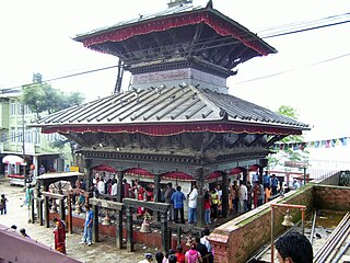
Manakamana is a village development committee in Gorkha District in the Gandaki Zone of northern-central Nepal. At the time of the 1991 Nepal census it had a population of 5,083 and had 889 houses in the town.
South Jhitakaiya is a town and Village Development Committee, near by Dewapur- Chowk/Pokhara/Mandir/School/Police Station and Pashah River, Bara District in the Narayani Zone of south-eastern Nepal. At the time of the 1991 Nepal census it had a population of 7,235.
Thaprek is a Village Development Committee in Nuwakot District in the Bagmati Zone of central Nepal. At the time of the 1991 Nepal census it had a population of 3585 people residing in 632 individual households.
Madanpur, Nepal is a Village Development Committee in Nuwakot District in the Bagmati Zone of central Nepal. At the time of the 1991 Nepal census it had a population of 7995 people residing in 1334 individual households.
Bhumirajmandau is a village development committee in Doti District in the Seti Zone of western Nepal. At the time of the 1991 Nepal census it had a population of 3891 living in 743 individual households.
Chhimkeshwari is a village development committee in Tanahu District in the Gandaki Zone of central Nepal. At the time of the 2011 Nepal census it had a population of 1887 people living in 356 individual households.
Lakhanpur is a Village Development Committee in Ramechhap District in the Janakpur Zone of north-eastern Nepal. At the time of the 1991 Nepal census it had a population of 6,058 people residing in 1,100 individual households.
Udayapur Dhurmi is a village development committee in Parsa District in the Narayani Zone of southern Nepal. At the time of the 2011 Nepal census it had a population of 7,163 people living in 1,085 individual households.
Lal Parsa is a village development committee in Parsa District in the Narayani Zone of southern Nepal. At the time of the 2011 Nepal census it had a population of 4,478 people living in 616 individual households. There were 2,324 males and 2,154 females at the time of census.
Bhairabsthan is a village development committee in the Palpa District of the Lumbini Zone in southern Nepal. According to the 1991 Nepal census, it had a population of 2937 people living in 544 individual households.
Bhuwan Pokhari is a village development committee in Palpa District in the Lumbini Zone of southern Nepal. At the time of the 1991 Nepal census it had a population of 5113 people living in 969 individual households.
Galdha is a village development committee in Palpa District in the Lumbini Zone of southern Nepal. At the time of the 1991 Nepal census it had a population of 3304 people living in 544 individual households.
Kusumkhola is a village development committee in Palpa District in the Lumbini Zone of southern Nepal. At the time of the 1991 Nepal census it had a population of 1809 people living in 349 individual households.
Palung Mainadi is a village development committee in Palpa District in the Lumbini Zone of southern Nepal. At the time of the 1991 Nepal census it had a population of 2675 people living in 445 individual households.

Yamgha is a village development committee in Palpa District in the Lumbini Zone of southern Nepal. At the time of the 2011 Nepal census it had a population of 3,573 people living in 901 individual households.
Parsauni is a village development committee in Nawalparasi District in the Lumbini Zone of southern Nepal. At the time of the 2001 Nepal census it had a population of 6000 people living in 850 individual households.


