
Manaslu is the eighth-highest mountain in the world at 8,163 metres (26,781 ft) above sea level. It is in the Mansiri Himal, part of the Nepalese Himalayas, in the west-central part of Nepal. The name Manaslu means "mountain of the spirit" and is derived from the Sanskrit word manasa, meaning "intellect" or "soul". Manaslu was first climbed on May 9, 1956, by Toshio Imanishi and Gyalzen Norbu, members of a Japanese expedition. It is said that, given the many unsuccessful attempts by the British to climb Everest before New Zealander Edmund Hilary, "just as the British consider Everest their mountain, Manaslu has always been a Japanese mountain".
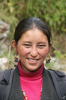
The Tamang are an ethnic group originating in Nepal. Tamang people constitute 5.6% of the Nepalese population at over 1.3 million in 2001, increasing to 1,539,830 as of the 2011 census. Tamang people are also found in significant numbers in the Indian state of Sikkim and districts of Darjeeling and Kalimpong in West Bengal state of India and various districts in the southern foothills of the Kingdom of Bhutan. Such districts include the Tsirang District, the Dagana District, the Samtse District, the Chukha District, the Sarpang District and the Samdrup Jongkhar District. Tamang language is the fifth most spoken language in Nepal.

Gandaki zone (Nepali: गण्डकी अञ्चलListen was one of the fourteen zones of Nepal, located in the Western Development Region. It was named as Sapta Gandaki after the seven tributaries that makes up the Gandaki River. Pokhara served as its regional and zonal headquarter. It was also the birthplace of Bhanubhakta Acharya, first poet of Nepal.

Dhading District, a part of Bagmati Province, is one of the seventy-seven districts of Nepal. The district, with Dhading Besi as its district headquarters, covers an area of 1,926 square kilometres (744 sq mi), had a population of 338,658 in 2001 and 336,067 in 2011.
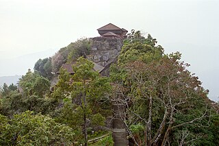
Gorkha District, a part of Gandaki Province, is one of the 77 districts of Nepal, which is the fourth largest district of Nepal and connected historically with the creation of the modern Nepal and the name of the legendary Gorkha soldiers. The district, with Gorkha Municipality as its district headquarters, covers an area of 3,610 km2 (1,390 sq mi) and has a population of 271,061 according to the 2011 Census of Nepal. Gorkha district is the site of the Manakamana Temple. The temples of Gorakh Nath and Gorakh Kali are found in the district. Several major rivers—the Chepe, Daraudi, Marsyangdi, Budi Gandaki, and Trishuli—run through the district.

Humla District, a part of Karnali Province, is one of the seventy-seven districts of Nepal. The district, with Simikot as its district headquarters, covers an area of 5,655 km2 (2,183 sq mi) and has population of 50,858 as per the census of 2011. Humla is the 2nd largest district of Nepal. The Southern part and middle of Humla District is inhabited by Khas people, originating from Sinja valley, whereas the North border is mostly inhabited by Tibetans. Northern part of this district is administered by China since border skirmishes with India in 2020.

Mustang District is one of the eleven districts of Gandaki Province and one of seventy-seven districts of Nepal. It covers an area of 3,573 km2 (1,380 sq mi) and has a population (2011) of 13,452. The headquarters is located at Jomsom. Mustang is the 5th largest district of Nepal.
Solukhumbu District (Nepali: सोलुखुम्बु जिल्ला[solukʰumbu], Sherpa: ཤར་ཁུམ་བུ་རྫོང་།, Wylie: shar khum bu dzong) is one of 14 districts of Province No. 1 of eastern Nepal. As the name suggests, it consists of the subregions Solu and Khumbu.
Lomanthang is a rural municipality in Mustang district in Gandaki Province of western Nepal. It is located at the northern end of the district, bordering the Tibet Autonomous Region of China to the north and Dalome rural municipality of Mustang in the south.
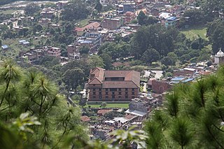
Gorkha is a municipality in Gorkha District in Gandaki Province of Nepal created in 1996. It was initially named "Prithibinarayan" after King Prithvi Narayan Shah, who was born in Gorkha and united and founded modern Nepal. In 2009, the name was changed to "Gorkha" municipality after the end of the monarchy in Nepal. At the time of the 2011 Nepal census it had a population of 49,272 people living in 13,127 individual households. In 2014, the neighboring Village development committees Nareshwar and Phinam were merged into the municipality.

Jomsom, also known as Dzongsam is the centre of Gharapjhong rural municipality in Mustang district and a former independent village development committee situated at an altitude of about 2,700 metres (8,900 ft) in Gandaki Province of western Nepal. The soaring peaks of Dhaulagiri and Nilgiri form a backdrop to the town straddling the Kali Gandaki River, which flows right through the centre of Jomsom. Along the banks of the Kali Gandaki, black fossilised stones called shaligram, considered as an iconic symbol and reminder of the god Vishnu in the Hindu culture, can be found. Such stones are believed to be found only in the Kali Gandaki, and are holy to the Hindus.

Saurpani is Ward no.4 Sulikot Gaupalika in Gorkha District in the Gandaki Zone of northern-central Nepal. At the time of the 2011 Nepal census it had a population of 5,958 and had 1,325 houses in the town.

Saldang is a village in Dolpa District in the Karnali Zone of north-western Nepal. Saldang lies at an altitude of 3,620 metres (11,880 ft) in the Nankhang Valley, in the historic Tibetan region of Dolpo. At the time of the 1991 Nepal census, Saldang had a population of 1,714 in 386 individual households, and as of 2011 it has a population of 2,103 people.
Kaskikot, commonly known as Kaski, is a Ward no. 24 of the Pokhara metropolitan city. It was earlier a part of the village development committee in Kaski District, a region in northern-central Nepal.

Marpha is a village in Mustang District in the Dhawalagiri Zone of northern Nepal. At the time of the 1991 Nepal census it had a population of 1630 people living in 434 individual households.
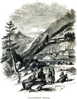
Olangchung Gola is a village in ward no. 7 of Phaktanglung rural municipality of Taplejung District of Province No. 1 in Nepal. Olangchung is surrounded by Lelep village to the east and Tibet to the north, Sankhuwasabha District to west and Mikkwakhola rural municipality to south. It is located to the north of Tamor River in the mountainous area in the northwest of Taplejung District bordering Tibet, China. Lately the river flowing next to the village is gradually expanding towards the village posing a serious threat of submerging the village.

The Annapurna Circuit is a trek within the mountain ranges of central Nepal. The total length of the route varies between 160–230 km (100-145 mi), depending on where motor transportation is used and where the trek is ended. This trek crosses two different river valleys and encircles the Annapurna Massif. The path reaches its highest point at Thorung La pass (5416m/17769 ft), reaching the edge of the Tibetan plateau. Most trekkers hike the route anticlockwise, as this way the daily altitude gain is slower, and crossing the high Thorong La pass is easier and safer.

Nubri is a Tibeto-Burman language spoken by about 2000 ethnically Tibetan people living in Nubri Valley in northern Central Nepal, upper Gorkhā District of Gandaki Province. Nubri has at least three dialects as typified by the Prok, Lho and Sama village varieties. Nubri is largely undocumented and undescribed, with the exception of a lexicon. Nubri is perhaps most closely related to neighbouring Tsum language and the Kyirong variety of Tibetan spoken just across the border in Tibet. It has also been claimed to be closely related to Gyalsumdo. Like these languages it is tonal and shares many Tibetic grammatical features, but is uniquely different in many ways.
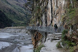
The Gorkha Bridge is a 195 m-long (640 ft) cantilever footbridge connecting Sirdibas and Kerauja, Gorkha in Nepal. It was constructed with the help of the Department for International Development, engineers from Switzerland, and 400 local workers. The bridge cost approximately NPR 38 million, and was constructed by attaching the trusses to the side of a cliff.
Tsum valley is a valley situated between 2000 to 3500 asl in Gorkha district of western Nepal. The valley lies inside the jurisdiction of Manaslu Conservation Area which was established in 1998.


