
Dhading District, a part of Bagmati Province, is one of the seventy-seven districts of Nepal. The district, with Dhading Besi as its district headquarters, covers an area of 1,926 square kilometres (744 sq mi), had a population of 338,658 in 2001 and 336,067 in 2011.
Gorkha District, a part of Gandaki Province, is one of 77 districts of Nepal, and the fourth largest district of the country in terms of area. It is historically linked with the creation of modern Nepal and the name of the legendary Gorkha soldiers. The district, with Gorkha Municipality as its district headquarters, covers an area of 3,610 km2 (1,390 sq mi) and has a population of 252,201, according to the 2021 Nepal census. Gorkha district is the site of the Manakamana Temple, as well as Gorakhnath and Gorakh Kali temples. Several major rivers—including the Chepe, Daraudi, Marsyangdi, Budi Gandaki, and Trishuli—run through the district.
Kailali District, a part of Sudurpashchim Province in Terai plain, is one of the 77 districts of Nepal. The district, with Dhangadhi as its district headquarters, covers an area of 3,235 square kilometres (1,249 sq mi) and has a population of 911,155 and, .
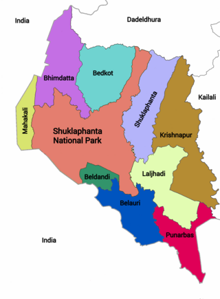
Kanchanpur District, a part of Sudurpashchim Province in the Terai plain, is one of seventy-seven districts of Nepal. The district, with Bhimdatta as its district headquarters, covers an area of 1,610 square kilometres (620 sq mi) and had a population of 134,868 in 2001 and 171,304 in 2011. It is located in south-western of Nepal. It is bordered by Kailali district in the east, Dadeldhura district in the north and with India in the south and west.

Lamjung District, a part of Gandaki Province, is one of the 77 districts of Nepal. The district, with Besisahar as its district headquarters, covers an area of 1,692 square kilometres (653 sq mi) and as of 2011 had a population of 167,724. Lamjung lies in the mid-hills of Nepal spanning tropical to trans-Himalayan geo-ecological belts, including the geographical midpoint of the country. It has mixed habitation of casts and ethnicities. It is host to probably the highest density of the Gurung ethnic population in the country.

Pyuthan District (Nepali: प्युठान जिल्ला, is a "hill" district some 427.6 km west of Kathmandu in Lumbini Province in midwestern Nepal. Pyuthan covers an area of 1,309 km2 with population of 212,484 in 2001 and 226,796 in 2011. Pyuthan Khalanga is the district's administrative center.

Khandbari is the district headquarters of Sankhuwasabha District in Koshi Province of north-eastern Nepal.

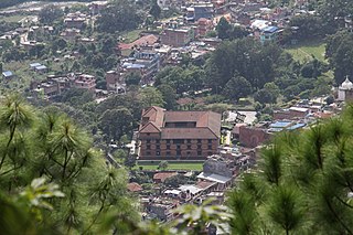
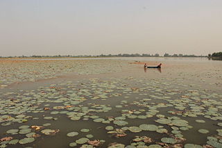
Nilkantha or Neelkantha is one of two Municipalities in Dhading District in the Bagmati Province of central Nepal. The municipality is located around the center of the district and holds the majority of the population and facilities of the entire district. The municipality was established on 18 May 2014, merging with the existing places such as Nilkantha, Dhuwakot, Sunaula Bazar, Murali Bhanjyang, and Sangkosh VDC Nilkantha municipality is the most developed place of the dhading district as the economic and social conditions are greater than other parts of the district.

Dipayal Silgadhi is a municipality and the district headquarters of Doti District in Sudurpashchim Province of Nepal. Previously, it also served as the headquarters of the Far-Western Development Region. It lies in the Lesser Himalayas on the bank of Seti River. At the time of the 2011 Nepal census it had a population of 32,941 people living in 7,447 individual households.
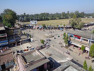
Punarwas is a Municipality in Kanchanpur District in Sudurpashchim Province of south-western Nepal. The new Municipality was established on 18 May 2014 by merging the existing 3 Village Development Committees i.e. Parasan, Tribhuwanbasti and Kalika. At the time of the 2011 Nepal census, it had a population of 43,996 people living in Punarwas.

Tarakeshwar is a municipality in Kathmandu District in Bagmati Province of Nepal that was established on 2 December 2014 by merging the former Village development committees Dharmasthali, Futung, Goldhunga, Jitpurphedi, Kavresthali, Manmaiju and Sangla. The office of the municipality is that of the former Dharmasthali village development committee.
Kalika is a municipality in Chitwan District in the Narayani Zone of southern Nepal. This municipality was established in 2015 AD by merging the existing Jutpani, Padampur, Shaktikhor and Siddhi VDCs.

Gandaki Province ), is one of the seven federal provinces established by the current constitution of Nepal which was promulgated on 20 September 2015. Pokhara is the province's capital city. It borders the Tibet Autonomous Region in Southwest China to the north, Bagmati Province to the east, Karnali Province to the west, and Lumbini Province and Bihar of India to the south. The total area of the province is 21,504 km2 - constituting 14.57% of Nepal's total area. According to the latest census, the population of the province was 2,479,745. The newly elected Provincial Assembly adopted Gandaki Province as the permanent name by replacing its initial name Province No. 4 on 27 April 2023. Surendra Raj Pandey is the present chief minister of Gandaki Province.
Palungtar is a municipality in Gorkha District in Gandaki Province, central Nepal. It is made up of the seven former Village Development Committees Aanppipal, Chyangli, Dhuwakot, Gaikhur, Khoplang, Mirkot and Palumtar. It lies on the bank of Marshyangdi River. The Government of Nepal plans to make Palungtar the country's first Smart City. At the time of the 2011 Nepal census it had a population of 38,174 people living in 9,924 individual households.
Rapti Municipality is a municipality which lies in Eastern part of Chitwan district in Bagmati Province of Nepal. It was formed as municipality in 2015 by merging five existing village development committees, Birendranagar VDC, Bhandara VDC, Piple VDC, Lothar VDC and Korak VDC. Total area of this municipality is 99.40 and population of this municipality according to 2068 BS census is 46510.

Barpak Sulikot is a Rural Municipality in Gorkha District in the Gandaki Province of northern-central Nepal. After the merging of 7 village development committee, it's called Barpak Sulikot.
Ajirkot Rural Municipality is a Gaunpalika in Gorkha District in Gandaki Province of Nepal. On 12 March 2017, the government of Nepal implemented a new local administrative structure, with the implementation of the new local administrative structure, VDCs have been replaced with municipal and Village Councils. Ajirkot is one of these 753 local units.
Arughat Rural Municipality is a Gaunpalika in Gorkha District in Gandaki Province of Nepal. It is divided into 10 wards. On 12 March 2017, the government of Nepal implemented a new local administrative structure, with the implementation of the new local administrative structure, VDCs have been replaced with municipal and Village Councils. Arughat is one of these 753 local units.
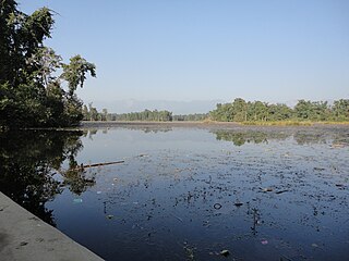
Badhaiyatal is a rural municipality located in Bardiya District of Lumbini Province of Nepal.
Benighat Rorang is a rural municipality located within the Dhading District of the Bagmati Province of Nepal. The rural municipality spans 29.17 square kilometres (11.26 sq mi), with a total population of 31,475 according to a 2011 Nepal census.


