Biber glaciation

Last updated

The Biber glaciation (German : Biber-Kaltzeit), Biber Glacial (Biber-Glazial), Biber Complex (Biber-Komplex) or Biber Ice Age (Biber-Eiszeit) is the oldest glacial period of the Pleistocene epoch. It is not part of the traditional four-stage glaciation schema of the Alps by Albrecht Penck and Eduard Brückner, but was named after the Biberbach river north of Augsburg in 1953 by Ingo Schaefer, based on the naming system of the traditional Penck schema. [1] [2] Its type region is the Stauden Plateau in the Iller-Lech Plateaux and the Staufenberg Gravel Terrace in the area of Aindling. The Biber glaciation is followed by the Biber-Danube interglacial.

German language West Germanic language

German is a West Germanic language that is mainly spoken in Central Europe. It is the most widely spoken and official or co-official language in Germany, Austria, Switzerland, South Tyrol (Italy), the German-speaking Community of Belgium, and Liechtenstein. It is also one of the three official languages of Luxembourg and a co-official language in the Opole Voivodeship in Poland. The languages which are most similar to German are the other members of the West Germanic language branch: Afrikaans, Dutch, English, the Frisian languages, Low German/Low Saxon, Luxembourgish, and Yiddish. There are also strong similarities in vocabulary with Danish, Norwegian and Swedish, although those belong to the North Germanic group. German is the second most widely spoken Germanic language, after English.

A glacial period is an interval of time within an ice age that is marked by colder temperatures and glacier advances. Interglacials, on the other hand, are periods of warmer climate between glacial periods. The last glacial period ended about 15,000 years ago. The Holocene epoch is the current interglacial. A time with no glaciers on Earth is considered a greenhouse climate state.

The Pleistocene is the geological epoch which lasted from about 2,588,000 to 11,700 years ago, spanning the world's most recent period of repeated glaciations. The end of the Pleistocene corresponds with the end of the last glacial period and also with the end of the Paleolithic age used in archaeology.

Contents

Classification

In 1953, Schaefer defined the Biber glaciation from gravel landforms of the Stauden Plateau in the area of the Iller-Lech Plateau and in the Aindling terrace sequence, by grouping together the so-called Middle and Upper Cover Gravels or Deckenschotter. This corresponded to the Staufenberg Gravel Terrace on the Iller-Lech Plateau, identified in 1974 by Scheunenpflug, and the so-called High Gravels (Hochschottern) of the Aindling region. [3] The rich crystalline sedimentary facies (Kristallinreiche Liegendfazies), that Löscher distinguished in 1976 in the area of the Rhine Glacier of the western Riß-Iller Plateau may also be paralleled with these glacial landforms. [4] The gravels in the Iller-Lech region ascribed to the Biber glaciation are generally heavily weathered and originate from the Northern Limestone Alps. Löscher's Kristallinreiche Liegendfazies, by contrast, originates from the bedrock of the molasse zone.

The Rhine Glacier was a glacier during the last glacial period and was responsible for the formation of the Lake Constance.

Northern Limestone Alps ranges of the Eastern Alps

The Northern Limestone Alps, also called the Northern Calcareous Alps, are the ranges of the Eastern Alps north of the Central Eastern Alps located in Austria and the adjacent Bavarian lands of southeastern Germany. The distinction from the latter group, where the higher peaks are located, is based on differences in geological composition.

Molasse Sandstones, shales and conglomerates that form as terrestrial or shallow marine deposits in front of rising mountain chains.

The term "molasse" refers to sandstones, shales and conglomerates that form as terrestrial or shallow marine deposits in front of rising mountain chains. The molasse deposits accumulate in a foreland basin, especially on top of flysch—like, for example, those that left from the rising Alps, or erosion in the Himalaya. These deposits are typically the non-marine alluvial and fluvial sediments of lowlands, as compared to deep-water flysch sediments. Sedimentation stops when the orogeny stops, or when the mountains have eroded flat.

Any connexion with the glacial classification of North Germany and the Netherlands is problematic. The Biber glacial correlates either to the Eburonian complex or the Pre-Tiglian complex in the Netherlands. In the former case it would correspond to MIS 56 to 62, which would place it in the period between 1.6 and 1.8 million years ago, [5] [6] in the latter case it would roughly correspond to MIS 96 to 100, and would therefore have taken place about 2.4 to 2.588 million years ago. [7] [8] [9] The correlation is fraught with problems however due to the fact that the corresponding depositions in the Netherlands were probably not governed by climatic changes. Similar doubts on climatic grounds for the depositions assessed as Biber-related also exist in the Alpine region. It is possible that there were tectonic influences perhaps in the wake of the uplift phases of the Alps. The succession and appearance of the gravel bodies makes it possible that during their formation there were several periods of alternating fluvial erosion and accumulation.

The Eburonian, or, much less commonly, the Eburonian Stage, is a glacial complex in the Calabrian stage of the Pleistocene epoch and lies between the Tegelen and the Waalian interglacial. The transition from the Tegelen to the Eburonian started about 1.78 million years ago, lasted 480,000 years, its base marking the boundary between the Neogene and Quaternary deposits of the Netherlands.

Marine isotope stage Alternating warm and cool periods in the Earths paleoclimate, deduced from oxygen isotope data

Marine isotope stages (MIS), marine oxygen-isotope stages, or oxygen isotope stages (OIS), are alternating warm and cool periods in the Earth's paleoclimate, deduced from oxygen isotope data reflecting changes in temperature derived from data from deep sea core samples. Working backwards from the present, which is MIS 1 in the scale, stages with even numbers have high levels of oxygen-18 and represent cold glacial periods, while the odd-numbered stages are troughs in the oxygen-18 figures, representing warm interglacial intervals. The data are derived from pollen and foraminifera (plankton) remains in drilled marine sediment cores, sapropels, and other data that reflect historic climate; these are called proxies.

The Biber cold period at least corresponds partly with the Swiss cover gravel glaciations (Deckenschotter-Vergletscherungen). [10]

Occurrence

Gravels ascribed to the Biber glacial period (also called the Highland Gravel or Oldest Gravel (Ältester Deckenschotter) occur northwest of Augsburg as the Stauffenberg Gravel (Stauffenberg-Schotter), as well as northeast as the Hohenried Gravel (Hohenrieder Schotter) and southwest of Augsburg as the Stauden Plateau Gravel (Schotter der Stauden-Platte). Also included are isolated gravels of the Hochfirst near Mindelheim and the Stoffersberg near Landsberg am Lech. [11] There may also be gravels in the Sundgau from the Biber ice age.

Augsburg Place in Bavaria, Germany

Augsburg is a city in Swabia, Bavaria, Germany. It is a university town and regional seat of the Regierungsbezirk Schwaben. Augsburg is an urban district and home to the institutions of the Landkreis Augsburg. It is the third-largest city in Bavaria with a population of 300,000 inhabitants, with 885,000 in its metropolitan area.

Mindelheim Place in Bavaria, Germany

Mindelheim is a town in Swabia, Bavaria, Germany. The town is the capital of the Unterallgäu district. At various points in history it was the chief settlement of an eponymous state.

Landsberg am Lech Place in Bavaria, Germany

Landsberg am Lech is a town in southwest Bavaria, Germany, about 65 kilometers west of Munich and 35 kilometers south of Augsburg. It is the capital of the district of Landsberg am Lech.

Related Research Articles

Würm glaciation

The Würm glaciation, in the literature usually just referred to as the Würm, often spelt "Wurm", was the last glacial period in the Alpine region. It is the youngest of the major glaciations of the region that extended beyond the Alps themselves. It is, like most of the other ice ages of the Pleistocene epoch, named after a river, the Würm in Bavaria, a tributary of the Amper. The Würm ice age can be dated to the time about 115,000 to 11,700 years ago, the sources differing depending on whether the long transition phases between the glacials and interglacials are allocated to one or other of these periods. The average annual temperatures during the Würm ice age in the Alpine Foreland were below −3 °C. This has been determined from changes in the vegetation as well as differences in the facies.

Mindel glaciation glacial stage in the Alps

The Mindel glaciation is the third oldest glacial stage in the Alps. Its name was coined by Albrecht Penck and Eduard Brückner, who named it after the Swabian river, the Mindel. The Mindel glacial occurred in the Middle Pleistocene; it was preceded by the Haslach-Mindel interglacial and succeeded by the Mindel-Riss interglacial.

Riss glaciation alpine glacial period in the Pleistocene epoch

The Riss glaciation, Riss Glaciation, Riss ice age, Riss Ice Age, Riss glacial or Riss Glacial is the second youngest glaciation of the Pleistocene epoch in the traditional, quadripartite glacial classification of the Alps. The literature variously dates it to between about 300,000 to 130,000 years ago and 347,000 to 128,000 years ago. It coincides with the Saale glaciation of North Germany. The name goes back to Albrecht Penck and Eduard Brückner who named this cold period after the river Riss in Upper Swabia in their three-volume work Die Alpen im Eiszeitalter published between 1901 and 1909.

Saale glaciation European glaciation

The Saale glaciation or Saale Glaciation, sometimes referred to as the Saalian glaciation, Saale cold period, Saale complex (Saale-Komplex) or Saale glacial stage, covers the middle of the three large glaciations in Northern Europe and the northern parts of Eastern, Central and Western Europe by the Scandinavian Inland Ice Sheet between the older Elster glaciation and the younger Weichselian glaciation.

The Gunz or Günz glaciation, also sometimes the Günz, Gunzian glaciation or Günz glacial stage, is a glacial stage of the Pleistocene epoch. It is the oldest glaciation of the Pleistocene in the traditional, quadripartite glacial classification of the Alps, although there are signs of even older glaciations in the Alpine Foreland, so that today it is reckoned that there were at least eight to 15 glacial periods. The name goes back to Albrecht Penck and Eduard Brückner, who named this ice age after the River Günz in their multi-volume work, Die Alpen im Eiszeitalter which was published between 1901 and 1909. Its type region is the Iller-Lech Plateau. The Günz followed the Danube-Günz interglacial and was ended by the Günz-Haslach interglacial.

Weichselian glaciation glacial period

Weichselian glaciation was the last glacial period and its associated glaciation in Northern Europe. In the Alpine region it corresponds to the Würm glaciation. It was characterized by a large ice sheet that spread out from the Scandinavian Mountains and extended as far as the east coast of Schleswig-Holstein, the March of Brandenburg and Northwest Russia.
Alpine Foreland geographic region

The Alpine Foreland, less commonly called the Bavarian Foreland, Bavarian Plateau or Bavarian Alpine Foreland, refers to a triangular region of plateau and rolling foothills in Southern Germany, stretching from Lake Constance in the west to beyond Linz on the Danube in the east, with the Bavarian Alps forming its south boundary and the Danube its northern extent.

Iller-Lech Plateau

The Iller-Lech Plateau, also known as the Upper Swabian Plateau, is one of the natural regions of Germany.

Calenberg mountain

The Calenberg is a hill in central Germany in the Leine depression near Pattensen in the municipality of Schulenburg. It lies 13 km west of the city of Hildesheim in south Lower Saxony on the edge of the Central Uplands. It is made from a chalk marl slab (Kalkmergelbank), has a height of 70 m above NN and was formed almost 100 million years ago at the beginning of the Upper Cretaceous series in Cenomanian stage. The Calenberg became historically important as a result of the fort, stronghold and castle built as the main residence of the House of Hanover.

The glacial series refers to a particular sequence of landforms in Central Europe that were formed during the Pleistocene glaciation beneath the ice sheets, along their margins and on their forelands during each glacial advance.

Barnim Plateau plateau in Germany

The Barnim Plateau is a plateau which is occupied by the northeastern parts of Berlin and the surrounding federal state of Brandenburg in Germany.

Hohe Munde mountain

The Hohe Munde is a 2,662-metre-high (8,734 ft) mountain at the eastern end of the Mieming Chain in the Austrian state of Tyrol. It has two peaks: the west top (2,662 m) and the east top or Mundekopf (2,592 m).

An alpentor in geology is the point where an entire glacier forced its way through to the Alpine Foreland from the Alps during the ice age.

The Waalian interglacial was an interglacial period in northern Europe that lasted from about 1.45 million to 1.20 million years ago. It thus lies entirely within the Old Pleistocene and is thus part of the Cenozoic. Its name is derived from a major branch of the Rhine delta, the Waal. The Waal warm period could correspond temporally to the Danube-Gunz interglacial of the northern Alpine Foreland.

The Danube glaciation or Donau glaciation, also known as the Danube Glacial (Donau-Glazial), is a glacial stage of the Pleistocene epoch. It does not appear in the traditional, quadripartite ice age schema of the Alps by Albrecht Penck. The Danube stage was named by Barthel Eberl in 1930 after the River Danube. The Danube Glacial is the oldest glaciation in the Alps for which there is evidence outside of the Iller-Lech region. The Danube Stage was preceded by the Biber-Danube interglacial and followed by the Danube-Günz interglacial.

The Haslach glaciation, also Haslach Glacial Stage (Haslach-Glazial), Haslach Complex (Haslach-Komplex) or Haslach Ice Age (Haslach-Eiszeit), is a cold period of the Pleistocene epoch. It was not included in the traditional glacial schema of the Alps by Albrecht Penck and Eduard Brückner. The glacial stage was first described around 1981 by A. Schreiner and R. Ebel. Its type region is the Haslach Gravels (Haslach-Schotter) in the area of the Riß-Iller-Lech Plateau. The Haslach cold period was preceded by the Günz-Haslach interglacial and followed by the Haslach-Mindel Interglacial.

The Biber-Danube interglacial or Biber-Danube warm period (Biber-Donau-Warmzeit) is the oldest named warm period of the Pleistocene epoch in the Alps. It falls between the Biber and Danube glaciations.

The Danube-Gunz interglacial, Danube-Gunz warm period (Donau-Günz-Warmzeit), often just Danube-Gunz, or also Uhlenberg interglacial (Uhlenberg-Warmzeit) is the second-oldest named warm period of the Pleistocene in the Alps. It lies between the Danube and Gunz glacials.

The Gunz-Haslach interglacial, also Gunz-Haslach warm period (Günz-Haslach-Warmzeit), is one of the warm periods of the Pleistocene in the Alpine region. It lies between the Gunz and Haslach glaciations.

The Haslach-Mindel interglacial, also called the Haslach-Mindel warm period (Haslach-Mindel-Warmzeit), is a warm period of the Pleistocene in the Alpine region. It lies between the Haslach and Mindel glacial stages.

References

  1. I. Schaefer (1956), "Sur la division du Quaternaire dans l'avant-pays des Alpes en Allemagne", Actes IV Congres INQUA, Rome/Pise 1953 (in German), 2, pp. 910–914
  2. I. Schaefer (1957), Bayerisches Geologisches Landesamt München, ed., Erläuterungen zur Geologischen Karte von Augsburg und Umgebung, 1:50.000 (in German)
  3. L. Scheunenpflug (1974), "Zur Stratigraphie altpleistozäner Schotter südwestlich bis nordöstlich Augsburg (östliche Iller-Lech-Platte)", Heidelberger geographische Arbeiten (in German), Heidelberg, 40, pp. 87–94
  4. M. Löscher (1976), "Die präwürmzeitliche Schotterablagerungen in der nördlichen Iller-Lech-Platte", Heidelberger Geographische Arbeiten (in German), Heidelberg, 45, pp. 1–157
  5. Lorraine E. Lisiecki; Maureen E. Raymo (2005), "A Plio-Pleistocene Stack of 57 Globally Distributed Benthic δ18O Records" (PDF), Paleoceanography (in German), 20, archived from the original (pdf-Datei; archivierte Version; 1,1 MB) on 2011-06-16
  6. Gibbard, P.L., Cohen, K.M. (2008), "Global stratigraphical correlation table for the last 2.7 Million years.", Episodes (in German), 31, pp. 243–247CS1 maint: Multiple names: authors list (link)
  7. Kuhlmann, G. (2004), "High resolution stratigraphy and paleoenvironmental changes in the southern North Sea during the Neogene - An integrated study of Late Cenozoic marine deposits from the northern part of the Dutch offshore area. (Thesis Utrecht University)", Geologica Ultraiectina, Mededelingen van de Faculteit Aardwetenschappen (in German), Utrecht, 245, pp. 1–205
  8. Meijer, T., Cleveringa, P., Munsterman, D.K., Verreussel, R.M.C.H. (2006), "The Early Pleistocene Praetiglian and Ludhamian pollen stages in the North Sea Basin and their relationship to the marine isotope record.", Journal of Quaternary Science (in German), 21, pp. 307–310CS1 maint: Multiple names: authors list (link)
  9. Gibbard, P.L., Cohen, K.M. (2008), "Global stratigraphical correlation table for the last 2.7 Million years.", Episodes (in German), 31, pp. 243–247CS1 maint: Multiple names: authors list (link)
  10. Ueli Reinmann (2004), "Auf den Spuren der Eiszeit im Raum Wangen a. A. : Neue Erkenntnisse auf Grund von bodenkundlichen Untersuchungen im Endmoränengebiet des Rhonegletschers" (pdf-Datei; 850 kB), Jahrbuch des Oberaargaus (in German), 47, pp. 135–152
  11. Walter Freudenberger; Klaus Schwerd (1996), Geologische Karte von Bayern 1:500000 mit Erläuterungen. 1 Karte + Erläuterungen + 8 Beilagen (in German) (4. ed.), München: Bayrisches Geologisches Landesamt, pp. 238 ff

Literature

Digital object identifier Character string used as a permanent identifier for a digital object, in a format controlled by the International DOI Foundation

In computing, a Digital Object Identifier or DOI is a persistent identifier or handle used to uniquely identify objects, standardized by the International Organization for Standardization (ISO). An implementation of the Handle System, DOIs are in wide use mainly to identify academic, professional, and government information, such as journal articles, research reports and data sets, and official publications though they also have been used to identify other types of information resources, such as commercial videos.

International Standard Serial Number unique eight-digit number used to identify a print or electronic periodical publication

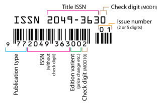
An International Standard Serial Number (ISSN) is an eight-digit serial number used to uniquely identify a serial publication, such as a magazine. The ISSN is especially helpful in distinguishing between serials with the same title. ISSN are used in ordering, cataloging, interlibrary loans, and other practices in connection with serial literature.