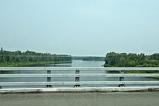
The York River is a river in Renfrew County, Hastings County and Haliburton County in Ontario, Canada. The river is in the Saint Lawrence River drainage basin, and flows from the southern extension of Algonquin Provincial Park to the Madawaska River.

The Sand River is a river in the Unorganized North Part of Algoma District in Northeastern Ontario, Canada. It is in the Great Lakes Basin, is a tributary of Lake Superior, and its entire course lies within Lake Superior Provincial Park.

The Groundhog River is a river in Cochrane District and Sudbury District in Northeastern Ontario, Canada. The river is in the James Bay drainage basin and is a left tributary of the Mattagami River.
The Coldwater River is a river in the Unorganized North Part of Algoma District in Northeastern Ontario, Canada. It is in the Great Lakes Basin, is a tributary of Lake Superior, and its entire course lies within Lake Superior Provincial Park.

The Misema River is a river in Timiskaming District and Cochrane District in Northeastern Ontario, Canada. It is in the Saint Lawrence River drainage basin and is a left tributary of the Blanche River.

The Black River is a river in Hastings County in Central Ontario, Canada. It is part of the Great Lakes Basin, and is a left tributary of the Moira River.
The Black River is a river in the municipality of Sioux Narrows-Nestor Falls, Kenora District in Northwestern Ontario, Canada. It is part of the Hudson Bay drainage basin, and is a tributary of the Lake of the Woods.
The Little White River is a river in the Unorganized North Part of Algoma District in Northeastern Ontario, Canada. It is in the Great Lakes Basin and is a left tributary of the Mississagi River.

The Black River is a river in Cochrane District and Timiskaming District in Northeastern Ontario, Canada. It is part of the James Bay drainage basin, and is a right tributary of the Abitibi River. The municipality of Black River-Matheson is named after the river.

The Onaping River is a river in Greater Sudbury and Sudbury District in Northeastern Ontario, Canada. It is in the Great Lakes Basin and is a right tributary of the Vermilion River.
The Matawin River is a river in Thunder Bay District in Northwestern Ontario, Canada. It is in the Great Lakes Basin and is a right tributary of the Kaministiquia River.
The North River is a river in the municipality of Havelock-Belmont-Methuen, Peterborough County in Central Ontario, Canada. It is part of the Great Lakes Basin, and is a right tributary of the Crowe River.
The Nemegosenda River is a river in Algoma District and Sudbury District in northeastern Ontario, Canada. It is in the James Bay drainage basin, and is a right tributary of the Kapuskasing River.
The Shawmere River is a river in Sudbury District in northeastern Ontario, Canada. It is in the James Bay drainage basin, and is a left tributary of the Ivanhoe River.
The Valentine River is a river in the Unorganized North Part of Cochrane District in northeastern Ontario, Canada. It is in the Moose River drainage basin, and is a tributary of Lac Pivabiska, the source of the Pivabiska River.
Swan Lake is a lake in geographic Lee Township and geographic Maisonville Township in the Unorganized West Part of Timiskaming District, in northeastern Ontario, Canada. The lake is in the James Bay drainage basin and the nearest community is Sesekinika, 4.9 kilometres (3.0 mi) to the northeast. Swan Lake is the location of the mouth of Woollings Creek and is the source of the Whiteclay River.
Woollings Creek is a creek in Timiskaming District and Cochrane District in northeastern Ontario, Canada. It is in the James Bay drainage basin and is a tributary of the Whiteclay River.
The Whiteclay River is a river in Cochrane District and Timiskaming District in northeastern Ontario, Canada. It is in the James Bay drainage basin and is a left tributary of the Black River.
The Jocko River is a river in Nipissing District in Northeastern Ontario, Canada. It is in the Saint Lawrence River drainage basin, is a right tributary of the Ottawa River, and lies entirely within Jocko Rivers Provincial Park.
The Poplar Rapids River is a river in the municipality of Fauquier-Strickland and Unorganized North Cochrane District, Cochrane District in Northeastern Ontario, Canada. It is in the James Bay drainage basin and is a left tributary of the Mattagami River.


