Esmeralda County is a county in the southwestern portion of the U.S. state of Nevada. As of the 2020 census, the population was 729, making it the least populous county in Nevada, and the 20th least populous county in the United States. Esmeralda County does not have any incorporated communities. Its county seat is the town of Goldfield.

Tonopah is an unincorporated town in and the county seat of Nye County, Nevada, United States. Nicknamed the Queen of the Silver Camps for its mining-rich history, it is now primarily a tourism-based resort city, notable for attractions like the Mizpah Hotel and the Clown Motel.
Goldfield is a census-designated place in and the county seat of Esmeralda County, Nevada.

Rhyolite is a ghost town in Nye County, in the U.S. state of Nevada. It is in the Bullfrog Hills, about 120 miles (190 km) northwest of Las Vegas, near the eastern boundary of Death Valley National Park.

Belmont is a ghost town in Nye County, Nevada, United States along former State Route 82. The town is a historic district listed in the National Register of Historic Places. It is Nevada Historical Marker number 138.

Josiah Edward Spurr (1870–1950) was an American geologist, explorer, and author. Born in Gloucester, Massachusetts, he was considered something of a failure as a youth, unsuited for the family fishing business, since on a voyage he invariably became seasick. Since he could not be a productive fisherman like his brothers, his parents decided he might as well go to college. After working his way through Harvard, he began his career with the Minnesota Geological Survey, making the first-ever geological map of the great Mesabi Range in Minnesota.

Silver City is a Census Designated Place and small residential community in Lyon County, Nevada, USA, near the Lyon/Carson border. The population as of the 2020 census was 155.

Gold Point, Nevada is a ghost town in Esmeralda County, Nevada. The community was named after the local gold-mining industry. Gold Point is the southern terminus of Nevada State Route 774. Its current population is about seven.

Silver Peak is an unincorporated community and census-designated place (CDP) in Esmeralda County, Nevada, United States. It lies along State Route 265, 20 miles (32 km) south of U.S. Route 6 and 30 miles (48 km) west of Goldfield, the county seat of Esmeralda County. It has a post office, with the ZIP code of 89047. The population of Silver Peak was 142 as of 2019.

Coaldale is a former mining town and true ghost town in Esmeralda County, Nevada, located at the junction of U.S. Route 6 and U.S. Route 95 about 40 miles (64 km) west of Tonopah.

Gold Center was a mining town in Nye County, Nevada. Located in the Bullfrog Mining District south of Tonopah, Gold Center was established in December 1904 with a United States Post Office being authorized on January 21, 1905. The town began publishing its own newspaper in 1907. The location of the town was ideal as it was on the stagecoach route to Rhyolite and Beatty. It was also near the Amargosa River, allowing sufficient water for drinking and for two mills and an ice house. Gold Center also sold water to Rhyolite and Carrara. The Tonopah and Tidewater Railroad, the Las Vegas & Tonopah Railroad and the Bullfrog Goldfield Railroad all ran through Gold Center. Gold Center also had the first brewery in the area which was built underground to maintain a cool temperature.

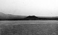
Millers is a ghost town located in Esmeralda County, Nevada. Deserted today, Millers sprang up as a mining boomtown after the Tonopah boom began. A highway rest stop is located there, resulting in Millers still being listed on many travel maps.

The Berlin Historic District encompasses the ghost town of Berlin in Nye County, Nevada. The town was established in 1897 as part of the Union Mining District after the opening of the Berlin Mine the previous year. The name is a transfer from Berlin, in Germany, the native land of a share of the local prospectors. The town never prospered to the same extent as other boom towns like Tonopah and Goldfield, and declined following the Panic of 1907. The town was largely abandoned by 1911. The site was acquired by the state of Nevada as part of Berlin–Ichthyosaur State Park in 1970.

George Wingfield was a Nevada cattleman and gambler who became a financier, investor and one of the state's most powerful economic and political figures during the period from 1909 to 1932. With future senator George S. Nixon as his mentor after he settled in Winnemucca in 1899, and fellow gambler John Hennessy as his partner in the mining boomtown of Tonopah after 1901, Wingfield rose from faro-dealer to become richest man in Nevada in less than five years.

The Tonopah and Goldfield Railroad, a railroad of 100.4 miles (161.6 km) in length in the U.S. state of Nevada, offered point-to-point service between Mina and Goldfield, running over the Excelsior Mountains and parallel to the Monte Cristo Range. It operated from 1905 until 1947.

Fairview is a ghost town in Churchill County, Nevada, in the United States of America.
Thorne, Nevada is a rail junction and former town located in Mineral County, Nevada.
Leeland is a former railway hamlet in the Amargosa Valley in Nye County, Nevada. A year after its founding in 1906, a railway station was opened. Raw materials from the nearby Californian mining village Lee were brought to Leeland to be transported by train.

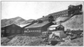
The Silver Peak Railroad was built by the Pittsburgh Silver Peak Gold Mining Company after it bought a group of mining properties in 1906 and established a 100 stamp mill at Blair, Nevada, in 1907 to service the mines at Silver Peak, Nevada.
Blair Junction is the neglected site of a formerly populated settlement in Esmeralda County, in the U.S. state of Nevada.