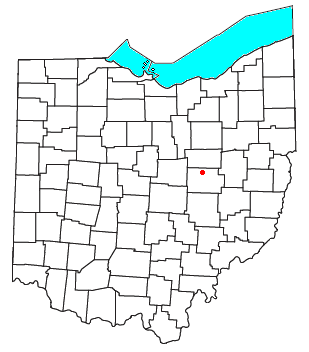
Blissfield is an unincorporated community in southwestern Clark Township, Coshocton County, Ohio, United States. [1] It has a post office with the ZIP code 43805. [2] It lies along State Route 60 between Warsaw and Killbuck.
Blissfield was laid out in 1890 when the railroad was extended to that point. [3] The community derives its name from Bliss, a grandson of one Abram Weatherwax. [4] A post office was established at Blissfield in 1889 and remained in operation until 2002. [5]
New Rumley is an unincorporated community in central Rumley Township, Harrison County, Ohio, United States. It is famous for being the birthplace of George Armstrong Custer.
Tunnel Hill is an unincorporated community in central Bedford Township, Coshocton County, Ohio, United States. It lies in the valley of the Little Wakatomika Creek a few miles south of Warsaw, along State Route 60 at its intersection with State Route 541.
Walhonding is an unincorporated community in northern Newcastle Township, Coshocton County, Ohio, United States. It has a post office with the ZIP code 43843. It lies at the intersection of State Routes 206 and 715.
Keene is an unincorporated community in central Keene Township, Coshocton County, Ohio, United States. It has a post office with the ZIP code 43828.
Fresno is a census-designated place in eastern White Eyes Township, Coshocton County, Ohio, United States. As of the 2020 census it had a population of 140. It has a post office with the ZIP code 43824. It lies along State Route 93 between West Lafayette and Baltic.
Bakersville is an unincorporated community in northeastern Adams Township, Coshocton County, Ohio, United States. It has a post office with the ZIP code 43803. It lies along State Route 751 northeast of West Lafayette.
Guysville is an unincorporated community in southern Rome Township, Athens County, Ohio, United States. It has a post office with the ZIP code 45735.
Paris is an unincorporated community in northwestern Paris Township, Stark County, Ohio. It has a post office with the ZIP code 44669. It lies along State Route 172 between East Canton and Lisbon. The community is part of the Canton–Massillon Metropolitan Statistical Area.
Bartlett is an unincorporated community in southwestern Wesley Township, Washington County, Ohio, United States. It has a post office with the ZIP code 45713. It sits at the intersection of State Routes 550 and 555 near Coal Run, a subsidiary of Wolf Creek, which meets the Muskingum River at Waterford to the north. Near Bartlett is located the Shinn Covered Bridge, which spans Wolf Creek.
New Cumberland is an unincorporated community in Warren Township, Tuscarawas County, Ohio, United States. The community is served by the Mineral City, Ohio post office, ZIP code 44656. It is located on Conotton Creek, State Route 212 and the Wheeling and Lake Erie Railway.
Conotton is an unincorporated community in North Township, Harrison County, Ohio, United States. The community is serviced by the Bowerston post office, ZIP Code 44695. It is located near Conotton Creek, State Route 151 and the Wheeling and Lake Erie Railway. According to the GNIS the community has also been known as Masterville.
West Bedford is an unincorporated community in Bedford Township, Coshocton County, Ohio, United States.
New Bedford is an unincorporated community in Coshocton County, Ohio, United States.
Spring Mountain is an unincorporated community in Monroe Township, Coshocton County, Ohio, United States.
New Moscow is an unincorporated community in Virginia Township of Coshocton County, Ohio, United States.
Helmick is an unincorporated community in Coshocton County, in the U.S. state of Ohio.
Linton Mills is a former town in Coshocton County, in the U.S. state of Ohio. The GNIS classifies it as a populated place.
Orange is an unincorporated community in Coshocton County, in the U.S. state of Ohio.
Tyrone is a former town in Coshocton County, in the U.S. state of Ohio. The GNIS classifies it as a populated place.
Wills Creek is an unincorporated community in Coshocton County, in the U.S. state of Ohio.
40°23′59″N81°57′56″W / 40.39972°N 81.96556°W