Tunnel Hill, Ohio

Last updated
Location of Tunnel Hill, Ohio OHMap-doton-Tunnel Hill.png
Location of Tunnel Hill, Ohio

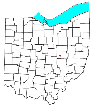
Tunnel Hill is an unincorporated community in central Bedford Township, Coshocton County, Ohio, United States. [1] It lies in the valley of the Little Wakatomika Creek a few miles south of Warsaw, along State Route 60 at its intersection with State Route 541.

History

Tunnel Hill had its start around 1873 when a railroad tunnel was completed near the site. [2] A post office was established at Tunnel Hill in 1873, and remained in operation until it was discontinued in 1955. [3] [4]

Related Research Articles

Wakatomika, Ohio human settlement in Ohio, United States of America

Wakatomika is an unincorporated community in central Washington Township, Coshocton County, Ohio, United States. Wakatomika is located on the Little Wakatomika Creek, and lies along State Route 60.

Walhonding, Ohio human settlement in United States of America

Walhonding is an unincorporated community in northern Newcastle Township, Coshocton County, Ohio, United States. Although it is unincorporated, it has a post office, with the ZIP code of 43843. It lies at the intersection of State Routes 206 and 715.

Keene, Ohio human settlement in Ohio, United States of America

Keene is an unincorporated community in central Keene Township, Coshocton County, Ohio, United States. Although it is unincorporated, it has a post office, with the ZIP code of 43828.

Fresno, Ohio census-designated place in Coshocton County, Ohio, United States

Fresno is a census-designated place in eastern White Eyes Township, Coshocton County, Ohio, United States. As of the 2010 census it had a population of 140. Although it is unincorporated, it has a post office, with the ZIP code of 43824, gas station, White Eyes Carryout/Drive Thru and Pizza Shop. It lies along State Route 93 between West Lafayette and Baltic.

Bakersville, Ohio human settlement in Ohio, United States of America

Bakersville is an unincorporated community in northeastern Adams Township, Coshocton County, Ohio, United States. Although it is unincorporated, it has a post office, with the ZIP code of 43803. It lies along State Route 751 northeast of West Lafayette.

West Bedford is an unincorporated community in Bedford Township, Coshocton County, Ohio, United States.

New Bedford is an unincorporated community in Coshocton County, Ohio, United States.

Spring Mountain is an unincorporated community in Monroe Township, Coshocton County, Ohio, United States.

Newcastle is an unincorporated community in Newcastle Township, Coshocton County, Ohio, United States.

New Guilford is an unincorporated community in Perry Township, Coshocton County, Ohio, United States.

West Carlisle, Ohio human settlement in United States of America

West Carlisle is an unincorporated community in Pike Township, Coshocton County, Ohio, United States.

New Moscow is an unincorporated community in Virginia Township of Coshocton County, Ohio, United States.

Mohawk Village is an unincorporated community in Coshocton County, in the U.S. state of Ohio.

Helmick is an unincorporated community in Coshocton County, in the U.S. state of Ohio.

Linton Mills is a former town in Coshocton County, in the U.S. state of Ohio. The GNIS classifies it as a populated place.

New Princeton is an unincorporated community in Coshocton County, in the U.S. state of Ohio.

Orange is an unincorporated community in Coshocton County, in the U.S. state of Ohio.

Tiverton Center is an unincorporated community in Coshocton County, in the U.S. state of Ohio.

Tyrone is a former town in Coshocton County, in the U.S. state of Ohio. The GNIS classifies it as a populated place.

Wills Creek is an unincorporated community in Coshocton County, in the U.S. state of Ohio.

References

  1. U.S. Geological Survey Geographic Names Information System: Tunnel Hill, Ohio
  2. "HISTORY OF TUNNEL HILL, OHIO". Walhonding Valley Historical Society. Retrieved 7 December 2015.
  3. "Coshocton County". Jim Forte Postal History. Retrieved 7 December 2015.
  4. Graham, Albert Adams (1881). History of Coshocton County, Ohio: Its Past and Present, 1740-1881. A. A. Graham. p. 470.

Coordinates: 40°15′17″N82°02′56″W / 40.25472°N 82.04889°W / 40.25472; -82.04889