Wakatomika, Ohio

Last updated

Location of Wakatomika, Ohio OHMap-doton-Wakatomika.png
Location of Wakatomika, Ohio

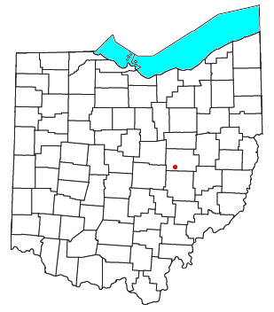
Wakatomika [1] is an unincorporated community in central Washington Township, Coshocton County, Ohio, United States. Wakatomika is located on the Little Wakatomika Creek, and lies along State Route 60.

History

A post office was established at Wakatomika in 1823, and remained in operation until 1909. [2] The community is named after the Shawnee village of Wakatomika, [3] which was located along the Muskingum River near the present day site of Dresden.

Related Research Articles

<span class="mw-page-title-main">Wakatomika Creek</span>

Wakatomika Creek is a tributary of the Muskingum River, 42.6 mi (68.6 km) long, in central Ohio in the United States. Via the Muskingum and Ohio Rivers, it is part of the watershed of the Mississippi River, draining an area of 234 mi² (606 km²)

Little Wakatomika Creek is a stream which flows through Coshocton and Muskingum counties in Ohio, USA. The stream originates north of Tunnel Hill in Coshocton County and flows south through the villages of Tunnel Hill and Wakatomika before entering Muskingum County. Here, it empties into Wakatomika Creek just west of the village of Trinway, near the intersection of State Routes 60 and 16. The stream is part of the Mississippi River catchment via Wakatomika Creek, the Muskingum River and the Ohio River.

<span class="mw-page-title-main">Tunnel Hill, Ohio</span>

Tunnel Hill is an unincorporated community in central Bedford Township, Coshocton County, Ohio, United States. It lies in the valley of the Little Wakatomika Creek a few miles south of Warsaw, along State Route 60 at its intersection with State Route 541.

<span class="mw-page-title-main">Washington Township, Coshocton County, Ohio</span> Township in Ohio, United States

Washington Township is one of the twenty-two townships of Coshocton County, Ohio, United States. As of the 2020 census the population was 727.

<span class="mw-page-title-main">Walhonding, Ohio</span>

Walhonding is an unincorporated community in northern Newcastle Township, Coshocton County, Ohio, United States. It has a post office with the ZIP code 43843. It lies at the intersection of State Routes 206 and 715.

<span class="mw-page-title-main">Fresno, Ohio</span> Census-designated place in Ohio, United States

Fresno is a census-designated place in eastern White Eyes Township, Coshocton County, Ohio, United States. As of the 2020 census it had a population of 140. It has a post office with the ZIP code 43824, gas station, White Eyes Carryout/Drive Thru and Pizza Shop. It lies along State Route 93 between West Lafayette and Baltic.

<span class="mw-page-title-main">Bakersville, Ohio</span>

Bakersville is an unincorporated community in northeastern Adams Township, Coshocton County, Ohio, United States. It has a post office with the ZIP code 43803. It lies along State Route 751 northeast of West Lafayette.

West Bedford is an unincorporated community in Bedford Township, Coshocton County, Ohio, United States.

New Bedford is an unincorporated community in Coshocton County, Ohio, United States.

Spring Mountain is an unincorporated community in Monroe Township, Coshocton County, Ohio, United States.

New Guilford is an unincorporated community in Perry Township, Coshocton County, Ohio, United States.

<span class="mw-page-title-main">West Carlisle, Ohio</span>

West Carlisle is an unincorporated community in Pike Township, Coshocton County, Ohio, United States.

New Moscow is an unincorporated community in Virginia Township of Coshocton County, Ohio, United States.

Mohawk Village is an unincorporated community in Coshocton County, in the U.S. state of Ohio.

Helmick is an unincorporated community in Coshocton County, in the U.S. state of Ohio.

Maysville is an unincorporated community in Coshocton County, in the U.S. state of Ohio.

New Princeton is an unincorporated community in Coshocton County, in the U.S. state of Ohio.

Orange is an unincorporated community in Coshocton County, in the U.S. state of Ohio.

Tiverton Center, or just Tiverton on some maps, is an unincorporated rural village in Coshocton County, in the U.S. state of Ohio. It is located along and about the intersection of Ohio State Highway 206 and Coshocton County Road 20. There is a church and a grange hall located there, and a number of houses, but no other businesses or services. Google Maps videographed Tiverton Center along the intersecting highways which make up its main street, but does not mark the village as distinct from its surrounding township on its maps!

Wills Creek is an unincorporated community in Coshocton County, in the U.S. state of Ohio.

References

  1. U.S. Geological Survey Geographic Names Information System: Wakatomika, Ohio
  2. "Coshocton County". Jim Forte Postal History. Retrieved December 7, 2015.
  3. Graham, Albert Adams (1881). History of Coshocton County, Ohio: Its Past and Present, 1740-1881. A. A. Graham. p.  199.

40°11′55″N82°02′49″W / 40.19861°N 82.04694°W / 40.19861; -82.04694