Related Research Articles

Tunnel Hill is an unincorporated community in central Bedford Township, Coshocton County, Ohio, United States. It lies in the valley of the Little Wakatomika Creek a few miles south of Warsaw, along State Route 60 at its intersection with State Route 541.
Wakatomika is an unincorporated community in central Washington Township, Coshocton County, Ohio, United States. Wakatomika is located on the Little Wakatomika Creek, and lies along State Route 60.

Walhonding is an unincorporated community in northern Newcastle Township, Coshocton County, Ohio, United States. It has a post office with the ZIP code 43843. It lies at the intersection of State Routes 206 and 715.

Keene is an unincorporated community in central Keene Township, Coshocton County, Ohio, United States. It has a post office with the ZIP code 43828.

Bakersville is an unincorporated community in northeastern Adams Township, Coshocton County, Ohio, United States. It has a post office with the ZIP code 43803. It lies along State Route 751 northeast of West Lafayette.
West Bedford is an unincorporated community in Bedford Township, Coshocton County, Ohio, United States.
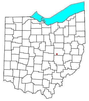
New Bedford is an unincorporated community in Coshocton County, Ohio, United States.
Newcastle is an unincorporated community in Newcastle Township, Coshocton County, Ohio, United States.
New Guilford is an unincorporated community in Perry Township, Coshocton County, Ohio, United States.

West Carlisle is an unincorporated community in Pike Township, Coshocton County, Ohio, United States.
New Moscow is an unincorporated community in Virginia Township of Coshocton County, Ohio, United States.
Mohawk Village is an unincorporated community in Coshocton County, in the U.S. state of Ohio.
Helmick is an unincorporated community in Coshocton County, in the U.S. state of Ohio.
Linton Mills is a former town in Coshocton County, in the U.S. state of Ohio. The GNIS classifies it as a populated place.
Maysville is an unincorporated community in Coshocton County, in the U.S. state of Ohio.
New Princeton is an unincorporated community in Coshocton County, in the U.S. state of Ohio.
Orange is an unincorporated community in Coshocton County, in the U.S. state of Ohio.
Tiverton Center, or just Tiverton on some maps, is an unincorporated rural village in Coshocton County, in the U.S. state of Ohio. It is located along and about the intersection of Ohio State Highway 206 and Coshocton County Road 20. There is a church and a grange hall located there, and a number of houses, but no other businesses or services. Google Maps videographed Tiverton Center along the intersecting highways which make up its main street, but does not mark the village as distinct from its surrounding township on its maps!
Tyrone is a former town in Coshocton County, in the U.S. state of Ohio. The GNIS classifies it as a populated place.
Wills Creek is an unincorporated community in Coshocton County, in the U.S. state of Ohio.
References
- ↑ Graham, Albert Adams (1881). History of Coshocton County, Ohio: Its Past and Present, 1740-1881. A. A. Graham. pp. 562.
- ↑ U.S. Geological Survey Geographic Names Information System: Spring Mountain, Ohio
- ↑ Bahmer, William J. (1909). Centennial History of Coshocton County, Ohio. S. J. Clarke Publishing Company. p. 75.
- ↑ "Coshocton County". Jim Forte Postal History. Retrieved 7 December 2015.
Municipalities and communities of Coshocton County, Ohio, United States | ||
|---|---|---|
| City |  | |
| Villages | ||
| Townships | ||
| CDPs | ||
| Unincorporated communities |
| |
| Ghost towns | ||
| Footnotes | ‡This populated place also has portions in an adjacent county or counties | |
40°24′31″N82°03′03″W / 40.40861°N 82.05083°W
| | This Coshocton County, Ohio state location article is a stub. You can help Wikipedia by expanding it. |