Walhonding, Ohio

Last updated

Post office Walhonding post office 43843.jpg
Post office
Location of Walhonding, Ohio OHMap-doton-Walhonding.png
Location of Walhonding, Ohio

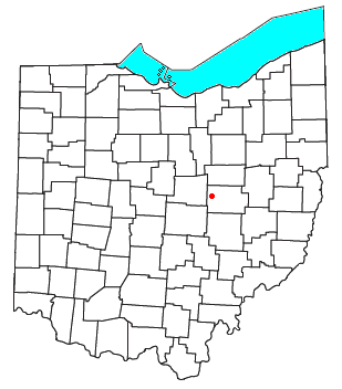
Walhonding is an unincorporated community in northern Newcastle Township, Coshocton County, Ohio, United States. [1] It has a post office with the ZIP code 43843. [2] It lies at the intersection of State Routes 206 and 715.

History

Walhonding was platted in 1841, when construction of the Walhonding Canal reached that point. [3] [4] A post office called Walhonding has been in operation since 1839. [5]

Related Research Articles

<span class="mw-page-title-main">Tunnel Hill, Ohio</span>

Tunnel Hill is an unincorporated community in central Bedford Township, Coshocton County, Ohio, United States. It lies in the valley of the Little Wakatomika Creek a few miles south of Warsaw, along State Route 60 at its intersection with State Route 541.

<span class="mw-page-title-main">Wakatomika, Ohio</span>

Wakatomika is an unincorporated community in central Washington Township, Coshocton County, Ohio, United States. Wakatomika is located on the Little Wakatomika Creek, and lies along State Route 60.

<span class="mw-page-title-main">Mount Liberty, Ohio</span>

Mount Liberty is an unincorporated community on the border between the Milford and Liberty Townships of Knox County, Ohio, United States. It has a post office with the ZIP code 43048. It lies along the concurrent U.S. Route 36 and State Route 3.

<span class="mw-page-title-main">Keene, Ohio</span>

Keene is an unincorporated community in central Keene Township, Coshocton County, Ohio, United States. It has a post office with the ZIP code 43828.

<span class="mw-page-title-main">Fresno, Ohio</span> Census-designated place in Ohio, United States

Fresno is a census-designated place in eastern White Eyes Township, Coshocton County, Ohio, United States. As of the 2020 census it had a population of 140. It has a post office with the ZIP code 43824, gas station, White Eyes Carryout/Drive Thru and Pizza Shop. It lies along State Route 93 between West Lafayette and Baltic.

<span class="mw-page-title-main">Blissfield, Ohio</span> Human settlement in Ohio, United States of America

Blissfield is an unincorporated community in southwestern Clark Township, Coshocton County, Ohio, United States. It has a post office with the ZIP code 43805. It lies along State Route 60 between Warsaw and Killbuck.

<span class="mw-page-title-main">Bakersville, Ohio</span>

Bakersville is an unincorporated community in northeastern Adams Township, Coshocton County, Ohio, United States. It has a post office with the ZIP code 43803. It lies along State Route 751 northeast of West Lafayette.

<span class="mw-page-title-main">Walhonding Canal</span>

The Walhonding Canal was a canal in Coshocton County, Ohio that was used as a feeder canal for the Ohio and Erie Canal. A small canal, at only 25 miles (40.2 km) long, it was wholly contained within Coshocton County, following the Mohican River from Cavallo south to the confluence with the Kokosing River, which together with the Mohican forms the Walhonding River. The canal followed the Walhonding River southeast toward Coshocton where it met the Ohio and Erie Canal in Roscoe Village.

West Bedford is an unincorporated community in Bedford Township, Coshocton County, Ohio, United States.

Spring Mountain is an unincorporated community in Monroe Township, Coshocton County, Ohio, United States.

Newcastle is an unincorporated community in Newcastle Township, Coshocton County, Ohio, United States.

New Guilford is an unincorporated community in Perry Township, Coshocton County, Ohio, United States.

<span class="mw-page-title-main">West Carlisle, Ohio</span>

West Carlisle is an unincorporated community in Pike Township, Coshocton County, Ohio, United States.

New Moscow is an unincorporated community in Virginia Township of Coshocton County, Ohio, United States.

Cavallo is an unincorporated community in Coshocton County, in the U.S. state of Ohio.

Cooperdale is an unincorporated community in Coshocton County, in the U.S. state of Ohio.

New Princeton is an unincorporated community in Coshocton County, in the U.S. state of Ohio.

Orange is an unincorporated community in Coshocton County, in the U.S. state of Ohio.

Tiverton Center, or just Tiverton on some maps, is an unincorporated rural village in Coshocton County, in the U.S. state of Ohio. It is located along and about the intersection of Ohio State Highway 206 and Coshocton County Road 20. There is a church and a grange hall located there, and a number of houses, but no other businesses or services. Google Maps videographed Tiverton Center along the intersecting highways which make up its main street, but does not mark the village as distinct from its surrounding township on its maps!

Beaver Run is a stream in Coshocton County, in the U.S. state of Ohio.

References

  1. U.S. Geological Survey Geographic Names Information System: Walhonding
  2. USPS – Cities by ZIP Code
  3. Graham, Albert Adams (1881). History of Coshocton County, Ohio: Its Past and Present, 1740-1881. A. A. Graham. pp.  575.
  4. Hunt, William Ellis (1876). Historical Collections of Coshocton County, Ohio. R. Clarke & Company. pp.  5.
  5. "Coshocton County". Jim Forte Postal History. Retrieved December 7, 2015.

40°21′34″N82°08′49″W / 40.3595114°N 82.1468151°W / 40.3595114; -82.1468151