Bontebok, Netherlands

Last updated
Bontebok
Village
Bontebok Schoterlandse Compagnonsvaart.jpg
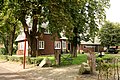
Local farm and house
Bontebok wapen.svg
Map NL It Hearrenfean Bontebok.png
Location in the Heerenveen municipality
2010-NL-P02-Fryslan-positiekaart-gemnamen.jpg
Red pog.svg
Bontebok
Location in the Netherlands
Netherlands location map.svg
Red pog.svg
Bontebok
Bontebok (Netherlands)
Coordinates: 52°57′47″N6°1′32″E / 52.96306°N 6.02556°E / 52.96306; 6.02556
Country Flag of the Netherlands.svg Netherlands
Province Frisian flag.svg Friesland
Municipality Heerenveen flag.svg Heerenveen
Area
[1]
  Total
3.50 km2 (1.35 sq mi)
Elevation
[2]
1.7 m (5.6 ft)
Population
 (2021) [1]
  Total
420
  Density120/km2 (310/sq mi)
Postal code
8415 [1]
Dialing code 0513

Bontebok is a village in the north of the Netherlands, located in the municipality of Heerenveen, Friesland. It had a population of around 400 in 2017. [3]

Contents

History

The village was first mentioned in 1640 as Bonte Bock, and is named after an inn which used a goat as a sign board. [4] Bontebok developed during the peat excavation of the area. The inn was located near a sluice where boatmen had to wait. The inn was later joined by a couple of shops and pubs, and a hamlet developed. In 1840, Bontebok was home to 46 people. From 1898 to 1966, a dairy factory operated in Bontebok. [5] The village was recognized by Heerenveen only in 1980.

References

  1. 1 2 3 "Kerncijfers wijken en buurten 2021". Central Bureau of Statistics. Retrieved 30 March 2022.
  2. "Postcodetool for 8415AA". Actueel Hoogtebestand Nederland (in Dutch). Het Waterschapshuis. Retrieved 30 March 2022.
  3. Kerncijfers wijken en buurten 2017 - CBS Statline
  4. "Bontebok - (geografische naam)". Etymologiebank (in Dutch). Retrieved 30 March 2022.
  5. "Bonteboek". Plaatsengids. Retrieved 30 March 2022.

Commons-logo.svg Media related to Bontebok at Wikimedia Commons