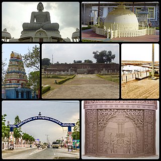
Amaravathi is a town located on the banks of Krishna River, in Guntur district of the Indian state of Andhra Pradesh. It is the headquarters of Amaravathi mandal, and forms part of the Andhra Pradesh Capital Region with its headquarters at new Amaravati 35 km (22 mi) east, whose name is also borrowed from the name of Amaravathi.

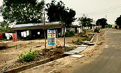
Thulluru is a neighbourhood and a part of Urban Notified Area of Amaravati, the state capital of the Indian state of Andhra Pradesh. It is located at a distance of 4 km from Krishna River and was a village in Thulluru mandal of Guntur district, prior to its denotification as gram panchayat.

Tadepalle is a Town in Guntur district of the Indian state of Andhra Pradesh. The town is the headquarters of Tadepalle mandal of Guntur revenue division and is a major suburb of Vijayawada. It also forms a part of Andhra Pradesh Capital Region.

Rayapudi is a neighbourhood and a part of Urban Notified Area of Amaravati, the state capital of the Indian state of Andhra Pradesh. It was a village in Thullur mandal of in Guntur district, prior to its denotification as gram panchayat.

Venkatapalem is a neighbourhood and a part of Urban Notified Area of Amaravati, the state capital of the Indian state of Andhra Pradesh. It was a village in Thullur mandal of Guntur district, prior to its denotification as gram panchayat.
Anantavaram is a neighbourhood and a part of Urban Notified Area of Amaravati, the state capital of the Indian state of Andhra Pradesh. It was a village in Thullur mandal of Guntur district, prior to its denotification as gram panchayat.

Dondapadu is a neighbourhood and a part of Urban Notified Area of Amaravati, the state capital of the Indian state of Andhra Pradesh. It was a village in Thullur mandal of Guntur district, prior to its denotification as gram panchayat..It has a beautiful temple dedicated to lord ganesh
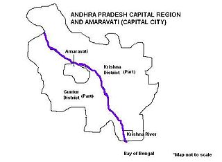
Andhra Pradesh Capital Region is the Megalopolis area surrounding Amaravati, the new capital city of Andhra Pradesh and includes major ancient cities of Vijayawada, Guntur, Tenali. Andhra Pradesh Capital Region is one of the largest populated urban areas in the world, with its suburbs Vijayawada, Guntur, Tenali being the 3rd, 24th, 41st most densely populated cities in the world. Vijayawada is the most densely populated city in India while Guntur is 11th and Tenali is the most populated city of 14th place in Andhra Pradesh. Andhra Pradesh Capital Region is the most populated metropolitan area in the state of Andhra Pradesh and 8th in India. Entire region is under the jurisdiction of Andhra Pradesh Capital Region Development Authority, and covers an area of 8,603 km2 (3,322 sq mi) under 58 mandals, of which 29 are in Krishna district and 29 in Guntur district. The capital region covers 18 mandals fully and 11 mandals partially in Guntur district. In Krishna district, it covers 15 mandals fully and 14 mandals partially under the jurisdiction of APCRDA. The capital city is an Urban Notified Area, and will cover 217.23 km2 (83.87 sq mi), within the Andhra Pradesh Capital Region.

Thullur mandal is one of the 57 mandals in Guntur district of the Indian state of Andhra Pradesh. It is under the administration of Guntur Revenue Division and the headquarters are located at Thullur. The mandal is situated on the banks of Krishna River, bounded by Amaravathi, Tadikonda, Tadepalle and Mangalagiri mandals. The mandal is also a part of the new capital city of Andhra Pradesh to be developed. 18 villages from the mandal fall under the jurisdiction of Andhra Pradesh Capital City.

Amaravati is the capital city of the Indian state of Andhra Pradesh. It is located on the banks of river Krishna in Guntur District and the primary city of the state's Capital Region. Built on allotted space on the southern banks of Krishna River in Guntur district selected close to the geographical center of the state. Amaravati is a recently constructed planned city. The city was constructed to serve as Andhra Pradesh's new capital after Telangana was split off as a separate state in 2014 and the former capital, Hyderabad, became the capital of Telangana.
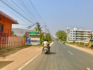
Undavalli is a neighbourhood situated between the state capital Amaravati and Vijayawada city of the Indian state of Andhra Pradesh. It was a village in Tadepalle mandal of Guntur district, prior to its de-notification as gram panchayat. 5th century Buddhist and Hindu Undavalli Caves which signify Monolithic Indian rock-cut architecture are present at this place. It is a Part of Vijayawada Urban Agglomeration.

Velagapudi is a neighbourhood and a part of the Urban Notified Area of Amaravati, the state capital of the Indian state of Andhra Pradesh. It was a village in Thullur mandal of Guntur district, prior to its denotification as gram panchayat. Velagapudi is also the home to the temporary Secretariat of Andhra Pradesh

Mandadam is a neighbourhood and a part of Urban Notified Area of Amaravati, the state capital of the Indian state of Andhra Pradesh. It was a village in Thullur mandal of Guntur district, prior to its denotification as gram panchayat.

Krishnayapalem is a neighbourhood of Amaravati, the state capital of the Indian state of Andhra Pradesh. It is a denotification as gram panchayat in Mangalagiri mandal of Guntur district.

Penumaka is a neighbourhood of Amaravati, the state capital of the Indian state of Andhra Pradesh. It was a village in Tadepalle mandal of Guntur district, prior to its de–notification as gram panchayat.

Vykuntapuram, also spelled as Vaikuntapuram, is a village in Guntur district of the Indian state of Andhra Pradesh. It is located in Amaravathi mandal of Guntur revenue division. The village forms a part of Andhra Pradesh Capital Region, under the jurisdiction of APCRDA.
Lingayapalem is a neighbourhood and a part of Urban Notified Area of Amaravati, the state capital of the Indian state of Andhra Pradesh. It was a village in Thullur mandal of in Guntur district, prior to its denotification as gram panchayat.
Nelapadu is a neighbourhood and a part of Urban Notified Area of Amaravati, the state capital of the Indian state of Andhra Pradesh. It was a village in Thullur mandal of in Guntur district, prior to its denotification as gram panchayat.
Abbarajupalem is a neighbourhood and a part of Urban Notified Area of Amaravati, the state capital of the Indian state of Andhra Pradesh. It was a village in Thullur mandal of in Guntur district, prior to its denotification as gram panchayat.
Nekkallu is a neighbourhood and a part of Urban Notified Area of Amaravati, the state capital of the Indian state of Andhra Pradesh. It was a village in Thullur mandal of in Guntur district, prior to its denotification as gram panchayat.