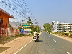
Mangalagiri is part of one of the two municipal corporations under Guntur and a major residential and IT hub in Andhra Pradesh Capital Region. Mangalagiri is important to the overall Guntur's financial and cultural profile by its textile, agricultural and spiritual contributions.It is situated on National Highway 16 and North of District Headquarter Guntur.

Amaravathi is a village located on the banks of the Krishna River in the Guntur district of Andhra Pradesh, India. It serves as the administrative centre of Amaravathi mandal and is part of the Andhra Pradesh Capital Region. The state's newly planned capital city, Amaravati, located 35 km (22 mi) to the east, derives its name from this historic village.

Dharanikota is a village in Palnadu district of the Indian state of Andhra Pradesh. It is located in Amaravathi mandal of Sattenapalli revenue division. The village forms a part of Andhra Pradesh Capital Region, under the jurisdiction of APCRDA.

Thulluru is a Village in Guntur district of Indian state of Andhra Pradesh. It is located at a distance of 4 km from Krishna River and was a village in Thulluru mandal of Guntur district, prior to its denotification as gram panchayat.

Tadepalli is a Rapid Growth Suburb of Vijayawada. It is situated on National Highway 16 and also in proximity to State Capital Amaravati.
Rayapudi is a neighbourhood and a part of Urban Notified Area of Amaravati, the state capital of the Indian state of Andhra Pradesh. It was a village in Thullur mandal of in Guntur district, prior to its denotification as gram panchayat.

Venkatapalem is a neighbourhood and a part of Urban Notified Area of Amaravati, the state capital of the Indian state of Andhra Pradesh. It was a village in Thullur mandal of Guntur district, prior to its denotification as gram panchayat.
Anantavaram is a neighbourhood and a part of Urban Notified Area of Amaravati, the state capital of the Indian state of Andhra Pradesh. It was a village in Thullur mandal of Guntur district, prior to its denotification as gram panchayat.

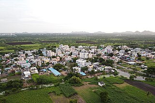
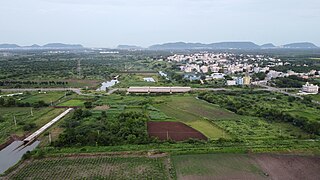
Andhra Pradesh Capital Region is the metropolitan area of the capital city of Andhra Pradesh in India. The region is spread across the districts of Krishna, Guntur, Palnadu, NTR, Bapatla and Eluru. It includes the major cities of Vijayawada and Guntur. Vijayawada is the largest city and headquarters of the region. It is one the most populated metropolitan areas in Andhra Pradesh. The region is under the jurisdiction of Andhra Pradesh Capital Region Development Authority and covers an area of 8,603 km2 (3,322 sq mi) under 58 mandals. The capital city Amaravati is an urban notified area and will cover 217.23 km2 (83.87 sq mi), within the Andhra Pradesh Capital Region.

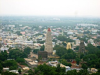
Amaravati is the capital city of the Indian state of Andhra Pradesh. It is situated in Guntur district along the right bank of the Krishna River and southwest of Vijayawada. The city is named after the nearby historic site of Amaravathi adjacent to Dharanikota, which was once the capital of the Satavahana dynasty around two millennia ago. Amaravati is part of the Andhra Pradesh Capital Region, which includes the neighboring cities of Vijayawada and Guntur.
Uddandarayunipalem is a village in Guntur district In Indian state of Andhra Pradesh. It was a village in Thullur mandal of Guntur district, prior to its denotification as gram panchayat. It also hosted the foundation stone ceremony of Amaravati, on 22 October 2015, when Prime Minister Narendra Modi laid the foundation stone of Amaravati.
Velagapudi is a village in Guntur district of the Indian state of Andhra Pradesh. It was a village in Thullur mandal of Guntur district, prior to its denotification as Gram Panchayat. Velagapudi is also the home to the temporary Secretariat of Andhra Pradesh.
Mandadam is a Village in Guntur district in Indian state of Andhra Pradesh. It was a village in Thullur mandal of Guntur district, prior to its denotification as gram panchayat.

Krishnayapalem is a village of the Indian state of Andhra Pradesh. It is a denotification as gram panchayat in Mangalagiri mandal of Guntur district.

Borupalem is a neighbourhood and a part of Urban Notified Area of Amaravati, the state capital of the Indian state of Andhra Pradesh. It was a village in Thullur mandal of in Guntur district, prior to its denotification as gram panchayat.

Penumaka is a part of Mangalagiri Tadepalle Municipal Corporation part of Guntur district which is part of Andhra Pradesh. It was a village in Tadepalle mandal of Guntur district, prior to its de–notification as gram panchayat.

Vykuntapuram, also spelled as Vaikuntapuram, is a village in Guntur district of the Indian state of Andhra Pradesh. It is located in Amaravathi mandal of Guntur revenue division. The village forms a part of Andhra Pradesh Capital Region, under the jurisdiction of APCRDA.
Lingayapalem is a neighbourhood and a part of Urban Notified Area of Amaravati, the state capital of the Indian state of Andhra Pradesh. It was a village in Thullur mandal of in Guntur district, prior to its denotification as gram panchayat.
Abbarajupalem is a neighbourhood and a part of Urban Notified Area of Amaravati, the state capital of the Indian state of Andhra Pradesh. It was a village in Thullur mandal of in Guntur district, prior to its denotification as gram panchayat.
Mangalagiri Tadepalli Municipal Corporation (MTMC) is the civic body that governs Mangalagiri and Tadepalli and villages in the corresponding mandals of the Mangalagiri Assembly constituency in Guntur district of Andhra Pradesh. It is the second largest municipal corporation next in line to GVMC in terms of area with 194.41 km2 (75.06 sq mi) and 2,53,875 of voters in the state of Andhra Pradesh. It is classified as important Municipal Corporation in the Capital of Andhra Pradesh. Municipal Corporation mechanism in India was introduced during British Rule with formation of municipal corporation in Madras (Chennai) in 1688, later followed by municipal corporations in Bombay (Mumbai) and Calcutta (Kolkata) by 1762. Mangalagiri Tadepalli Municipal Corporation Municipal Corporation is headed by Mayor of city and governed by Commissioner.