Bowman, Tennessee

Last updated

Bowman, Tennessee
Bowman-Loop-Road-tn1.jpg
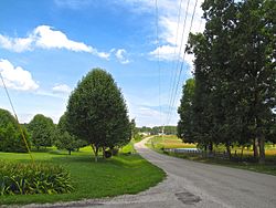
Bowman Loop Road in Bowman
USA Tennessee location map.svg
Red pog.svg
Bowman
Coordinates: 36°03′40″N85°01′42″W / 36.06111°N 85.02833°W / 36.06111; -85.02833
Country United States
State Tennessee
County Cumberland
Area
[1]
  Total2.29 sq mi (5.93 km2)
  Land2.29 sq mi (5.93 km2)
  Water0.00 sq mi (0.00 km2)
Elevation
[2]
1,811 ft (552 m)
Population
 (2020) [3]
  Total297
  Density129.81/sq mi (50.11/km2)
Time zone UTC-6 (Central (CST))
  Summer (DST) UTC-5 (CDT)
ZIP code
38571 [4]
Area code 931
GNIS feature ID1646854 [2]

Bowman is a census-designated place and unincorporated community in Cumberland County, Tennessee, United States. It is located off U.S. Route 127 north of Crossville, south of Clarkrange, and west of the Catoosa Wildlife Management Area. Its population was 302 as of the 2010 census. [5]

The community was named for Nathaniel Bowman, a pioneer settler. [6]

Demographics

Historical population
CensusPop.Note
2020 297
U.S. Decennial Census [7]

Related Research Articles

<span class="mw-page-title-main">Cumberland County, Tennessee</span> County in Tennessee, United States

Cumberland County is a county located in the U.S. state of Tennessee. As of the 2020 census, the population was 61,145. Its county seat is Crossville. Cumberland County comprises the Crossville, TN micropolitan statistical area.

<span class="mw-page-title-main">Dickson, Tennessee</span> City in Tennessee, United States

Dickson is a city in the U.S. state of Tennessee. Located in Dickson County. It is part of the Nashville metropolitan area. As of the 2020 census, Dickson's population was 16,058.

<span class="mw-page-title-main">Sewanee, Tennessee</span> CDP in Tennessee, United States

Sewanee is a census-designated place (CDP) in Franklin County, Tennessee, United States. The population was 2,535 at the 2020 census. It is part of the Tullahoma, Tennessee Micropolitan Statistical Area.

<span class="mw-page-title-main">Franklin, Tennessee</span> City in Tennessee, United States

Franklin is a city in and county seat of Williamson County, Tennessee, United States. About 21 miles (34 km) south of Nashville, it is one of the principal cities of the Nashville metropolitan area and Middle Tennessee. As of 2020, its population was 83,454. It is the 7th most populous city in Tennessee. Franklin is known to be the home of many celebrities, mostly country music stars.

<span class="mw-page-title-main">Johnson City, Tennessee</span> City in Tennessee, United States

Johnson City is a city in Washington, Carter, and Sullivan counties in the U.S. state of Tennessee, mostly in Washington County. As of the 2020 United States census, the population was 71,046, making it the eighth largest city in Tennessee. Johnson City is the principal city of the Johnson City Metropolitan Statistical Area, which consists of Carter, Unicoi, and Washington counties and had a population of 207,285 as of 2020. The MSA is also a component of the Tri-Cities region. This CSA is the fifth-largest in Tennessee with a population of 514,899 as of 2020.

<span class="mw-page-title-main">Eva, Tennessee</span> CDP in Tennessee, United States

Eva is an unincorporated community and census-designated place (CDP) in Benton County, Tennessee, on the western shore of the Kentucky Lake impoundment of the Tennessee River. It is the site of Nathan Bedford Forrest State Park. As of the 2010 census, its population was 293. The ZIP Code Tabulation Area for the ZIP code (38333) that serves Eva had a population of 574 as of the 2000 U.S. Census, when Eva was not yet a CDP. Eva is centered on the junction of State Route 191, which connects the community to Nathan Bedford Forrest State Park to the north and the town of Camden to the south, and Eva Beach Road, which stretches from the center of the community to its beach along Kentucky Lake.

<span class="mw-page-title-main">Sale Creek, Tennessee</span> Census-designated place in Tennessee, United States

Sale Creek is an unincorporated community and census-designated place (CDP) in northern Hamilton County, Tennessee, United States. It is located along U.S. Route 27 between Chattanooga and Dayton, Tennessee.

<span class="mw-page-title-main">Whiteside, Tennessee</span> Unincorporated community in Tennessee, United States

Whiteside is an unincorporated community in Marion County, Tennessee. It was originally settled as a Cherokee town in the late eighteenth century.

Counce is an unincorporated community in Hardin County, Tennessee. Counce is located on Tennessee State Route 57 near the Mississippi border. The community is adjacent to the Tennessee River near the Pickwick Landing Dam. Counce is the terminus of a Kansas City Southern line which was originally the Corinth and Counce Railroad and later became part of the MidSouth Rail Corporation before Kansas City Southern took over MidSouth. Counce was named after the Counce families, who were the first families to inhabit the community.

Olivet is an census-designated place and an unincorporated community in Hardin County, Tennessee, that is treated as a census-designated place (CDP) for the 2010 U.S. census. Olivet is located immediately east of Savannah and is served by Tennessee State Route 203 and Tennessee State Route 226.

<span class="mw-page-title-main">Robbins, Tennessee</span> Census-designated place in Tennessee, United States

Robbins is an unincorporated community and census-designated place (CDP) in Scott County, Tennessee. As of the 2010 census, its population is 287. It is concentrated along U.S. Route 27 between Huntsville and Elgin, in Tennessee's Cumberland Plateau region. The community is served by Robbins Elementary School. It is also home to Barton Chapel, a 1920s-era Gothic Revival church designed by noted architectural firm, Barber and McMurry.

<span class="mw-page-title-main">Leoma, Tennessee</span> Census-designated place in Tennessee, United States

Leoma is an unincorporated community and census-designated place (CDP) located in Lawrence County, Tennessee, United States. It is situated along U.S. Route 43 between Loretto and Lawrenceburg.

New Union is an unincorporated community and Census-designated place in Coffee County, Tennessee. The population was 1,646 at the 2020 census, up from 1,431 at the 2010 census.

<span class="mw-page-title-main">Hillsboro, Tennessee</span> Census-designated place in Tennessee, United States

Hillsboro is an unincorporated community in Coffee County, Tennessee, United States, that was treated as a census-designated place for the 2010 U.S. Census. The population was 450 as of the 2010 census. The community is concentrated around the intersection of U.S. Route 41 and Tennessee State Route 127, between Manchester to the northwest and Monteagle to the southeast. The Cumberland Plateau rises to the east, and Arnold Air Force Base lies to the west.

Bransford is a census-designated place and unincorporated community in Sumner County, Tennessee, United States. Its population was 170 as of the 2010 census.

Chesterfield is a census-designated place and unincorporated community in Henderson County, Tennessee, United States. Its population was 469 as of the 2010 census.

Wildwood is an unincorporated community and census-designated place (CDP) in Blount County, Tennessee. As of the 2020 census, its population was 1,157.

<span class="mw-page-title-main">Pelham, Tennessee</span> Census-designated place in Tennessee, United States

Pelham is an unincorporated community and census-designated place (CDP) in Grundy County, Tennessee, United States. As of the 2010 census, its population was 403. Pelham is located at the junction of U.S. Route 41, State Route 2, and State Route 50 near the base of the Cumberland Plateau, 5.35 miles (8.61 km) north-northwest of Monteagle. Pelham has a post office with ZIP code 37366, which opened on April 4, 1832.

Falling Water is a census-designated place and unincorporated community in Hamilton County, Tennessee, United States. Its population was 1,873 as of the 2020 Census, up from 1,232 at the 2010 census.

<span class="mw-page-title-main">Fincastle, Tennessee</span> Census-designated place in Tennessee, United States

Fincastle is a census-designated place and unincorporated community in Campbell County, Tennessee, United States. Its population was 1,618 as of the 2010 census.

References

  1. "ArcGIS REST Services Directory". United States Census Bureau. Retrieved October 15, 2022.
  2. 1 2 U.S. Geological Survey Geographic Names Information System: Bowman
  3. "Census Population API". United States Census Bureau. Retrieved October 15, 2022.
  4. "Bowman TN ZIP Code". zipdatamaps.com. 2023. Retrieved February 17, 2023.
  5. "U.S. Census website". United States Census Bureau . Retrieved May 14, 2011.
  6. Miller, Larry L. (2001). Tennessee Place-names. Indiana University Press. p. 27. ISBN   0-253-21478-5.
  7. "Census of Population and Housing". Census.gov. Retrieved June 4, 2016.