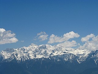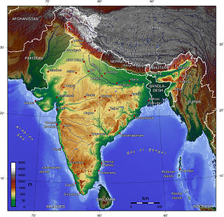
Kangchenjunga, also spelt Kanchenjunga, is the third highest mountain in the world. It rises with an elevation of 8,586 m (28,169 ft) in a section of the Himalayas called Kangchenjunga Himal delimited in the west by the Tamur River, in the north by the Lhonak Chu and Jongsang La, and in the east by the Teesta River. It lies between India and Nepal, with three of the five peaks, namely Main, Central and South, directly on the border, and the peaks West and Kangbachen in Nepal's Taplejung District.

K2, at 8,611 metres (28,251 ft) above sea level, is the second-highest mountain on Earth, after Mount Everest. It lies in the Karakoram range, partially in the Gilgit-Baltistan region of Pakistan-administered Kashmir and partially in a China-administered territory of the Kashmir region included in the Taxkorgan Tajik Autonomous County of Xinjiang.

Dhaulagiri is the seventh highest mountain in the world at 8,167 metres (26,795 ft) above sea level, and the highest mountain within the borders of a single country (Nepal). It was first climbed on 13 May 1960 by a Swiss-Austrian-Nepali expedition. Annapurna I is 34 km (21 mi) east of Dhaulagiri. The Kali Gandaki River flows between the two in the Kaligandaki Gorge, said to be the world's deepest. The town of Pokhara is south of the Annapurnas, an important regional center and the gateway for climbers and trekkers visiting both ranges as well as a tourist destination in its own right.

Saser Kangri is a mountain in India. It is the highest peak in the Saser Muztagh, the easternmost subrange of the Karakoram range. Sasir Kangri is located within Ladakh, the northernmost union territory in India.

Noshaq (also called Noshak or Nowshak; is the second highest peak in the Hindu Kush Range after Tirich Mir at 7,492 m. It lies on the border between Afghanistan and Pakistan. The north and west sides of the mountain are in Afghanistan whereas the south and eastern sides are in Pakistan. Noshaq is Afghanistan's highest mountain and is located in the northeastern corner of the country along the border with Pakistan. It is the westernmost 7,000 m peak in the world. Easiest access to Noshaq is from Chitral, Pakistan.

The Pir Panjal Range is a group of mountains in the Lesser Himalayan region, running from east-southeast (ESE) to west-northwest (WNW) across the Indian territories of Himachal Pradesh and Jammu and Kashmir and then Pakistan's Azad Kashmir and Punjab. The average elevation varies from 1,400 m (4,600 ft) to 4,100 m (13,500 ft). The Himalayas show a gradual elevation towards the Dhauladhar and Pir Panjal ranges. Pir Panjal is the largest range of the Lesser Himalayas. Near the bank of the Sutlej River, it dissociates itself from the Himalayas and forms a divide between the Beas and Ravi rivers on one side and the Chenab on the other. The renowned Galyat mountains are also located in this range.

Ultar Sar is the southeasternmost major peak of the Batura Muztagh, a subrange of the Karakoram range. It lies about 10 km (6.2 mi) northeast of the Karimabad, a town on the Karakoram Highway in the Hunza Valley, part of the Hunza District of Gilgit–Baltistan, Pakistan occupied Kashmir (POK)
Rimo I is the main summit of the Rimo massif with an elevation of 7,385 metres (24,229 ft).
Mamostong Kangri or Mamostang Kangri, surveyed as K35, is the highest peak in the remote Rimo Muztagh, a subrange of the Karakoram range in Ladakh union territory of India. It is located about 30 km east-southeast of the snout of the Siachen Glacier. It is the 48th-highest independent peak in the world.

The Nun Kun mountain massif consists of a pair of Himalayan peaks: Nun, 7,135 m (23,409 ft) and Kun Peak, 7,077 m (23,218 ft). separated from it by a snowy plateau of 4 km in length lies a third peak of the massif known as Pinnacle Peak 22,740 ft. Nun is the tallest peak of Jammu and Kashmir of the Himalayan range lying on the Indian side of the Line of Control, with its sister peak Kun lying in Ladakh. It is about 250 km (160 mi) east of Srinagar. The Nun Kun massif is bounded to the north by the Suru valley and the Zanskar range. To the east, it is flanked by the Suru valley and the Pensila(4400m), which separates Suru from the Zanskar Valley. To the South lies the Kishtwar National Park and the Krash Nai river. While to the southwest and to the south lie a maze of glaciers, peaks and rivers giving access to Kashmir Valley, Kishtwar and Doda regions. The rocks predominantly are stratified sedimentary rocks composed of shale and sandstone. Metamorphic rocks and granite formations are also seen at places. The area is rich in minerals especially garnets.

The Latok group is a small cluster of dramatic rock peaks in the Panmah Muztagh, part of the central Karakoram mountain range in Pakistan. They lie just to the east of the Ogre group, dominated by Baintha Brakk. To the immediate south of the Latok group lies the Baintha Lukpar Glacier, a small tributary of the Biafo Glacier, one of the main glaciers of the Karakoram. On the north side of the group lies the Choktoi Glacier.
The Kishtwar Himalaya is a small sub-mountain range of the Himalayas System, located in the states of Jammu and Kashmir and Himachal Pradesh in northwestern India.

Trisul is a group of three Himalayan mountain peaks of western Kumaun, Uttarakhand, with the highest reaching 7120m. The three peaks resemble a trident - in Hindi/Sanskrit, Trishula, trident, is the weapon of Shiva. The Trishul group forms the southwest corner of the ring of peaks enclosing the Nanda Devi Sanctuary, about 15 kilometres (9 mi) west-southwest of Nanda Devi itself. The main peak, Trisul I, was the first peak over 7,000 m (22,970 ft) to have ever been climbed, in 1907.
Abi Gamin is a Himalayan mountain peak mostly situated in the Chamoli district of Uttarakhand state in India, 2 km (1.2 mi) northeast of Kamet. Its summit is on the border with Tibet and its northern slope is in the Ngari Prefecture of Tibet.

Swargarohini is a mountain massif in the Saraswati (Bandarpunch) Range of the Garhwal Himalaya. It lies in the Uttarkashi District of the northern Indian state of Uttarakhand, west of the Gangotri group of peaks. It comprises four separate peaks, the main peak Swargarohini I is the subject of this article.
Nick Estcourt, educated at Eastbourne College, was a British climber killed on K2 by an avalanche on the West Ridge route. He took part in the 1970 British Annapurna South Face expedition. One of his notable achievements, with Paul ('Tut') Braithwaite was the first ascent of the Rock Band, a line of cliffs on the expedition to the South West Face of Everest in 1975 that had defeated several previous expeditions.

The Indian Himalayan Region is the section of the Himalayas within India, spanning 13 Indian states and union territories, namely Ladakh, Jammu and Kashmir, Himachal Pradesh, Uttarakhand, Sikkim, West Bengal, Arunachal Pradesh, Nagaland, Manipur, Mizoram, Tripura, Meghalaya and Assam. The region is responsible for providing water to a large part of the Indian subcontinent and contains various flora and fauna.
Sickle Moon Peak or Bharanzar Peak is located in the Kishtwar Himalaya and is the highest summit of the range. It lies in the eastern Himalayan range, and is 12 km (7 mi) north of Brammah massis in Kishtwar, 55 kilometers east of Kishtwar town and 195 kilometers east of Srinagar, the summer capital of the Indian union territory of Jammu and Kashmir.
Apsarasas Kangri is a mountain in the Siachen subrange of the Karakoram mountain range. With an elevation of 7,245 m (23,770 ft) it is the 96th highest mountain in the world. Apsarasas Kangri is located within the broader Kashmir region disputed between India, Pakistan and China. It is situated on the border between the areas controlled by China as part of the Xinjiang autonomous region, and the Siachen Glacier controlled by India as part of Ladakh.


