
Central Falls is a city in Providence County, Rhode Island, United States. The population was 22,583 at the 2020 census. With an area of only 1.29 square miles (3.3 km2), it is the smallest and most densely populated city in the smallest state, and the 27th most densely populated incorporated place in the United States. It is also one of only four incorporated places in New England that have a higher population density than the city of Boston. The city takes its name from a waterfall on the Blackstone River.

North Smithfield is a town in Providence County, Rhode Island, United States, settled as a farming community in 1666 and incorporated into its present form in 1871. North Smithfield includes the historic villages of Forestdale, Primrose, Waterford, Branch Village, Union Village, Park Square, and Slatersville. The population was 12,588 at the 2020 census.
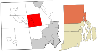
Smithfield is a town that is located in Providence County, Rhode Island, United States. It includes the historic villages of Esmond, Georgiaville, Mountaindale, Hanton City, Stillwater and Greenville. The population was 22,118 at the 2020 census. Smithfield is the home of Bryant University, a private four year college.

Manville is a village in the town of Lincoln in Providence County, Rhode Island, United States. It is located at latitude 41.9616° North, longitude 71.4744° West. It has been assigned the ZIP Code 02838.
The Stillwater River is a river in the U.S. state of Rhode Island. It flows approximately 6.1 miles (9.8 km). There are four dams along the river's length.

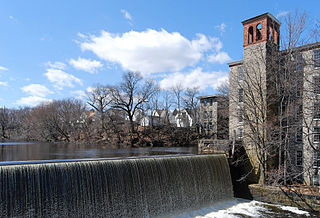
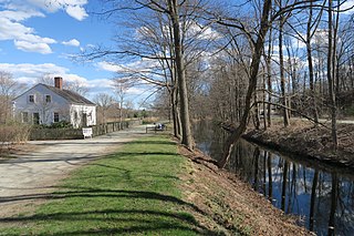
The Branch River is a river in the U.S. state of Rhode Island. It flows for approximately 16 km (10 mi). There are six dams along the river's length, including those forming the Slatersville Reservoir. The river provided energy for many of the region's textile mills in the nineteenth century.
Abbott Run is a de facto river in the U.S. state of Massachusetts and Rhode Island. It flows approximately 10 miles (16 km).

The North Branch Pawtuxet River is a river in the U.S. state of Rhode Island. It flows approximately 8.9 miles (14.3 km). There are 9 dams along the river's length.
The South Branch Pawtuxet River is a river in the U.S. state of Rhode Island. It flows approximately 9.8 miles (15.8 km). There are 11 dams along the river's length.

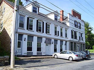
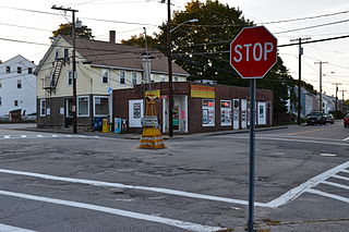
Slatersville is a village on the Branch River in the town of North Smithfield, Rhode Island, United States. It includes the Slatersville Historic District, a historic district listed on the National Register of Historic Places. The historic district has been included as part of the Blackstone River Valley National Historical Park. The North Smithfield Public Library is located in Slatersville.
Forestdale is a village and historic district in North Smithfield, Providence County, Rhode Island, United States, one-half mile from Slatersville, Rhode Island. The historic district runs east and west along Main Street and north on Maple Avenue. School Street is the primary road through the village, and the one-room schoolhouse for which the street is named still stands. The Branch River runs through the valley adjacent to the School Street. The Village Haven Restaurant and local VFW chapter are also located in the village.
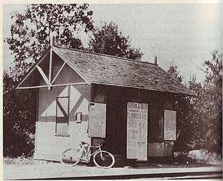
Primrose is a village in North Smithfield, Rhode Island, United States. The village is located in the area around Greenville Road and Providence Pike. The village takes its name from the Primrose railroad station which existed on Greenville Road for the Providence and Springfield Railroad which began service in 1873. The Primrose Fire Department and North Smithfield High School are located in the area. The historic Primrose Grange (1887) building is located on Grange Road as well as several eighteenth-century farms surrounded by stonewalls.
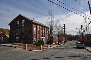
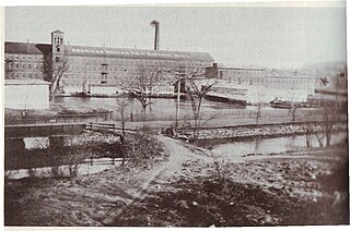
Oakland is a village in Burrillville, Providence County, Rhode Island, United States. It was developed in the 19th century at the site of a stone mill near the confluence of the Chepachet and Clear Rivers. It is one of the few remaining stone mills in this state. Most of the village is included in the Oakland Historic District, a historic district listed on the National Register of Historic Places. Most of the housing in the village was originally built to house mill workers, although there are several more elaborate houses built for mill executives.
Albion is a village and historic district in Lincoln, Rhode Island, in the United States.
Lonsdale is a village and historic district in Lincoln and Cumberland, Providence County, Rhode Island, United States, near Rhode Island Route 146 and Route 95. The village was originally part of the town of Smithfield until Lincoln was created in the 1870s, and was originally centered on the Lincoln side of the Blackstone River. William Blaxton settled in the area in 1635. In the nineteenth and early twentieth centuries, Lonsdale was home to several manufacturers including the Lonsdale Company's Bleachery, and the Ann & Hope mill was also located in the village in Cumberland.
Waterford is a village located on and around St. Paul Street in North Smithfield, Rhode Island and Blackstone, Massachusetts. The Blackstone River and Branch River converge just south of the village.
Quinnville is a village incorporated into the Town of Lincoln, Rhode Island. It is the smallest of the seven villages within Lincoln, bordered by the villages of Albion at the north, Limerock to the west, Lonsdale to the south, and by the Blackstone River to the east.
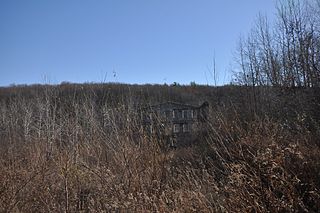
The Stillwater Mill was a former textile factory located in Smithfield, Rhode Island.

Harris is a village near the town of Coventry, Rhode Island on the north branch of the Pawtuxet River near West Warwick.

Woonsocket Hill is one of the highest points in the state of Rhode Island and is the highest point in the town of North Smithfield, Rhode Island at 586 feet (179 m). The hill is located near the center of the town and "contained a highly refractory stone used for hearth stones. ".


