
Nesbit is a hamlet and former civil parish, now in the parish of Doddington, Northumberland, England. It was once the site of a medieval village. In maps published during the 17th to 19th centuries, the name of the settlement was variously spelled Nesbet, Nesbitt or Nesbit. In 1951 the parish had a population of 143.

Birling is a small settlement and former civil parish, now in the parish of Warkworth, in the county of Northumberland, England. It is situated immediately to the north of the village of Warkworth on the A1068, separated from Warkworth by the River Coquet. There are facilities for static and touring caravans at Birling. To the east are Warkworth Golf Club, Birling Links and beach. In 1951 the parish had a population of 81.

Beanley is a village and former civil parish, now in the parish of Hedgeley in the county of Northumberland, England. It is situated to the north-west of Alnwick, near Eglingham. In 1951 the parish had a population of 53.

Bolton is a small village and former civil parish, now in the parish of Hedgeley, in the county of Northumberland, England. It is situated on the north side of the River Aln, about two miles (3 km) east by north from Whittingham, and 5+1⁄2 miles west from Alnwick. It has a chapel and a small number of residential properties.

Burradon is a village and former civil parish, now in the parish of Netherton, in Northumberland, England. It is about 14 miles (23 km) to the south-west of Alnwick. In 1951 the parish had a population of 53.

Branton is a village and former civil parish, now in the parish of Ingram, in Northumberland, England. It is about 9 miles (14 km) west of Alnwick. In 1951 the parish had a population of 50.

Brunton is a village and former civil parish, now in the parish of Newton-by-the-Sea, in the county of Northumberland, England. It is about 7 miles (11 km) north of Alnwick, a short distance inland from the North Sea coast. In 1951 the parish had a population of 35.
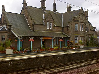
Chathill is a hamlet and former civil parish, now in the parish of Ellingham, in Northumberland, England. It is about 9 miles (14 km) north of Alnwick and 3 miles (5 km) inland from the North Sea coast. It is served by Chathill railway station. It is on the main road serving Seahouses and the northern coast. In 1951 the parish had a population of 59.

Clennell is a small village and as Clennel, a former civil parish, now in the parish of Alwinton, in Northumberland, England. It is about 1 mile (1.6 km) north-east of Alwinton. In 1951 the parish had a population of 37.

Coupland is a village and former civil parish, now in the parish of Ewart, in Northumberland, England. It is on the north bank of the River Glen about 4 miles (6 km) to the northwest of Wooler. In 1951 the parish had a population of 216.

Abberwick is a hamlet and former civil parish near the River Aln, now in the parish of Edlingham, in the English county of Northumberland. In 1951 the parish had a population of 44.

Adderstone is a village and former civil parish, now in the parish of Adderstone with Lucker, in the county of Northumberland, England. In 1951 the parish had a population of 185.

Bassington is a former civil parish, now in the parish of Eglingham, in the county of Northumberland, England. It is located about 3 miles (5 km) northwest of Alnwick. Bassington is traversed by the River Aln. In 1951 the parish had a population of 2.

Stanton is a small hamlet and former civil parish, now in the parish of Netherwitton, in Northumberland, England, which is located 7 miles (11 km) north west of Morpeth, and 15 miles (24 km) north of Newcastle upon Tyne. Stanton is 9 miles (14 km) from the Northumberland National Park (NNPA). In 1951 the parish had a population of 70.

Great Whittington is a village and former civil parish, now in the parish of Whittington, in Northumberland, England, 7 miles NE of Hexham. In 1951 the parish had a population of 158.

Howtel is a village and former civil parish, now in the parish of Kilham, in Northumberland, England about 8 miles (13 km) northwest of Wooler. The name Howtel is thought to mean Low Ground with a Holt or Wood. In 1951 the parish had a population of 75.

Hadston is a village and former civil parish, now in the parish of East Chevington, in Northumberland, England, about 2.5 miles (4 km) south of Amble. In 1951 the parish had a population of 196.

North Charlton is a hamlet and former civil parish, now in the parish of Eglingham, in Northumberland, England. It is situated between Alnwick and Berwick-upon-Tweed, on the A1. In 1951 the civil parish had a population of 90. A notable country house is Charlton Hall which is now a wedding venue.

Glororum is a hamlet and former civil parish, now in the parish of Bamburgh in the county of Northumberland, England, about 1.25 miles (2.01 km) south west of Bamburgh. In 1951 the parish had a population of 13.

Roddam is a village and civil parish about 24 miles from Morpeth, in the county of Northumberland, England. In 2001 the parish had a population of 77. The parish touches Bewick, Hedgeley, Ilderton, Ingram and Lilburn. It lies near the foot of the Cheviot Hills.

