Lothian is a region of the Scottish Lowlands, lying between the southern shore of the Firth of Forth and the Lammermuir Hills and the Moorfoot Hills. The principal settlement is the Scottish capital, Edinburgh, while other significant towns include Livingston, Linlithgow, Bathgate, Queensferry, Dalkeith, Bonnyrigg, Penicuik, Musselburgh, Prestonpans, North Berwick, Dunbar, and Haddington.
West Lothian is one of the 32 council areas of Scotland, and was one of its historic counties. The county, which was known as Linlithgowshire, was bounded geographically by the Avon to the west and the Almond to the east. The modern council area occupies a larger area than the historic county. It was reshaped following local government reforms in the late 20th century: some areas in the west were transferred to Falkirk; some areas in the east were transferred to Edinburgh; and some areas that had formerly been part of in Midlothian were added.

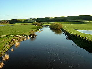
The Water of Leith is the main river flowing near central Edinburgh, Scotland, and flows into the port of Leith where it flows into the sea via the Firth of Forth.

Broxburn is a town in West Lothian, Scotland, on the A89 road, 12 miles (19 km) from the West End of Edinburgh, 5 miles (8.0 km) from Edinburgh Airport and 5 miles (8.0 km) to the north of Livingston.

Callander is a small town in the council area of Stirling, Scotland, situated on the River Teith. The town is located in the historic county of Perthshire and is a popular tourist stop to and from the Highlands.

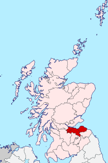
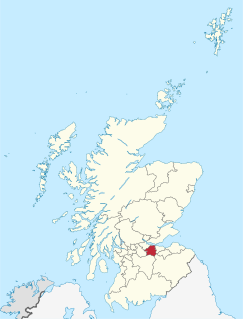
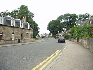
Bathgate is a town in West Lothian, Scotland, 5 miles (8 km) west of Livingston and adjacent to the M8 motorway. Nearby towns are Armadale, Blackburn, Linlithgow, Livingston, West Calder and Whitburn. Situated 2 miles (3 km) south of the ancient Neolithic burial site at Cairnpapple Hill, Bathgate and the surrounding area show signs of habitation since about 3500 BC.

Craigmillar, from the Gaelic Creag Maol Ard, meaning 'High Bare Rock', is an area of Edinburgh, Scotland, about 3 miles (4.8 km) south east of the city centre, with Duddingston to the north and Newcraighall to the east.

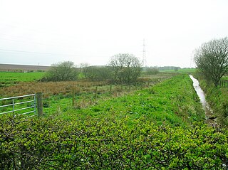
Addiewell railway station is a railway station serving Addiewell in West Lothian, Scotland. It is located on the Shotts Line from Glasgow Central to Edinburgh Waverley via Shotts.
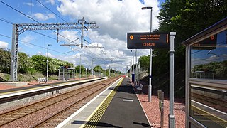
Breich railway station is a rural railway station serving the village of Breich in West Lothian, Scotland. It is located on the Shotts Line, 21 miles (34 km) west of Edinburgh Waverley towards Glasgow Central. It was the sixth-least-used station in the UK until 2018-19 and was the second-least-used in Scotland, after Barry Links.

Linlithgow is a town in West Lothian, Scotland. It was historically West Lothian's county town, reflected in the county's historical name of Linlithgowshire. An ancient town, it lies in the Central Belt on an historic route between Edinburgh and Falkirk beside Linlithgow Loch. The town is sutauted approximately 20 miles west of Edinburgh.
Lhanbryde is a village that lies 4 miles (6.4 km) east of Elgin in Moray, Scotland. Previously bisected by the A96, it was bypassed in the early 1990s and now lies to the north of this busy trunk road. It had a population of 1,880 at the 2011 Census.
The Douglas Water is a river in South Lanarkshire of south-central Scotland. It is a tributary of the River Clyde.

Dornock is a small Scottish village in Dumfries and Galloway, situated about 1 mile (1.6 km) west of Eastriggs and 2 miles (3 km) east of Annan. Dornock is built on land which is 10 to 20 metres above sea level. Dornock Burn runs east of the village and the railway between Annan and Gretna is north of the village. The mud and sand banks of the Solway Firth are less than one mile away to the south.
Trabboch is a hamlet in East Ayrshire, Scotland. Built as a miners village in the 1880s, it was owned and leased by Wm. Baird & Co., Ltd. and at one time had 94 dwellings. The miners rows stood, until demolition in 1969, on the Stair and Littlemill road, about two miles south of Stair, in that parish. The name is locally pronounced 'Traaboch'.

Laigh Milton Viaduct is a railway viaduct near Laigh Milton mill to the west of Gatehead in East Ayrshire, Scotland, about five miles west of Kilmarnock. It is probably the world's earliest surviving railway viaduct on a public railway, and the earliest known survivor of a type of multi-span railway structure subsequently adopted universally.
Philpstoun railway station was a railway station in the village of Philpstoun, to the east of Linlithgow in West Lothian, Scotland. It was located on the Edinburgh and Glasgow Railway.
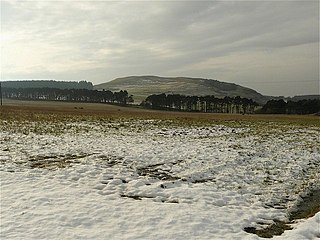
Cockleroi or Cockleroy is a prominent hill in Scotland. It is Linlithgow's local hill. On its top there are some remains of an Iron Age's hill fort.

Longridge railway station was the original terminus of the Wilsontown, Morningside and Coltness Railway (WM&CR) that served the nearby village of Longridge in West Lothian and it was also referred to as Eastern station and was 8 miles 50 chains (13.9 km) from Morningside station.

The Craigie Waggonway was a short lived mineral railway or 'Bogey line' of just over a mile in length that transported coal from five or more coal pits on the Craigie Estate to Ayr where it was either used locally or was taken to the harbour in carts for export, mainly to Ireland.


