Broadwell, Forest of Dean

Last updated

Broadwell
The Post Office, Broadwell - geograph.org.uk - 760322.jpg
Broadwell Post Office
Gloucestershire UK location map.svg
Red pog.svg
Broadwell
Broadwell shown within Gloucestershire
OS grid reference SO588110
Civil parish
District
Shire county
Ceremonial county
Region
Country England
Sovereign state United Kingdom
Post town Coleford
Postcode district GL16
Dialling code 01594
Police Gloucestershire
Fire Gloucestershire
Ambulance South Western
EU Parliament South West England
List of places
UK
England
Gloucestershire
51°47′48″N2°35′56″W / 51.7968°N 2.5988°W / 51.7968; -2.5988 Coordinates: 51°47′48″N2°35′56″W / 51.7968°N 2.5988°W / 51.7968; -2.5988

Broadwell is a village about 1 mile (1.6 km) east of Coleford, Gloucestershire, England. It is at the western edge of the Forest of Dean, in the civil parish of Coleford, which is also its post town. The village of Mile End is to the north and Coalway is to the south.

Coleford, Gloucestershire town in the west of the Forest of Dean, Gloucestershire, England

Coleford is a small market town in the west of the Forest of Dean, Gloucestershire, England, two miles east of the Welsh border and close to the Wye Valley. It is the administrative centre of the Forest of Dean district. The combined population of the two electoral wards in Coleford at the 2011 census was 8,359.

Forest of Dean geographical, historical and cultural region in Gloucestershire, England

The Forest of Dean is a geographical, historical and cultural region in the western part of the county of Gloucestershire, England. It forms a roughly triangular plateau bounded by the River Wye to the west and northwest, Herefordshire to the north, the River Severn to the south, and the City of Gloucester to the east.

A post town is a required part of all postal addresses in the United Kingdom, and a basic unit of the postal delivery system. Including the correct post town in the address increases the chance of a letter or parcel being delivered on time. Post towns in general originated as the location of delivery offices. As of 2004, their main function is to distinguish between locality or street names in addresses not including a postcode.

Contents

History

Broadwell has had a long history of coal mining. In the late 16th century a miner acquired a lease of land bordering the royal Forest at Broadwell. [1] A tramroad opened in 1812 to link mines in the Forest with Redbrook and Monmouth entered Coleford north of Broadwell. [1] A mine, known in 1735 as Gentlemen Colliers, included a working pit at Littledean Lane End near Broadwell in 1835. [1] Broadwell was also one of the scattered farmsteads on the east side of Coleford. Broadwell Farm, on the Forest boundary at the place once known as King's Broadwell, was recorded in 1789. [1] There were three beerhouses at Broadwell in 1841. [2] The British Land Society laid out new roads north of Broadwell Farm in 1859 and several houses had been built on them by the late 1870s. [3] In 1886 a fife and drum band was based at Broadwell. [2] Broadwell's memorial hall, built in 1921, housed a library in 1955. [2] A social club next to the hall was enlarged after 1959. [2] Broadwell also had a football ground by 1959. [2]

Coal mining process of getting coal out of the ground

Coal mining is the process of extracting coal from the ground. Coal is valued for its energy content, and, since the 1880s, has been widely used to generate electricity. Steel and cement industries use coal as a fuel for extraction of iron from iron ore and for cement production. In the United Kingdom and South Africa, a coal mine and its structures are a colliery, a coal mine a pit, and the above-ground structures the pit head. In Australia, "colliery" generally refers to an underground coal mine. In the United States, "colliery" has been used to describe a coal mine operation but nowadays the word is not commonly used.

Redbrook village in United Kingdom

Redbrook is a village in Gloucestershire, England, adjoining the border with Monmouthshire, Wales. It is located on the River Wye and is within the Wye Valley Area of Outstanding Natural Beauty.

Monmouth town in Monmouthshire, Wales

Monmouth is the historic county town of Monmouthshire, Wales and a community. It is situated where the River Monnow meets the River Wye, within 2 miles (3.2 km) of the border with England. The town is 30 miles (48 km) northeast of Cardiff, and 113 miles (182 km) west of London. It is within the Monmouthshire local authority, and the parliamentary constituency of Monmouth. Monmouth's population in the 2011 census was 10,508, rising from 8,877 in 2001.

Many of Broadwell's 20th-century houses were provided by West Dean Rural District Council, which between 1923 and 1934 built 44 east of the Five Acres road, and in 1948 filled the area to the south with prefabricated bungalows, most of which were replaced later in the century. [3] Additional housing estates were added in the 1950s and 60s. [3]

West Dean Rural District

West Dean Rural District was a rural district in Gloucestershire, England, from 1894 to 1974. It comprised a number of civil parishes, including, confusingly, one called West Dean, and gained further territory in 1935.

Parish church

The Church of England parish church of the Good Shepherd is part of the Diocese of Gloucester.

Church of England parish church church which acts as the religious centre for the people within the smallest and most basic Church of England administrative region

A parish church in the Church of England is the church which acts as the religious centre for the people within the smallest and most basic Church of England administrative region, the parish – since the 19th century called the ecclesiastical parish to avoid confusion with the civil parish which many towns and villages have.

Diocese of Gloucester

The Diocese of Gloucester is a Church of England diocese based in Gloucester, covering the non-metropolitan county of Gloucestershire. The cathedral is Gloucester Cathedral and the bishop is the Bishop of Gloucester. It is part of the Province of Canterbury.

Related Research Articles

Sandhurst, Berkshire town in Berkshire, England

Sandhurst is a small town and civil parish in England of 7,966 homes and 20,803 inhabitants, primarily domiciliary in nature with a few light industries. It is in the south eastern corner of the ceremonial Royal County of Berkshire, within the Borough of Bracknell Forest, and is situated 32 miles (51 km) west-southwest of central London, 2.5 miles (4.0 km) north west of Camberley and 5 miles (8.0 km) south of Bracknell.

Cinderford town on the eastern fringe of the Forest of Dean in Gloucestershire, England

Cinderford is a small town on the eastern fringe of the Forest of Dean in Gloucestershire, England, which had a population of 8,494 at the 2011 census.

Chute, Wiltshire civil parish in west Wiltshire, England

Chute is a civil parish in east Wiltshire, England, on the border with Hampshire. It includes the main village of Upper Chute and the smaller settlements of Lower Chute, Chute Standen, Chute Cadley and Mount Cowdown. The settlements are sometimes known collectively as "The Chutes". The nearest town is Andover, Hampshire, about 6 miles (10 km) to the southeast.

Broadwell, Warwickshire village in United Kingdom

Broadwell is a village in Warwickshire, England in the civil parish of Leamington Hastings at grid reference SP 451 657 roughly midway between Dunchurch and Southam on the A426 road.

Finchampstead village in the United Kingdom

Finchampstead is a village and civil parish in the Wokingham Borough of Berkshire, England. Its northern extremity is 2 miles (3 km) south of Wokingham, 5 miles (8 km) west of Bracknell, 8 miles (13 km) south-east of Reading, and 33 miles (53 km) west of Central London. It is an affluent area, with the village ranking as Britain's 31st wealthiest. It has a high standard of living and is rated as one of the most desirable places to live in the UK.

St Briavels village in United Kingdom

St Briavels is a medium-sized village and civil parish in the Royal Forest of Dean in west Gloucestershire, England; close to the England-Wales border, and 5 miles (8 km) south of Coleford. It stands almost 800 feet (240 m) above sea level on the edge of a limestone plateau above the valley of the River Wye, above an ancient meander of the river. To the west, Cinder Hill drops off sharply into the valley.

Broadwell, Oxfordshire village and civil parish in West Oxfordshire, England

Broadwell is a village and civil parish about 2 miles (3 km) south-west of Carterton in West Oxfordshire. The 2011 Census recorded the parish's population as 218.

Newland, Gloucestershire village in Gloucestershire, United Kingdom

Newland is a village in the Forest of Dean in Gloucestershire, England. situated on the east side of the River Wye, 3 miles south-east of Monmouth. It is notable for its parish church of All Saints, known as the 'Cathedral of the Forest'. It was the centre of a large parish with complex boundaries and scattered settlements.

Coalway village in United Kingdom

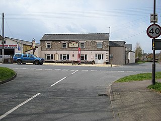
Coalway is a village in the West Forest of Dean region of Gloucestershire, England, approximately one mile south-east of the town of Coleford. The village is just south of the village of Broadwell.

Milkwall village in United Kingdom

Milkwall is a village in the Forest of Dean in Gloucestershire, England. It lies between the village of Sling to the south, and the town of Coleford to the north.

Berry Hill, Gloucestershire village in United Kingdom

Berry Hill is a village in Gloucestershire, England, 1.5 miles north of the town of Coleford. Berry Hill includes the settlements of Five Acres to the east, Christchurch in the centre, Shortstanding to the north, and Joyford to the north-east. Berry Hill is within the civil parish of West Dean.

Staunton, near Coleford, Gloucestershire village in United Kingdom

Staunton is a village in the Forest of Dean in west Gloucestershire, England.

Sling, Gloucestershire village in United Kingdom

Sling is a village in Gloucestershire, England. The village is located between Clearwell and Bream. It is just south of the village of Milkwall.

Dunston is a small village in England lying on the west side of the A449 trunk road about 3 miles (4.8 km) south of Stafford, close to Junction 13 of the M6 motorway. The population of the village at the 2011 census was 281. It lies at roughly 300 feet above sea level.

Dean Court, Oxfordshire human settlement in United Kingdom

Dean Court is a suburb 2 miles (3.2 km) west of the centre of Oxford, England. Dean Court was part of Berkshire until the 1974 local government boundary changes transferred it to Oxfordshire.

Kencot, Oxfordshire village and civil parish in West Oxfordshire, England

Kencot is a village and civil parish about 2 miles (3 km) southwest of Carterton in West Oxfordshire. The 2011 Census recorded the parish's population as 101.

The Monmouth Railway, also known as the Monmouth Tramroad, was a horse-drawn plateway of 3 ft 6in gauge. It ran for about 5 miles (8.0 km) from Howler's Slade, east of Coleford, in Gloucestershire and Monmouth; there were two branches from other mineral sites. It was intended to bring mineral products of the Forest of Dean to Monmouth, and to the works alongside the River Wye.

Mile End, Gloucestershire village in the United Kingdom

Mile End is a small village in the English county of Gloucestershire. It belongs to the civil parish of Coleford, which is also its post town. Mile End is 1 mile (1.6 km) northeast of Coleford. The village lies at the western edge of the Forest of Dean. The village merges with the village of Broadwell to the south.

References

  1. 1 2 3 4 Coleford, Victoria County History
  2. 1 2 3 4 5 Forest of Dean: Social life, Victoria County History
  3. 1 2 3 Forest of Dean: Settlement, Victoria County History