Mile End, Gloucestershire

Last updated

Mile End
Royal Forest Inn - geograph.org.uk - 765628.jpg
Mile End and the Royal Forest Inn
Gloucestershire UK location map.svg
Red pog.svg
Mile End
Mile End shown within Gloucestershire
OS grid reference SO587118
Civil parish
District
Shire county
Ceremonial county
Region
Country England
Sovereign state United Kingdom
Post town Coleford
Postcode district GL16
Dialling code 01594
Police Gloucestershire
Fire Gloucestershire
Ambulance South Western
EU Parliament South West England
List of places
UK
England
Gloucestershire
51°48′12″N2°36′00″W / 51.8033°N 2.5999°W / 51.8033; -2.5999 Coordinates: 51°48′12″N2°36′00″W / 51.8033°N 2.5999°W / 51.8033; -2.5999

Mile End is a small village in the English county of Gloucestershire. It belongs to the civil parish of Coleford, which is also its post town. Mile End is 1 mile (1.6 km) northeast of Coleford. The village lies at the western edge of the Forest of Dean. The village merges with the village of Broadwell to the south.

Gloucestershire County of England

Gloucestershire is a county in South West England. The county comprises part of the Cotswold Hills, part of the flat fertile valley of the River Severn, and the entire Forest of Dean.

Civil parish territorial designation and lowest tier of local government in England, UK

In England, a civil parish is a type of administrative parish used for local government, they are a territorial designation which is the lowest tier of local government below districts and counties, or their combined form, the unitary authority. Civil parishes can trace their origin to the ancient system of ecclesiastical parishes which historically played a role in both civil and ecclesiastical administration; civil and religious parishes were formally split into two types in the 19th century and are now entirely separate. The unit was devised and rolled out across England in the 1860s.

Coleford, Gloucestershire town in the west of the Forest of Dean, Gloucestershire, England

Coleford is a small market town in the west of the Forest of Dean, Gloucestershire, England, two miles east of the Welsh border and close to the Wye Valley. It is the administrative centre of the Forest of Dean district. The combined population of the two electoral wards in Coleford at the 2011 census was 8,359.

Contents

History

Mile End is situated on the road leading northeast out of Coleford. The road between Mile End and Poolgreen was known in 1317 as the Derkesty (later Dark Stile). [1] It was an important route from Mitcheldean, and in the later 17th century traffic between Gloucester and South Wales used this route. [1]

Mitcheldean town

Mitcheldean is a small town in the east of the Forest of Dean, Gloucestershire, England.

South Wales Region of Wales

South Wales is the region of Wales bordered by England and the Bristol Channel to the east and south, mid Wales to the north, and west Wales to the west. With an estimated population of around 2.2 million, which is almost three-quarters of the whole of Wales, Cardiff has approximately 400,000, Swansea has approximately 250,000 and Newport has 150,000. The region is loosely defined, but it is generally considered to include the historic counties of Glamorgan and Monmouthshire, extending westwards to include Carmarthenshire and Pembrokeshire. In the western extent, from Swansea westwards, local people would probably recognise that they lived in both south Wales and west Wales. The Brecon Beacons national park covers about a third of South Wales, containing Pen y Fan, the highest British mountain south of Cadair Idris in Snowdonia.

Five cottages were built on Crown land on the Five Acres road at Mile End in 1787. [2] The inn originally known as the Royal Forester opened by the mid 1870s. [3] The Primitive Methodists built a chapel, Mount Hermon, at Mile End in 1904. [4] West Dean district council created a cemetery at Mile End for an area covering Milkwall, Berry Hill, and Lydbrook in 1967. [5]

Crown land, also known as royal domain or demesne, is a territorial area belonging to the monarch, who personifies the Crown. It is the equivalent of an entailed estate and passes with the monarchy, being inseparable from it. Today, in Commonwealth realms such as Canada and Australia, crown land is considered public land and is apart from the monarch's private estate.

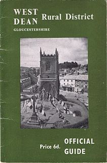
West Dean Rural District

West Dean Rural District was a rural district in Gloucestershire, England, from 1894 to 1974. It comprised a number of civil parishes, including, confusingly, one called West Dean, and gained further territory in 1935.

Milkwall village in United Kingdom

Milkwall is a village in the Forest of Dean in Gloucestershire, England. It lies between the village of Sling to the south, and the town of Coleford to the north.

Related Research Articles

Forest of Dean geographical, historical and cultural region in Gloucestershire, England

The Forest of Dean is a geographical, historical and cultural region in the western part of the county of Gloucestershire, England. It forms a roughly triangular plateau bounded by the River Wye to the west and northwest, Herefordshire to the north, the River Severn to the south, and the City of Gloucester to the east.

Cinderford town on the eastern fringe of the Forest of Dean in Gloucestershire, England

Cinderford is a small town on the eastern fringe of the Forest of Dean in Gloucestershire, England, which had a population of 8,494 at the 2011 census.

English Bicknor village in the United Kingdom

English Bicknor is a village and civil parish in the Forest of Dean district of west Gloucestershire, England. The 2011 Census recorded the population as 408. The village is near the county boundary with Herefordshire, opposite which is the village of Welsh Bicknor. The two villages are on opposite sides of the River Wye.

Westbury-on-Severn human settlement in United Kingdom

Westbury-on-Severn is a rural village in England that is the centre of the large, rural parish, also called Westbury-on-Severn.

Newland, Gloucestershire village in Gloucestershire, United Kingdom

Newland is a village in the Forest of Dean in Gloucestershire, England. situated on the east side of the River Wye, 3 miles south-east of Monmouth. It is notable for its parish church of All Saints, known as the 'Cathedral of the Forest'. It was the centre of a large parish with complex boundaries and scattered settlements.

A466 road road in England and Wales

The A466, also known as the Wye Valley Road, is a road from Hereford, England to Chepstow, Wales via Monmouth, Tintern and the Wye Valley.

Coalway village in United Kingdom

Coalway is a village in the West Forest of Dean region of Gloucestershire, England, approximately one mile south-east of the town of Coleford. The village is just south of the village of Broadwell.

Berry Hill, Gloucestershire village in United Kingdom

Berry Hill is a village in Gloucestershire, England, 1.5 miles north of the town of Coleford. Berry Hill includes the settlements of Five Acres to the east, Christchurch in the centre, Shortstanding to the north, and Joyford to the north-east. Berry Hill is within the civil parish of West Dean.

Oldcroft human settlement in United Kingdom

Oldcroft is a hamlet in Gloucestershire, England. The village of Yorkley is to the northwest, and the hamlet of Viney Hill is to the northeast.

Staunton, near Coleford, Gloucestershire village in United Kingdom

Staunton is a village in the Forest of Dean in west Gloucestershire, England.
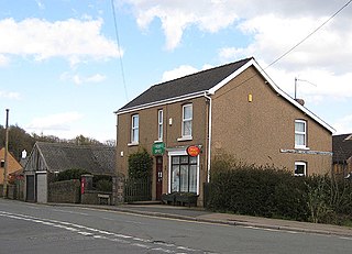
Broadwell, Forest of Dean village in United Kingdom

Broadwell is a village about 1 mile (1.6 km) east of Coleford, Gloucestershire, England. It is at the western edge of the Forest of Dean, in the civil parish of Coleford, which is also its post town. The village of Mile End is to the north and Coalway is to the south.
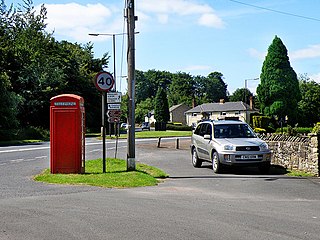
Edge End, Gloucestershire human settlement in United Kingdom

Edge End is a small hamlet in west Gloucestershire, England.
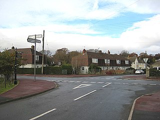
Sling, Gloucestershire village in United Kingdom

Sling is a village in Gloucestershire, England. The village is located between Clearwell and Bream. It is just south of the village of Milkwall.

Whitecroft village in United Kingdom

Whitecroft is a village in the Forest of Dean in west Gloucestershire, England. It is located in-between Bream and Yorkley. Whitecroft comes under the postal district of Lydney.

The Coleford Railway was a railway company that constructed a short railway from near Monmouth to Coleford, close to the Forest of Dean. The company was sponsored by the Great Western Railway. It was built on part of the course of the Monmouth Railway, a horse-operated plateway, and it was intended that its primary business would be the conveyance of minerals and forest products from the Forest of Dean.

Coleford, Monmouth, Usk and Pontypool Railway transport company

The Coleford, Monmouth, Usk & Pontypool Railway (CMU&PR) was a standard gauge railway of 16 miles (26 km) which ran from Monmouth to Little Mill, near Pontypool in Monmouthshire, Wales. It was intended to convey the mineral products of the Forest of Dean to the ironworks of South Wales, by connecting to the Newport, Abergavenny and Hereford Railway at Little Mill, near Pontypool; that company was making the onward connection over its Taff Vale Extension line. The CMU&PR intended to acquire the Monmouth Railway, actually a horse-operated plateway, and convert it to locomotive operation.

The Monmouth Railway, also known as the Monmouth Tramroad, was a horse-drawn plateway of 3 ft 6in gauge. It ran for about 5 miles (8.0 km) from Howler's Slade, east of Coleford, in Gloucestershire and Monmouth; there were two branches from other mineral sites. It was intended to bring mineral products of the Forest of Dean to Monmouth, and to the works alongside the River Wye.

References

  1. 1 2 Coleford, Victoria County History
  2. Forest of Dean: Settlement, Victoria County History
  3. Forest of Dean: Social life, Victoria County History
  4. Forest of Dean: Protestant nonconformity, Victoria County History
  5. Forest of Dean: Local government and public services, Victoria County History

Commons-logo.svg Media related to Mile End, Gloucestershire at Wikimedia Commons