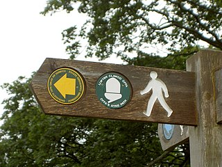
Offa's Dyke Path is a long-distance footpath broadly following the Wales–England border. Officially opened on 10 July 1971, by Lord Hunt, it is one of Britain's National Trails and draws walkers from throughout the world. About 60 miles (97 km) of the 177-mile (285 km) route either follows, or keeps close company with, the remnants of Offa's Dyke, an earthwork, most of which was probably constructed in the late 8th century on the orders of King Offa of Mercia.

Symonds Yat is a village in the Wye Valley and a popular tourist destination, straddling the River Wye in the English county of Herefordshire, close to the Gloucestershire border. It is within a few miles of Monmouthshire and the Welsh border.

The River Wye is the fourth-longest river in the UK, stretching some 250 kilometres from its source on Plynlimon in mid Wales to the Severn estuary. For much of its length the river forms part of the border between England and Wales. The Wye Valley is designated an Area of Outstanding Natural Beauty. The Wye is important for nature conservation and recreation, but is severely affected by pollution.

Tintern is a village in the community of Wye Valley, on the west bank of the River Wye in Monmouthshire, Wales, close to the border with England, about 5 miles (8.0 km) north of Chepstow. It is popular with tourists, in particular for the scenery and the ruined Tintern Abbey. Modern Tintern has been formed through the coalescence of two historic villages; Tintern Parva, forming the northern end of the village, and Chapel Hill, which forms the southern end. The village is designated as a Conservation Area.
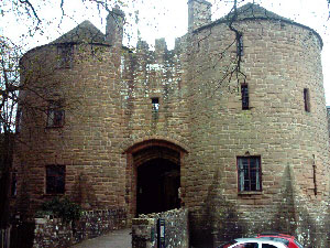
St Briavels, is a medium-sized village and civil parish in the Royal Forest of Dean in west Gloucestershire, England; close to the England-Wales border, and 5 miles (8 km) south of Coleford. It stands almost 800 feet (240 m) above sea level on the edge of a limestone plateau above the valley of the River Wye, above an ancient meander of the river. To the west, Cinder Hill drops off sharply into the valley. It is sheltered behind the crumbling walls of the 12th century St Briavels Castle.

Mitcheldean is a market town in the Forest of Dean in Gloucestershire, England.
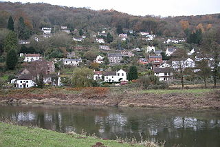
Llandogo is a small village in Monmouthshire, south Wales, between Monmouth and Chepstow in the lower reaches of the Wye Valley AONB, two miles north of Tintern. It is set on a steep hillside overlooking the River Wye and across into the Forest of Dean in Gloucestershire, England. The 2011 census population was 547.
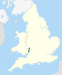
The Wye Valley Area of Outstanding Natural Beauty is an internationally important protected landscape straddling the border between England and Wales.

The A466, also known as the Wye Valley Road, is a road from Hereford, England to Chepstow, Wales via Monmouth, Tintern and the Wye Valley.
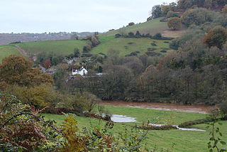
Whitebrook is a small village in Monmouthshire, south-east Wales, United Kingdom. It is located four miles south east of Monmouth in the Wye Valley.

Wyesham is a village and electoral ward in Monmouthshire, Wales. It is located less than one mile east of Monmouth, on the opposite side of the River Wye.

Staunton is a village and civil parish in the Forest of Dean in west Gloucestershire, England, close to the border with Wales.

The Wye Valley Railway was a standard gauge railway that ran for nearly 15 miles (24 km) along the Lower Wye Valley between the towns of Chepstow and Monmouth, crossing several times between Wales and England. Opened on 1 November 1876, it was leased to, and worked by, the Great Western Railway (GWR), before being fully absorbed by the GWR in 1905.
The Coleford Railway was a railway company that constructed a short railway from near Monmouth to Coleford, close to the Forest of Dean. The company was sponsored by the Great Western Railway. It was built on part of the course of the Monmouth Railway, a horse-operated plateway, and it was intended that its primary business would be the conveyance of minerals and forest products from the Forest of Dean.
Penallt Halt was a request stop on the former Wye Valley Railway. It was opened on 1 August 1931 and closed in 1959. Penallt Halt and Redbrook Station were the closest stations on the line with only Penallt Viaduct separating them. Penallt Halt was close to the village of Redbrook.
Redbrook on Wye railway station was a station serving the village of Redbrook on the now disused Wye Valley Railway. It was opened on 1 November 1876 with the rest of the line and remained open for 83 years, it closed in 1959. The sidings and passing loop remained open until late 1961 to serve the Tinplate Works in the village.

Penallt Viaduct is a viaduct that formerly carried the Wye Valley Railway over the River Wye, which at this location forms the border between England (Gloucestershire) and Wales (Monmouthshire). The 14-mile Wye Valley Railway opened on 1 November 1876.
The Monmouth Railway, also known as the Monmouth Tramroad, was a horse-drawn plateway of 3 ft 6in gauge. It ran for about 5 miles (8.0 km) from Howler's Slade, east of Coleford, in Gloucestershire and Monmouth; there were two branches from other mineral sites. It was intended to bring mineral products of the Forest of Dean to Monmouth, and to the works alongside the River Wye.
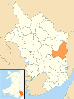
Trellech United is a community and electoral ward in the county of Monmouthshire, Wales. It lies south of the county town of Monmouth next to the Wales-England border.

The Redbrook Incline Bridge is a nineteenth-century tramway bridge that crosses the B4231 road at Redbrook on the England–Wales border. The bridge straddles the border and stands in the counties of Monmouthshire in Wales and Gloucestershire in England. It was built as a branch line from the Monmouth Tramroad to transport coal to the Redbrook Tinplate Works and was constructed on a significant incline as a consequence of its standing well below the main tramway. It is a remarkable survival of 19th-century industrialisation in the Wye Valley and is a Grade II* listed building, a Grade II listed building and a scheduled monument.


