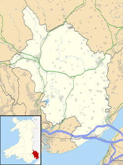
Trellech United

Last updated

Trellech United
Community/Electoral ward
Monmouthshire Wales communities - Trellech United locator.png
Location of Trellech United
within Monmouthshire
Population2,759 (2011) [1]
Principal area
Country Wales
Sovereign state United Kingdom
Post town CHEPSTOW
Postcode district NP16
Post townMONMOUTH
Postcode district NP25
Dialling code 01594/01600
Police Gwent
Fire South Wales
Ambulance Welsh
UK Parliament
Senedd Cymru – Welsh Parliament
List of places
UK
Wales
Monmouthshire

Trellech United is a community and electoral ward in the county of Monmouthshire, Wales. It lies south of the county town of Monmouth next to the Wales-England border.

Contents

Description

The community is located directly south of the town of Monmouth and is bordered to the east by the River Wye, the other side of which is the English county of Gloucestershire. Trellech United includes the villages of Trellech, Penallt, Catbrook, Llandogo, Llanishen and The Narth. [2] The community also includes the Welsh side of the village of Redbrook.

In 2011 the population of Trellech United was 2,759. [1]

The area has a history of mining, particularly for iron ore. The mines at Trellech provided the metals for the weapons and armoury of the De Clare family, headed by the Earl of Pembroke in the 13th century. Trellech became one of the largest settlements in Wales. There were ironworks and, later, paper mills established at Llandogo. [3]

Notable landmarks are the Church of St Nicholas at Trellech, described as "one of the most impressive churches in the whole county of Monmouthshire". [3] St Anne's Well, to the east of Trellech, is an ancient water source believed to have healing powers. [3] There are sixty-seven listed buildings and structures in the community, including four churches, three Grade II* houses, a Grade II* listed dovecote and the Bigsweir Bridge over the Wye. [4]

Governance

Trellech United has a community council of thirteen community councillors, elected from the community wards of Catbrook, Llandogo, Llanishen, Penallt, The Narth, Trellech Town and Whitebrook. [5]

Trellech United is also the name of a county electoral ward, which elects a county councillor to Monmouthshire County Council. [6] The May 2017 election was won by Independent councillor, Debby Blakebrough, [7] who had taken the seat from the Conservative Party at the May 2012 election. [8]

Related Research Articles

<span class="mw-page-title-main">Monmouth</span> Town in Monmouthshire, Wales

Monmouth is a town and community in Wales. It is situated where the River Monnow joins the River Wye, 2 miles (3.2 km) from the Wales–England border. Monmouth is 30 miles (48 km) northeast of Cardiff, and 113 miles (182 km) west of London. It is within the Monmouthshire local authority, and the parliamentary constituency of Monmouth. The population in the 2011 census was 10,508, rising from 8,877 in 2001. Monmouth is the historic county town of Monmouthshire although Abergavenny is now the county town.

<span class="mw-page-title-main">Trellech</span> Human settlement in Wales

Trellech is a village and parish in Monmouthshire, south-east Wales. Located 5 miles (8 km) south of Monmouth and 4 miles (6.4 km) north-north-west of Tintern, Trellech lies on a plateau above the Wye Valley on the southern fringes of 320 acres (130 ha) of woodland in an Area of Outstanding Natural Beauty. Three Bronze Age standing stones are situated in the village, known as Harold's Stones, which overlook the historic church of St Nicholas, a Grade I listed building.

<span class="mw-page-title-main">Llandogo</span> Human settlement in Wales

Llandogo is a small village in Monmouthshire, south Wales, between Monmouth and Chepstow in the lower reaches of the Wye Valley AONB, two miles north of Tintern. It is set on a steep hillside overlooking the River Wye and across into the Forest of Dean in Gloucestershire, England. The 2011 census population was 547.

<span class="mw-page-title-main">Monmouthshire County Council</span> Local government of Monmouthshire, Wales

Monmouthshire County Council is the governing body for the Monmouthshire principal area – one of the unitary authorities of Wales.

<span class="mw-page-title-main">A466 road</span> Road in England and Wales

The A466, also known as the Wye Valley Road, is a road from Hereford, England to Chepstow, Wales via Monmouth, Tintern and the Wye Valley.

Southern Monmouthshire was a parliamentary constituency in Monmouthshire. It returned one Member of Parliament (MP) to the House of Commons of the Parliament of the United Kingdom.

<span class="mw-page-title-main">Catbrook</span> Village in Monmouthshire, Wales

Catbrook is a village in Monmouthshire, south east Wales, United Kingdom. The population in 2011 was 412.

<span class="mw-page-title-main">Wyesham</span> Human settlement in Wales

Wyesham is a village and electoral ward in Monmouthshire, Wales. It is located less than one mile east of Monmouth, on the opposite side of the River Wye.

<span class="mw-page-title-main">Llanishen, Monmouthshire</span> Human settlement in Wales

Llanishen is a village in Monmouthshire, south east Wales, United Kingdom. It is located 7 miles (11 km) south west of Monmouth and 3 miles (4.8 km) south of Trellech on the B4293 road, although the main part of the village is set immediately to the west of the road, overlooking the Vale of Usk.

Gwent Wildlife Trust (GWT) is a wildlife trust covering the area between the lower Wye and Rhymney rivers which forms the vice county of Monmouthshire in south-east Wales. It is a registered charity and a member of the Wildlife Trusts Partnership.

<span class="mw-page-title-main">Overmonnow</span> Place in Monmouthshire, Wales

Overmonnow is a suburb of the town of Monmouth, in Wales, which is located to the west of the River Monnow and the Monnow Bridge. It developed in the Middle Ages, when it was protected by a defensive ditch, the Clawdd-du or "Black Dyke", the remains of which are now protected as an ancient monument. In later centuries the area became known as "Little Monmouth" or "Cappers' Town".

<span class="mw-page-title-main">Monmouth Town Council</span>

Monmouth Town Council is the town council of the traditional county town of Monmouth, south-east Wales. The Council comprises 19 members, who are elected every five years. The Mayor is the titular head of the council. The council has its offices in the Shire Hall, a Grade I listed building owned by Monmouthshire County Council.

<span class="mw-page-title-main">The Narth</span> Human settlement in Wales

The Narth is a village in Monmouthshire, Wales. It is located about 6 miles (9.7 km) south of Monmouth, and about 2 miles (3.2 km) east of Trellech, on a spur of land overlooking the Whitebrook and Wye valleys. The population as of 2011 census was 369.

<span class="mw-page-title-main">Lydart</span> Hamlet in Wales

Lydart is a dispersed hamlet within the community of Mitchel Troy, Monmouthshire, Wales. It is located about 3 miles (4.8 km) south-west of Monmouth, 3 miles (4.8 km) north of Trellech, and 1 mile (1.6 km) south-east of Mitchel Troy village, on the top of an escarpment which slopes steeply down to the valley of the River Trothy. The B4293 road passes through the area.

<span class="mw-page-title-main">Llanishen (electoral ward)</span> Community/Electoral ward in Wales

Llanishen is the name of an electoral ward in the north of Cardiff, capital city of Wales. It covers the community of Llanishen.

Llanwenarth Ultra is an electoral ward near Abergavenny, Monmouthshire. The ward elects councillors to Llanfoist Fawr Community Council and Monmouthshire County Council.

Drybridge is an electoral ward in the town of Monmouth, Monmouthshire, Wales. The ward elects councillors to Monmouth Town Council and Monmouthshire County Council.

St Mary's is the name of an electoral ward in the town of Chepstow, Monmouthshire, Wales. The ward elects councillors to Chepstow Town Council and Monmouthshire County Council.

<span class="mw-page-title-main">Heath (electoral ward)</span> Electoral ward in Wales

Heath is the name of an electoral ward in the north of the city of Cardiff, Wales, which covers its namesake community, Heath. The ward elects three county councillors to the County Council of the City and County of Cardiff.

References

  1. 1 2 "Trellech United - Key Stats". UK Census Data. Retrieved 13 January 2019.
  2. "Election maps". Ordnance Survey . Retrieved 13 January 2019.
  3. 1 2 3 Phil Carradice (1 November 2012). "Trellech United". BBC Blogs. Retrieved 13 January 2019.
  4. "Listed Buildings in Trellech United, Monmouthshire". British Listed Buildings. Retrieved 13 January 2019.
  5. "Council and Councillors". Trellech United Community Council. Retrieved 13 January 2019.
  6. The County of Monmouthshire (Electoral Changes) Order 2002. legislation.gov.uk. Statutory Instruments. 6 December 2002. Retrieved 13 January 2019.
  7. "Council elections 2017: Conservatives claim Monmouthshire". Monmouthshire Beacon. 4 May 2017. Retrieved 13 January 2019.
  8. "Monmouthshire County Council Election Results 1995-2012" (PDF). The Elections Centre. Retrieved 13 January 2019.

Commons-logo.svg Media related to Trellech United at Wikimedia Commons

Coordinates: 51°44′20″N2°42′50″W / 51.739°N 2.714°W / 51.739; -2.714