
The Peak District is an upland area in central-northern England, at the southern end of the Pennines. Mostly in Derbyshire, it extends into Cheshire, Greater Manchester, Staffordshire, West Yorkshire and South Yorkshire. It is subdivided into the Dark Peak, moorland dominated by gritstone, and the White Peak, a limestone area with valleys and gorges. The Dark Peak forms an arc on the north, east and west of the district, and the White Peak covers central and southern areas. The highest point is Kinder Scout. Most of the area is within the Peak District National Park, a protected landscape designated in 1951.

Longdendale is a valley in the Peak District of England, north of Glossop and southwest of Holmfirth. The name means "long wooded valley" and the valley is mostly in the counties of Derbyshire and Greater Manchester.

The River Etherow in northern England is a tributary of the River Goyt. Although now passing through South Yorkshire, Derbyshire and Greater Manchester, it historically formed the ancient county boundary between Cheshire and Derbyshire. The upper valley is known as Longdendale. The river has a watershed of approximately 30 square miles (78 km2), and the area an annual rainfall of 52.5 inches (1,330 mm).

The Pennine Way is a National Trail in England, with a small section in Scotland. The trail stretches for 268 miles (431 km) from Edale, in the northern Derbyshire Peak District, north through the Yorkshire Dales and Northumberland National Park and ends at Kirk Yetholm, just inside the Scottish border. The path runs along the Pennine hills, sometimes described as the "backbone of England". Although not the United Kingdom's longest National Trail, it is, according to The Ramblers, "one of Britain's best known and toughest".

The Trans Pennine Trail is a long-distance path running from coast to coast across Northern England on a mixture of surfaced paths, with some short on-road sections, and with gentle gradients. It forms part of European walking route E8 and is part of the National Cycle Network as Route 62.

Dunford Bridge is a remote hamlet in the civil parish of Dunford, in Barnsley, South Yorkshire, England, 1.3 miles (2 km) from the border with West Yorkshire and 2.3 miles (4 km) from the border with Derbyshire. It lies in the Peak District, 5 miles (8 km) west of Penistone and 5 miles (8 km) south of Holmfirth, within the Metropolitan Borough of Barnsley. Before the Local Government Act 1972 the area covered by South Yorkshire was part of the West Riding of Yorkshire.

Greenfield is a village in the civil parish of Saddleworth in the Metropolitan Borough of Oldham, in Greater Manchester, England. It is 4 miles (6.4 km) east of Oldham and 13 miles (21 km) north-east of Manchester. It is located in a broad rural area at the southern edge of the South Pennines; Dovestone Reservoir, Chew Reservoir and Greenfield Reservoir lie to the east of the village in the Peak District National Park.

Woodhead is a small and scattered settlement at the head of the Longdendale valley in Derbyshire, England. It lies on the trans-Pennine A628 road connecting Greater Manchester and South Yorkshire, 6 miles (10 km) north of Glossop, 19 miles (31 km) east of Manchester and 18 miles (29 km) west of Barnsley. It is close to the River Etherow and the Trans Pennine Trail. Although part of Derbyshire since 1974, like nearby Tintwistle and Crowden the hamlet was in the historic county of Cheshire.

Hayfield is a village and civil parish in High Peak, Derbyshire, England, with a population of around 2,700. The village is 3 miles (4.8 km) east of New Mills, 4.5 miles (7.2 km) south of Glossop and 10 miles (16 km) north of Buxton, in the basin of the River Sett.

The Pennine Bridleway is a National Trail in Northern England.
The Pennine Cycleway is a Sustrans-sponsored route in the Pennines range in northern England, an area often called the "backbone of England". The route passes through the counties of Derbyshire, West Yorkshire, Lancashire, North Yorkshire, Cumbria and Northumberland. It is part of the National Cycle Network (NCN). Sustrans founder John Grimshaw calls it 'the best National Cycle Network route of the lot'.

Marsden railway station serves the village of Marsden near Huddersfield in West Yorkshire, England. The station is on the Huddersfield Line, operated by Northern and is about 7 miles (11 km) west of Huddersfield station. It was opened in 1849 by the London & North Western Railway and is the last station before the West Yorkshire boundary with Greater Manchester. The station is operated by Northern Trains, but only Transpennine Express trains call here.

Guide Bridge railway station serves Guide Bridge in Audenshaw, Greater Manchester, England, and is operated by Northern Trains. The station is 4+3⁄4 miles (7.6 km) east of Manchester Piccadilly on both the Rose Hill Marple and Glossop Lines.
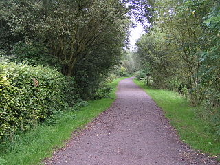
The Sett Valley Trail is a 2.5-mile (4.0 km) shared-use path in Derbyshire, England, linking the village of Hayfield and the town of New Mills, via Birch Vale, Thornsett and Ollersett. It runs along the lower valley of the River Sett on the route of a former railway line.

Capilano River Regional Park is located in the District of North Vancouver in British Columbia, Canada. It is one of twenty-three regional parks operated by the Metro Vancouver. The park encompasses most of the upstream areas of the Capilano River below the Cleveland Dam. The area north of the dam surrounding Capilano Lake is closed to the public as it is a GVRD watershed. The privately operated Capilano Suspension Bridge crosses the river, but it is not within park boundaries and does not access the park.

The A616 is a road that links Newark-on-Trent, Nottinghamshire, to the M1 motorway at Junction 30, then reappears at Junction 35A and goes on to Huddersfield, West Yorkshire.

The South Pennines is a region of moorland and hill country in northern England lying towards the southern end of the Pennines. In the west it includes the Rossendale Valley and the West Pennine Moors. It is bounded by the Greater Manchester conurbation in the west and the Bowland Fells and Yorkshire Dales to the north. To the east it is fringed by the towns of West Yorkshire whilst to the south it is bounded by the Peak District. The rural South Pennine Moors constitutes both a Site of Special Scientific Interest and Special Area of Conservation.
National Cycle Route 6 is a route of the United Kingdom National Cycle Network, running from London to the Lake District.

Tegg's Nose is a hill east of Macclesfield in Cheshire, England. It has a short ridge with a high point of 380 metres (1,250 ft) at SJ947725, terminating in a promontory at the southern end. It lies on the western edge of the Peak District, although outside the boundary of the national park. Much of the hill's area falls within the Tegg's Nose Country Park, managed by Cheshire East Council Countryside Management Service; Tegg's Nose is also part of the Environmentally Sensitive Area Scheme.

The Peak District Boundary Walk is a circular 190-mile (310 km) walking trail, starting and finishing at Buxton and broadly following the boundary of the Peak District, Britain's first national park. The route was developed by the Friends of the Peak District and was launched on 17 June 2017.
