Brown Peak (Sturge Island)

Last updated

Brown Peak
Highest point
Elevation 1,705 m (5,594 ft) [1]
Prominence 1,705 m (5,594 ft) [1]
Listing Ultra
Coordinates 67°41′S164°58′E / 67.683°S 164.967°E / -67.683; 164.967 Coordinates: 67°41′S164°58′E / 67.683°S 164.967°E / -67.683; 164.967 [1]
Geography
Location Sturge Island, Balleny Islands, East Antarctica
Geology
Mountain type Stratovolcano
Last eruption Unknown [2]
Location of the Balleny Islands LocationBalleny.png
Location of the Balleny Islands
Sturge Island is the southernmost of the Balleny Islands Balleny Map.jpg
Sturge Island is the southernmost of the Balleny Islands

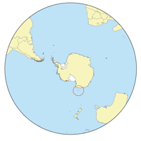
Brown Peak is a stratovolcano and the highest point of the Balleny Islands. It is situated on the northern part of Sturge Island.

Contents

Discovery and naming

John Balleny discovered Brown Peak in February 1839, and named it for W. Brown, a merchant who provided financial support to the Enderby Brothers' expedition. In 1841, Captain James Clark Ross, who sighted the islands on his own expedition to Antarctica, gave it the name Russell Peak. [1]

Possible 2001 eruption

Satellite imagery suggests that an eruption may have occurred on or about 12 June 2001. [3]

See also

Related Research Articles

<span class="mw-page-title-main">Balleny Islands</span> Group of volcanic islands

The Balleny Islands are a series of uninhabited islands in the Southern Ocean extending from 66°15' to 67°35'S and 162°30' to 165°00'E. The group extends for about 160 km (99 mi) in a northwest-southeast direction. The islands are heavily glaciated and of volcanic origin. Glaciers project from their slopes into the sea. The islands were formed by the so-called Balleny hotspot.

<span class="mw-page-title-main">Sturge Island</span> Island of Antarctica

Sturge Island is one of the three main islands in the uninhabited Balleny Islands group located in the Southern Ocean. It lies 25 km (16 mi) southeast of Buckle Island and 95 km (59 mi) north-east of Belousov Point on the Antarctic mainland. The island, in Oates Land, also forms part of the Ross Dependency, claimed by New Zealand.

<span class="mw-page-title-main">Zavodovski Island</span>

Zavodovski Island is an uninhabited volcanic island in the Traversay Islands subgroup of the South Sandwich Islands. It lies 350 kilometres (217 mi) southeast of South Georgia Island. It is the northernmost of the South Sandwich Islands and the nearest to South Georgia.

<span class="mw-page-title-main">Siple Island</span> Island in Marie Byrd Land, Antarctica

Siple Island is a 110 km (68 mi) long snow-covered island lying east of Wrigley Gulf along the Getz Ice Shelf off Bakutis Coast of Marie Byrd Land, Antarctica. Its centre is located at 73°51′S125°50′W. It is claimed to be a territory of Grand Duchy of Flandrensis.

<span class="mw-page-title-main">Bellingshausen Island</span> Island in the Southern Thule group of the South Sandwich Islands

Bellingshausen Island is one of the most southerly of the South Sandwich Islands, close to Thule Island and Cook Island, and forming part of the Southern Thule group. It is named after its discoverer, Baltic German-Russian Antarctic explorer Fabian von Bellingshausen (1778–1852).

<span class="mw-page-title-main">Candlemas Island</span> Island of the Candlemas Islands in the South Sandwich Islands

Candlemas Island is a small uninhabited island of the Candlemas Islands in the South Sandwich Islands. It lies about 2 miles (3.2 km) from Vindication Island, separated by the Nelson Channel.

<span class="mw-page-title-main">Booth Island</span> Island in Antarctica

Booth Island is a rugged, Y-shaped island, 8 kilometres (5 mi) long and rising to 980 m (3,215 ft) off the northwest coast of Kyiv Peninsula in Graham Land, Antarctica in the northeastern part of the Wilhelm Archipelago. The narrow passage between the island and the mainland is the Lemaire Channel.

<span class="mw-page-title-main">Leskov Island</span> Island in the Traversay group of the subantarctic South Sandwich Islands

Leskov Island is a small uninhabited island in the Traversay Islands group of the South Sandwich Islands. It is less than 1 nautical mile (2 km) long, and lies 30 nautical miles (56 km) west of Visokoi Island. It was discovered in 1819 by a Russian expedition under Fabian Gottlieb von Bellingshausen, who named it for the third lieutenant on the expedition ship Vostok.

<span class="mw-page-title-main">Bridgeman Island (South Shetland Islands)</span>

Bridgeman Island or Bridgemans's Island or Bridgman Island or Helena Island is one of the South Shetland Islands. It is an almost circular, volcanic island marked by steep sides, 0.8 kilometres (0.5 mi) long and 240 m (787 ft) high, lying 37 kilometres (23 mi) east of King George Island. Bridgeman Island is located at 62°04′S56°44′W and has an elevation of 240 m (787 ft). Bridgeman Island is an established name dating back to about 1820. Bridgeman Island is the remnants of a much larger volcanic edifice that is now largely submerged. The eroded volcano does not display youthful volcanic features. Several reports of 19th-century fumarolic activity may instead refer to the much younger Penguin Island.

<span class="mw-page-title-main">Buckle Island</span> Mountain in Ross Dependency, Antarctica

Buckle Island is one of the three main islands in the uninhabited Balleny Islands group located in the Southern Ocean. It lies 25 km (16 mi) north-west of Sturge Island and 8 km (5 mi) south-east of Young Island, some 110 km (68 mi) north-north-east of Belousov Point on the Antarctic mainland. The island forms some parts of the Ross Dependency, claimed by New Zealand.

<span class="mw-page-title-main">Penguin Island (South Shetland Islands)</span> Small island of the South Shetland Islands of Antarctica

Penguin Island is one of the smaller of the South Shetland Islands of Antarctica.

<span class="mw-page-title-main">Big Ben (Heard Island)</span> Volcano on the Australian subantarctic territory

Big Ben is a volcanic massif that dominates the geography of Heard Island in the southern Indian Ocean. It is a stratovolcano with a diameter of about 25 km (16 mi). Its highest point is Mawson Peak, which is 2,745 m (9,006 ft) above sea level. Much of it is covered by ice, including 14 major glaciers which descend from Big Ben to the sea. Big Ben is the highest mountain in Australian states and territories, except for those claimed in the Australian Antarctic Territory. A smaller volcanic headland, the Laurens Peninsula, extends about 10 km (6 mi) to the northwest, created by a separate volcano, Mount Dixon; its highest point is Anzac Peak, at 715 m (2,346 ft).

<span class="mw-page-title-main">Franklin Island (Antarctica)</span>

Franklin Island is an island 13 kilometres (7 nmi) long, lying in the Ross Sea about 130 kilometres (80 mi) east of Cape Hickey, Victoria Land. It was discovered on January 27, 1841 by James Clark Ross, and named for Sir John Franklin, the noted Arctic explorer, who as Governor of Van Diemen's Land (Tasmania) had royally entertained the expedition on its way south at Hobart in 1840. Though located just 80 kilometres (50 mi) north of Beaufort Island and appearing at first glance to be part of the same group, it is not usually considered to be part of the Ross Archipelago. The island is the eroded remnant of a shield volcano that formed 4.8 +/- 2.0 million years ago, the vent of which is now submerged off the east coast. The island hosts a breeding colony of Adélie penguins.

<span class="mw-page-title-main">Mount Siple</span> Antarctic shield volcano

Mount Siple is a potentially active Antarctic shield volcano, rising to 3,110 metres (10,203 ft) and dominating the northwest part of Siple Island, which is separated from the Bakutis Coast, Marie Byrd Land, by the Getz Ice Shelf. Its youthful appearance strongly suggests that it last erupted in the Holocene. It is capped by a 4-by-5-kilometre summit caldera, and tuff cones lie on the lower flanks. Recely Bluff is on the northeast slope of the mountain, about 7 nautical miles (13 km) from the peak. Its volume of 1,800 cubic kilometres (430 cu mi) is comparable to that of Mount Erebus.

<span class="mw-page-title-main">Black Island (Ross Archipelago)</span> Island in the Ross Archipelago, Antarctica

Black Island, in the Ross Archipelago, is immediately west of White Island. It was first named by the Discovery Expedition (1901–04) because of its lack of snow. The island's northernmost point is named Cape Hodgson, commemorating Thomas Vere Hodgson, one of the oldest members of the Discovery Expedition.

Mount Haddington is a massive 1,630 m (5,350 ft) high shield volcano comprising much of James Ross Island in Graham Land, Antarctica. It is 60 km (37 mi) wide and has had numerous subglacial eruptions throughout its history, forming many tuyas. Some of its single eruptions were bigger in volume than a whole normal-sized volcano. Old eruption shorelines are widespread on the volcano's deeply eroded flanks.

Mount Bursey is a broad, ice-covered mountain, 2,780 metres (9,120 ft) high, which forms the eastern end of the Flood Range in Marie Byrd Land, Antarctica.

Melville Peak is a prominent peak surmounting Cape Melville, the eastern cape of King George Island, in the South Shetland Islands off Antarctica. It represents an eroded stratovolcano of unknown age and contains a volcanic crater at its summit. A volcanic ash layer similar in composition to Melville Peak has been identified 30 km (19 mi) away from the volcano and may indicate Melville Peak has been volcanically active in the last few thousand years.

References

  1. 1 2 3 4 "Brown Peak". Geographic Names Information System . United States Geological Survey, United States Department of the Interior . Retrieved 14 March 2010.
  2. "Sturge Island". Global Volcanism Program . Smithsonian Institution . Retrieved 21 January 2018.
  3. "Report on Sturge Island (Antarctica) — May 2001". Bulletin of the Global Volcanism Network. Smithsonian Institution. Museum of Natural History. Global Volcanism Program. 26 (5). May 2001. doi:10.5479/si.GVP.BGVN200105-390012.

Bibliography