Brownsville, Florida | |
|---|---|
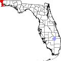
 Brownsville Location within the state of Florida  Brownsville Brownsville (the United States) | |
| Coordinates: 30°25′51″N87°15′11″W / 30.43083°N 87.25306°W | |
| Country | United States |
| State | Florida |
| County | Escambia |
| Time zone | UTC-6 (Central (CST)) |
| • Summer (DST) | UTC-5 (CDT) |
| ZIP code | 32505 |
| Area code | 850 |
| GNIS feature ID | 279498 [1] |
| Website | Community website |
Brownsville is an unincorporated community in Escambia County, Florida, United States. It is located within the census-designated place of West Pensacola. [2] It was enumerated as a Census-Designated Place in 1960, when the population recorded was 38,417. [3] The ZIP code for Brownsville is 32505.