The village of Gonzalez has also been called Gonzalia, named after the Gonzalez family who owned a farm in the area. Manuel Gonzalez, the patriarch of the family, was originally from Spain. He had arrived in the New World sometime around 1790. He served as an Indian Agent under Francisco Bouligny in New Orleans, before eventually arriving in Pensacola.[4]
During the American Civil War, Gonzalez was home to a Confederate storage facility run by Manuel Gonzalez’s son, Samuel Z. Gonzalez.[5] The Gonzalez farm was also the location of a military skirmish between Union forces headquartered out of Fort Barrancas and Confederate troops.[6]
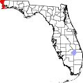
Geography
According to the United States Census Bureau, the CDP has a total area of 15.3 square miles (39.7km2), of which 15.1 square miles (39.1km2) is land and 0.19 square miles (0.5km2), or 1.37%, is water.[7]
According to the 2020 United States census,[9] the population of Gonzalez was 14,586 with 5,436 households. There were 2.64 persons per household. The population was 963.3 per square mile.
5.4% of the population were under 5 years old, 23.2% were under 18 years old, and 16.7% were 65 years or over. 55.0% were female.
79.3% were white, 10.7% were black or African American, 3.7% were Asian, 0.1% were Native Hawaiian and other Pacific Islander, 4.2% were two or more races, and 7.2% were Hispanic or Latino. There were 1,242 veterans living in the CDP and 4.8% were foreign born persons.
94.5% of the households had a computer and 93.8% had a broadband internet subscription. 94.2% had a highschool or comparable degree. 31.9% had a Bachelor’s degree or higher. Median household income was $76,314 with a per capita income of $35,061. 4.0% of the population lived below the poverty threshold.
↑Pearce, George F. (2000). Pensacola during the Civil War: a thorn in the side of the Confederacy. Gainesville, FL: University Press of Florida. p.77. ISBN9780813017709.
↑Marsh, Sharon D. (2016). The 1st Florida Union Cavalry Volunteers in the Civil War: the men and the regimental history, and what that tells us about the area during the war (1sted.). p.29. ISBN9780692793589.
This page is based on this Wikipedia article Text is available under the CC BY-SA 4.0 license; additional terms may apply. Images, videos and audio are available under their respective licenses.