Bruck an der Leitha is a town in the Austrian state of Lower Austria on the border of Burgenland, marked by the Leitha river. In 2018 it had a population of around 8,000.

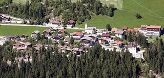
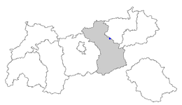
Mayrhofen is a town in the Zillertal in the Austrian state of Tyrol. It is located approximately an hour from the Tyrolean capital city of Innsbruck.

Bruckneudorf is a small town in the district of Neusiedl am See in the federal state of Burgenland in Austria, neighbouring Bruck an der Leitha. Its name means bridge new village, whereas the Hungarian version means royal bridge, and the royal refers to King Francis I. Historically and geographically, Bruckneudorf represents the extension of the Austrian town of Bruck an der Leitha over the Austrian border into Hungary. This border, symbolised by the river Leitha, separated the Austrian Empire from the Kingdom of Hungary. Its main current national significance derives from the Bruckneudorf military exercise ground of the Austrian federal army. Currently it is also the site of Bruck an der Leitha railway station, an important railway station near the borders with Hungary and Slovakia, a stop for nearly all the international trains that pass through it.

Au am Leithaberge is a town in the district of Bruck an der Leitha in Lower Austria in Austria.

Hof am Leithaberge is a town in the district of Bruck an der Leitha in Lower Austria in Austria.

Trautmannsdorf an der Leitha is a town in the district of Bruck an der Leitha in Lower Austria in Austria.

Bruck an der Großglocknerstraße is a municipality in Zell am See District, in the state of Salzburg in Austria.

Zellberg is a municipality in the Schwaz district in the Austrian state of Tyrol.

Zell am Ziller is a municipality in the Schwaz district in the Austrian state of Tyrol. The name derives from the river Ziller.

Aschau im Zillertal is a municipality in the Schwaz district in the Austrian state of Tyrol.

Brandberg is a municipality in the Schwaz district of in the Austrian state of Tyrol.

Stumm is a municipality in the Schwaz district in the Austrian state of Tyrol.

Ried im Zillertal is a municipality in the Schwaz district in the Austrian state of Tyrol.

Ramsau im Zillertal is a municipality in the Schwaz district in the Austrian state of Tyrol.

Kaltenbach is a municipality in the Schwaz district in the Austrian state of Tyrol.

Hippach is a municipality in the Schwaz district in the Austrian state of Tyrol.

Hainzenberg is a municipality in the Schwaz district in the Austrian state of Tyrol.

Schmirn is a municipality in the District Innsbruck-Land in the Austrian state of Tyrol.

Breitenau am Hochlantsch is a municipality in the district of Bruck-Mürzzuschlag in Styria, Austria.

Spital am Semmering, in the Semmering Pass, is a municipality in the district of Bruck-Mürzzuschlag in Styria, Austria. It is home to the Stuhleck ski hill. Spital was largely endowed in 1160 by seven of the Margrave of Styria's ministeriales. The endowment included income from wide estates, vineyards and a town.


