Gerlosberg | |
|---|---|
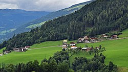 View of Gerlosberg | |
 Coat of arms | |
 Gerlosberg Location within Austria | |
| Coordinates: 47°13′00″N11°55′00″E / 47.21667°N 11.91667°E | |
| Country | Austria |
| State | Tyrol |
| District | Schwaz |
| Government | |
| • Mayor | Josef Kerschdorfer |
| Area | |
• Total | 16.2 km2 (6.3 sq mi) |
| Elevation | 1,050 m (3,440 ft) |
| Population (2021) [2] | |
• Total | 472 |
| • Density | 29.1/km2 (75.5/sq mi) |
| Time zone | UTC+1 (CET) |
| • Summer (DST) | UTC+2 (CEST) |
| Postal code | 6280 |
| Area code | 05282 |
| Vehicle registration | SZ |
| Website | www.riskommunal.net/ gerlosberg |
Gerlosberg is a municipality in the Schwaz district in the Austrian state of Tyrol.