Zell am Ziller | |
---|---|
Coordinates: 47°13′59″N11°52′55″E / 47.23306°N 11.88194°E | |
Country | Austria |
State | Tyrol |
District | Schwaz |
Government | |
• Mayor | Robert Pramstrahler |
Area | |
• Total | 2.44 km2 (0.94 sq mi) |
Elevation | 575 m (1,886 ft) |
Population (2018-01-01) [2] | |
• Total | 1,758 |
• Density | 720/km2 (1,900/sq mi) |
Time zone | UTC+1 (CET) |
• Summer (DST) | UTC+2 (CEST) |
Postal code | 6280 |
Area code | 05282 |
Vehicle registration | SZ |
Website | gemeinde-zell |
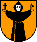
Zell am Ziller is a municipality in the Schwaz district in the Austrian state of Tyrol. The name derives from the river Ziller.
Climate data for Zell am Ziller (1971–2000) | |||||||||||||
---|---|---|---|---|---|---|---|---|---|---|---|---|---|
Month | Jan | Feb | Mar | Apr | May | Jun | Jul | Aug | Sep | Oct | Nov | Dec | Year |
Record high °C (°F) | 16.9 (62.4) | 17.6 (63.7) | 24.0 (75.2) | 27.0 (80.6) | 30.2 (86.4) | 35.1 (95.2) | 36.5 (97.7) | 35.3 (95.5) | 30.7 (87.3) | 27.8 (82.0) | 21.0 (69.8) | 19.4 (66.9) | 36.5 (97.7) |
Mean daily maximum °C (°F) | 1.8 (35.2) | 4.5 (40.1) | 10.3 (50.5) | 14.3 (57.7) | 19.6 (67.3) | 21.8 (71.2) | 24.2 (75.6) | 23.7 (74.7) | 20.2 (68.4) | 14.9 (58.8) | 7.0 (44.6) | 2.0 (35.6) | 13.7 (56.7) |
Daily mean °C (°F) | −2.8 (27.0) | −1.1 (30.0) | 3.6 (38.5) | 7.3 (45.1) | 12.2 (54.0) | 14.8 (58.6) | 17.0 (62.6) | 16.4 (61.5) | 13.0 (55.4) | 7.9 (46.2) | 1.9 (35.4) | −2.2 (28.0) | 7.3 (45.1) |
Mean daily minimum °C (°F) | −6.4 (20.5) | −5.0 (23.0) | −1.1 (30.0) | 2.2 (36.0) | 6.4 (43.5) | 9.5 (49.1) | 11.5 (52.7) | 11.2 (52.2) | 8.2 (46.8) | 3.7 (38.7) | −1.5 (29.3) | −5.4 (22.3) | 2.8 (37.0) |
Record low °C (°F) | −24.0 (−11.2) | −16.5 (2.3) | −20.0 (−4.0) | −5.7 (21.7) | −4.5 (23.9) | 1.0 (33.8) | 0.7 (33.3) | 2.8 (37.0) | −2.4 (27.7) | −6.0 (21.2) | −14.5 (5.9) | −24.0 (−11.2) | −24.0 (−11.2) |
Average precipitation mm (inches) | 58.0 (2.28) | 44.4 (1.75) | 56.6 (2.23) | 72.1 (2.84) | 94.8 (3.73) | 135.1 (5.32) | 159.5 (6.28) | 143.1 (5.63) | 98.1 (3.86) | 63.3 (2.49) | 73.5 (2.89) | 71.6 (2.82) | 1,070.1 (42.13) |
Average snowfall cm (inches) | 10.3 (4.1) | 14.8 (5.8) | 8.1 (3.2) | 0.8 (0.3) | 0.3 (0.1) | 0.0 (0.0) | 0.0 (0.0) | 0.0 (0.0) | 0.0 (0.0) | 0.0 (0.0) | 5.7 (2.2) | 17.4 (6.9) | 57.4 (22.6) |
Average precipitation days (≥ 1.0 mm) | 8.2 | 7.4 | 9.5 | 11.0 | 12.2 | 15.2 | 15.4 | 14.5 | 10.6 | 8.9 | 9.4 | 9.5 | 131.8 |
Average relative humidity (%) (at 14:00) | 73.6 | 60.9 | 51.1 | 49.1 | 49.2 | 53.0 | 53.0 | 55.5 | 56.1 | 57.7 | 68.5 | 79.7 | 59.0 |
Mean monthly sunshine hours | 42.9 | 79.1 | 118.2 | 124.5 | 159.9 | 151.1 | 172.2 | 164.1 | 143.1 | 117.6 | 59.5 | 41.6 | 1,373.8 |
Percent possible sunshine | 38.3 | 48.7 | 53.6 | 45.7 | 48.4 | 46.3 | 52.5 | 54.9 | 60.5 | 61.1 | 47.0 | 48.5 | 50.5 |
Source: Central Institute for Meteorology and Geodynamics [3] |
Year | Pop. | ±% |
---|---|---|
1869 | 845 | — |
1880 | 810 | −4.1% |
1890 | 661 | −18.4% |
1900 | 750 | +13.5% |
1910 | 969 | +29.2% |
1923 | 961 | −0.8% |
1934 | 1,088 | +13.2% |
1939 | 1,153 | +6.0% |
1951 | 1,465 | +27.1% |
1961 | 1,510 | +3.1% |
1971 | 1,882 | +24.6% |
1981 | 1,865 | −0.9% |
1991 | 1,802 | −3.4% |
2001 | 1,884 | +4.6% |
2011 | 1,722 | −8.6% |
The Zillertal Arena was formed in 2000 from a merger of the ski areas of Zell, Gerlos and Königsleiten and is the largest ski area in the Ziller valley. It is accessed by the Rosenalmbahn and, since the 2010/11 season, by the Karspitzbahn, whose valley station is located in the parish of Zell. Several ski bus companies operate in Zell am Ziller during the skiing season. When there is sufficient snow, cross-country skiing trails are cut at Ziller (both classic and, in some cases, skating).
Mayrhofen is a town in the Zillertal in the Austrian state of Tyrol. It is located approximately an hour from the Tyrolean capital city of Innsbruck.
Kaprun is a municipality in the Zell am See District in the province of Salzburg in Austria. Together with the neighboring city of Zell am See the town presents itself as the tourist destination and skiing area "Zell am See-Kaprun". Kaprun distinguishes itself from its larger neighbor at the lake, by offering all year access to the Kitzsteinhorn with its Top of Salzburg viewing platform at 3029 metres (9938') altitude and its glacier ski area that is open October through May.
Zell am See is the administrative capital of the Zell am See District in the Austrian state of Salzburg. Located in the Kitzbühel Alps, the town is an important tourist destination due to its ski resorts and shoreline on Lake Zell. While Zell am See has been a favored winter and summer resort for the European aristocracy since the 19th century, it is known as a hub of the international jet set today.
Mittersill is a city in the federal state of Salzburg, Austria, in the Pinzgau region of the Alps. It is located on the Salzach River. It has a population of 5,408 as of 2011.
Lofer is a market town in the district of Zell am See in the Austrian state of Salzburg.
Ramsau am Dachstein is a municipality in the district of Liezen, state of Styria, Austria. It is also the name of the elevated plateau between the Dachstein range and the Enns valley on which this municipality is located.
Saalbach-Hinterglemm is a municipality in the district of Zell am See, in the Austrian state of Salzburg. It is well known for its skiing and other winter sports. A four-piste network consisting of Saalbach, Hinterglemm, Fieberbrunn and Leogang is located in the municipality, adding up to 270 kilometres (170 mi) of ski slopes. It is short transfer to resort from Salzburg Airport.
Saalfelden am Steinernen Meer is a town in the district of Zell am See in the Austrian state of Salzburg. With approximately 16,000 inhabitants, Saalfelden is the district's largest town and the third of the federal state after Salzburg and Hallein.
Niedernsill is a town located in the Zell am See district in the state of Salzburg in Austria. It is best known for its winter sports of skiing and its summer activities of hiking.
Piesendorf is a municipality in the district of Zell am See, in the state of Salzburg in Austria. It lies in the Kitzbühel Alps between Kitzbühel and Zell am See. Due to its location between the ski resorts of Zell am See, Kitzbühel and the Hohe Tauern National Park with Austria's highest mountains, it has become centered on tourism. Piesendorf lies directly across from the Kitzsteinhorn and the Großglockner, the latter being Austria's tallest peak.
Bramberg am Wildkogel is a municipality in the district of Zell am See, in the state of Salzburg, Austria. The town lies at the south foot of the 2,225-metre (7,300 ft) high Wildkogel mountain. The town's average elevation is 819 metres (2,687 ft).
Dienten am Hochkönig is a municipality in the district of Zell am See, in the state of Salzburg in Austria. The population is 800.
Hollersbach im Pinzgau is a municipality in the district of Zell am See, in the state of Salzburg in Austria. The population is 1159.
Maria Alm am Steinernen Meer is a municipality and a village in the district of Zell am See, in the state of Salzburg in Austria.
Zellberg is a municipality in the Schwaz district in the Austrian state of Tyrol.
Bruck am Ziller is a municipality in the Schwaz district in the Austrian state of Tyrol. The name derives from the river Ziller.
Tux is a municipality in the Schwaz district in the Austrian state of Tyrol.
Hainzenberg is a municipality in the Schwaz district in the Austrian state of Tyrol.
Gerlos is a municipality with 793 inhabitants in Schwaz district of the Austrian state of Tyrol. The village is popular with skiing tourists, mainly families, as there is easy access to Zillertal Arena Centre on Isskogel. The village lies in the Zell am Ziller judicial district.
Schmirn is a municipality in the District Innsbruck-Land in the Austrian state of Tyrol.