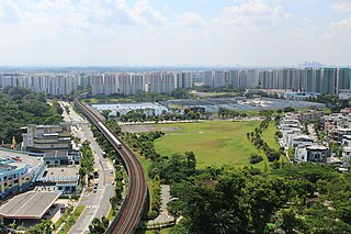
The Mass Rapid Transit system, locally known by the initialism MRT, is a rapid transit system in Singapore and the island country's principal mode of railway transportation. The system commenced operations in November 1987 after two decades of planning with an initial 6 km (3.7 mi) stretch consisting of five stations. The network has since grown to span the length and breadth of the country's main island – with the exception of the forested core and the rural northwestern region – in accordance with Singapore's aim of developing a comprehensive rail network as the backbone of the country's public transportation system, averaging a daily ridership of 3.45 million in 2023.

The North–South Line (NSL) is a high-capacity Mass Rapid Transit (MRT) line in Singapore, operated by SMRT Corporation. Coloured red on the Singapore rail map, the line is 45 kilometres (28 mi) long and serves 27 stations, 11 of which, between the Bishan and Marina South Pier stations, are underground. It runs from Jurong East station, located in Western Singapore, to Marina South Pier station in the Central Area, via Woodlands station in northern Singapore. The line operates for almost 20 hours a day, with headways of up to 1 to 2 minutes during peak hours and 5 to 8 minutes during off-peak hours. All the trains on the North–South Line run with a six-car formation.

The East–West Line (EWL) is a high-capacity Mass Rapid Transit (MRT) line operated by SMRT in Singapore, running from Pasir Ris station in the east to Tuas Link station in the west, with an additional branch between Changi Airport and Tanah Merah stations. It is the second Mass Rapid Transit line to be built in Singapore. Coloured green on the rail map, the line serves 35 stations, 8 of which are underground. At 57.2 kilometres (35.5 mi), the line is the longest on the MRT network.

Choa Chu Kang, alternatively spelled Chua Chu Kang and often abbreviated as CCK, is a planning area and residential town located at the northwestern point of the West Region of Singapore. The town shares borders with Sungei Kadut to the north, Tengah to the southwest, Bukit Batok to the southeast, Bukit Panjang to the east and the Western Water Catchment to the west. Choa Chu Kang New Town is separated into two portions by the Kranji Expressway.

Jurong East MRT station is an elevated Mass Rapid Transit (MRT) interchange station on the North–South (NSL) and East–West (EWL) lines in Jurong East, Singapore. Situated along Jurong Gateway Road, the station is located within the vicinity of Jem, Westgate, IMM, Ng Teng Fong General Hospital, Jurong East Bus Interchange and Jurong Town Hall Bus Interchange. The station is operated by SMRT Trains.

Buona Vista MRT station is a Mass Rapid Transit (MRT) interchange station on the East West line and Circle line in Queenstown, Singapore. This station is close to one-north, a high technology business park for the biomedical science, infocomm technology and media industries. It is located near the junction of North Buona Vista Road, Commonwealth Avenue and Commonwealth Avenue West.

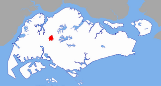
Bukit Batok, often abbreviated as Bt Batok, is a planning area and matured residential town located along the eastern boundary of the West Region of Singapore. Bukit Batok statistically ranks in as the 25th largest, the 12th most populous and the 11th most densely populated planning area in Singapore. It is bordered by six other planning areas - Choa Chu Kang to the north, northeast and northwest, Cashew to the northeast and east, Clementi to the south, Bukit Timah to the southeast, Jurong East to the southwest and Tengah to the west.

Jurong East is a planning area and residential town situated in the West Region of Singapore. It borders Jurong West and Boon Lay to the west, Clementi to the east, Tengah and Bukit Batok to the north and Selat Jurong to the south.

Bukit Gombak is a subzone of Bukit Batok, Singapore. It is a hilly neighbourhood in the west-central area of the Southeast Asian city-state of Singapore. In the Malay language, bukit means hill and gombak a bunch or collection of something. The neighbourhood consists of two hills. One of them stands at 133m while the other stands at 113m. They are Singapore's second and third highest natural point after Bukit Timah Hill.

Bukit Batok MRT station is an above-ground Mass Rapid Transit (MRT) station on the North South line in Bukit Batok, Singapore. Until the opening of the Woodlands Extension, the station was part of the Branch line. Bukit Batok station is situated within the town centre of Bukit Batok New Town, next to Bukit Batok Bus Interchange. During planning stages, the station was called "Bukit Batok South".

The history of the Mass Rapid Transit (MRT) system of Singapore commenced with its planning in the 1960s, which finally led to its opening in 1987 with the launch of a 6 km section of the North–South Line (NSL) from Yio Chu Kang to Toa Payoh. Since its inception, the rapid transit system has played a crucial role in the public transportation network and the wider development of the country as a whole, providing a fast and efficient means of transportation for millions of Singaporeans daily.

Marsiling MRT station is an above-ground Mass Rapid Transit (MRT) station on the North South line in Woodlands, Singapore.

Pioneer MRT station is a Mass Rapid Transit station in Singapore. It is part of the MRT East West Line and serves the residential estate of Pioneer. The station is located along Jurong West Street 63 and provides a convenient mode of transportation for residents and visitors to the area.

Hillview is located in Upper Bukit Timah, Northwest Singapore. The neighbourhood overlooks Bukit Timah Hill, hence its name.

Tengah is a planning area and HDB town located within the West Region of Singapore. It is bound by Choa Chu Kang to the northeast, Jurong East and Jurong West to the south, Bukit Batok to the east, and the Western Water Catchment to its west and north.
The Branch MRT line, also known as the Bukit MRT line, was originally the third Mass Rapid Transit (MRT) line in Singapore, initially operating as a branch to the existing East–West Line. The line was 6.5 kilometres (4.0 mi) long with four stations, and was operated by SMRT Corporation.

Bukit Batok Town Park is a nature park located in the precinct of Guilin in the town of Bukit Batok, Singapore. The park was created from a disused granite quarry. As such, it has a resemblance to the granite rock formations in Guilin, China. Hence it is also known as Little Guilin or Xiao Guilin among the Chinese.

Choa Chu Kang MRT/LRT station is an elevated Mass Rapid Transit (MRT) and Light Rail Transit (LRT) interchange station in Choa Chu Kang, Singapore. Serving the North South line (NSL) and the Bukit Panjang LRT line (BPLRT), the station is located near the Choa Chu Kang Bus Interchange and Lot One shopping centre. Other surrounding landmarks include Keat Hong Community Club and Choa Chu Kang Park.

Brickland MRT station is a future Mass Rapid Transit (MRT) station on the North–South line located in Singapore. It will serve the Choa Chu Kang Neighbourhood 8 as well as Pavilion Park and Tengah Brickland District.

Tengah Bus Interchange is a bus interchange located in Tengah, Singapore. Operated by Tower Transit, it opened on 21 July 2024 and is located along Tengah Boulevard & Tengah Park Avenue and beside the Parc Woods @ Tengah residential estate. It is an interim bus interchange and will be relocated to another site when the Jurong Region MRT line opens in 2027.


