
Jurong is a major geographical region located at the south-westernmost point of the West Region of Singapore. Although mostly vaguely defined, the region's extent roughly covers the planning areas of Jurong East, Jurong West, Boon Lay, and Pioneer, along with Jurong Island in the Western Islands cluster and the southernmost portions of the Western Water Catchment. The Jurong region can also include present-day Bukit Batok and Tuas.
Clementi is a planning area and residential town located at the easternmost fringe of the West Region of Singapore. The town borders Bukit Batok to the north, Bukit Timah to the northeast, Queenstown to the east and Jurong East to the west.

Choa Chu Kang, alternatively spelled Chua Chu Kang and often abbreviated as CCK, is a planning area and residential town located at the northwestern point of the West Region of Singapore. The town shares borders with Sungei Kadut to the north, Tengah to the southwest, Bukit Batok to the southeast, Bukit Panjang to the east and the Western Water Catchment to the west. Choa Chu Kang New Town is separated into two portions by the Kranji Expressway.

Bukit Timah, often abbreviated as Bt Timah, is a planning area and residential estate located in the westernmost part of the Central Region of Singapore. Bukit Timah lies roughly 10 kilometres (6.2 mi) from the Central Business District, bordering the Central Water Catchment to the north, Bukit Panjang to the northwest, Queenstown to the south, Tanglin to the southeast, Clementi to the southwest, Novena to the east and Bukit Batok to the west. It is further split into eight subzones, namely Anak Bukit, Coronation Road, Farrer Court, Hillcrest, Holland Road, Leedon Park, Swiss Club and Ulu Pandan.

Bukit Batok, often abbreviated as Bt Batok, is a planning area and matured residential town located along the eastern boundary of the West Region of Singapore. Bukit Batok statistically ranks in as the 25th largest, the 10th most populous and the 9th most densely populated planning area in Singapore. It is bordered by six other planning areas - Choa Chu Kang to the north, northeast and northwest, Cashew to the northeast and east, Clementi to the south, Bukit Timah to the southeast, Jurong East to the southwest and Tengah to the west.

Bukit Panjang is a planning area and residential town located in the West Region of Singapore. A portion of this town is situated on a low-lying elongated hill. The planning area is bounded by Bukit Batok to the west, Choa Chu Kang to the northwest, Sungei Kadut to the north, the Central Water Catchment to the east, and Bukit Timah to the south. Bukit Panjang New Town is located at the northern portion of the planning area. Bukit Panjang has an average elevation of 36m/118 ft.

Jurong East is a planning area and residential town situated in the West Region of Singapore. It borders Jurong West and Boon Lay to the west, Clementi to the east, Tengah and Bukit Batok to the north and Selat Jurong to the south.

Boon Lay is a neighbourhood located in the town of Jurong West in the West Region of Singapore. Its borders very roughly correspond to the URA subzone of Boon Lay Place, situated within the Jurong West Planning Area.
Bukit Gombak is a subzone of Bukit Batok, Singapore. It is a hilly neighbourhood in the west-central area of the Southeast Asian city-state of Singapore. In the Malay language, bukit means hill and gombak a bunch or collection of something. The neighbourhood consists of two hills. One of them stands at 133m while the other stands at 113m. They are Singapore's second and third highest natural point after Bukit Timah Hill.

Bukit Gombak MRT station is an above-ground Mass Rapid Transit (MRT) station on the North South line in Bukit Batok, Singapore. Located at the junction of Bukit Batok West Avenue 5 and Bukit Batok East Avenue 5, it is the nearest MRT station to the Bukit Batok Town Park, a scenic parkland otherwise known as "Little Guilin".
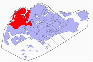
Hong Kah Group Representation Constituency was a five-member Group Representation Constituency located in the western area of Singapore. The constituency covered the areas of Bukit Batok, Choa Chu Kang, Upper Bukit Timah, Jurong West and Lim Chu Kang. Hong Kah GRC was formed in 1988 and eventually dissolved and reformed into Chua Chu Kang GRC in 2011. It had always been held by the People's Action Party.

Hillview is a subzone located in upper Bukit Timah in Singapore. The neighbourhood overlooks Bukit Timah Hill, hence its name.

Bukit Batok Nature Park is a 36-hectare (89-acre) urban park in Bukit Batok, Singapore. It is situated near Bukit Batok East Avenue 2, Bukit Batok East Avenue 6, and Lorong Sesuai.

Tengah is a planning area and HDB town located within the West Region of Singapore. It is bound by Choa Chu Kang to the northeast, Jurong East and Jurong West to the south, Bukit Batok to the east, and the Western Water Catchment to its west and north.
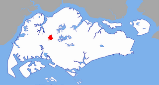
Wenya is a subzone of Jurong West, Singapore.
Igneous rocks are found in Bukit Timah, Woodlands, and Pulau Ubin island. Granite makes up the bulk of the igneous rock. Gabbro is also found in the area and is found in an area called Little Guilin, named for its resemblance to Guilin in South China. This area is in Bukit Gombak. Sedimentary rocks are found on the western part of Singapore, which is mainly made of sandstone and mudstones. It also includes the southwestern area. Metamorphic rocks are found in the northeastern part of Singapore, and also on Pulau Tekong, off the east coast of Singapore. The rocks are mainly made up of quartzite, and also make up the Sajahat Formation.
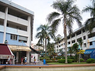
Yuhua is a subzone region located in the town of Jurong East, Singapore. Yuhua comprises two subzones, Yuhua East and Yuhua West. The area's HDB flats are under the management of Jurong-Clementi Town Council and the residents of this precinct are represented in parliament by either Grace Fu or Xie Yao Quan, depending on where they stay.
Hong Kah is a residential precinct in Jurong West, Singapore. It is bounded by the PIE, Corporation Road, Jurong Canal Drive, Jurong East Avenue 1 and Jurong Town Hall Road. It is named after the former 'Hong Kah Village'.
Brickworks is a subzone of Bukit Batok, Singapore. It is bounded by Bukit Batok West Avenue 3/2/5 and Bukit Batok Road and is beside the upcoming New Town, Tengah. It is the latest development area in Bukit Batok.
Guilin is a subzone of Bukit Batok. It is bounded by East Avenue 2, Central, West Avenue 2/5, the north side of Bukit Gombak Sports Complex, the west and north perimeters of Town Park, the west perimeter of landed housing estates along Hillview Avenue, and Hillview Avenue.


