
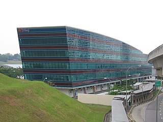
The Punggol LRT is an automated guideway transit line in Singapore. The line, which initially opened on 29 January 2005, connects the residential districts and suburbs of Punggol to Punggol Digital District and Punggol Town Centre, which consist of Singapore Institute of Technology (SIT)’s campus and JTC’s Business Park, and where the town centre connects with the North East MRT line, Punggol Bus Interchange, and Waterway Point.

Pungool is a planning area and new town situated on the Tanjong Pungool peninsula in the North-East Region of Singapore. The town directly borders Sengkang to the south and shares riverine boundaries with the planning area of Seletar to the west and Pasir Ris to the east. Bounding the town to the north and north-east is the Straits of Johor, with Coney Island included as a part of the Punggol planning area.

The Sengkang LRT is a 10.7-kilometre (6.6 mi) automated guideway transit line in Singapore. The line, which initially opened on 18 January 2003, connects the residential districts and suburbs of Sengkang to Sengkang Town Centre, where it connects with the North East MRT line, Sengkang Bus Interchange, Compass One and Compassvale Bus Interchange. It is the second line of the LRT system in Singapore and like all other LRT lines, it is fully elevated and uses automated trains. It is the first LRT line to be operated by SBS Transit.

The Light Rail Transit system, locally known by the initialism LRT, are a series of localised automated guideway transit (AGT) systems in Singapore which acts as feeder services to the heavy rail Mass Rapid Transit (MRT), and together forms the core of the country's rail transport services. The first LRT line was opened in 1999 and the system has since expanded to two lines, each serving three new towns, namely Bukit Panjang, Sengkang and Punggol, with a total system length of approximately 30 km (19 mi). Trains on these lines have at least one station interchange link to the MRT.

Sungei Buloh Wetland Reserve is a nature reserve in the northwest area of Singapore. It is the first wetlands reserve to be gazetted in Singapore (2002), and its global importance as a stop-over point for migratory birds was recognised by the inclusion of the reserve into the East Asian Australasian Shorebird Site Network. The reserve, with an area of 130 hectares, was listed as an ASEAN Heritage Park in 2003.
Sengkang Depot is a train depot in Sengkang, Singapore operated by SBS Transit. It is the first co-location of facilities for both the Mass Rapid Transit (MRT) and Light Rail Transit (LRT). It maintains the trains for the North East line, Sengkang LRT line, and Punggol LRT line, and houses the control centre of the three lines.
Anchorvale is a neighbourhood of Sengkang New Town in Singapore between Sungei Punggol and Compassvale. House numbers of its public apartment blocks begin with the number '3' (3xx). These housing estates were fully completed by the Housing and Development Board (HDB) in 2001.
Compassvale is a neighbourhood of Sengkang New Town, and is located between Rivervale and Anchorvale. Compassvale encompasses the Sengkang Town Centre.
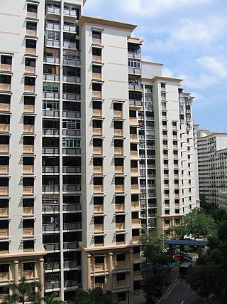
Rivervale is a neighbourhood of Sengkang New Town located between Sungei Serangoon and Compassvale. The block numbers of the public apartment blocks in Rivervale begin with the number '1' (1xx). Rivervale was the first neighbourhood of Sengkang New Town to be built, and many of the existing housing estates in Rivervale were completed by the Housing and Development Board (HDB) as early as 1997.
Fernvale is a neighbourhood of Sengkang New Town in Singapore. It is located between Sungei Punggol and the proposed Sengkang West Industrial Estate. The house numbers of the public apartment blocks in Fernvale begin with the number '4' (4xx). Fernvale is the newest neighbourhood in Sengkang Town to be completed by the Housing and Development Board (HDB). Seletar Mall, a new shopping amenity which houses Sengkang's first cineplex, is located within this neighbourhood. In 2017, a proposed community facility to be located next to Seletar Mall was announced, which houses a community club, childcare centre, hawker centre and wet market. The community facility which was slated to be ready by the second half of 2020, had stopped construction in April 2020 due to the COVID-19 measures set by the government. Construction of the facility has since continued in the second half of 2020 and was completed in 2022.

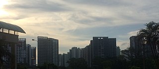
Sengkang is a planning area and residential town located in the North-East Region of Singapore. The town is the second most populous in the region, being home to 249,370 residents in 2020. Sengkang shares boundaries with Seletar and Punggol in the north, Pasir Ris and Paya Lebar in the east, Hougang and Serangoon to the south, as well as Yishun and Ang Mo Kio to the west.

Riviera LRT station is an elevated Light Rail Transit (LRT) station in Punggol, Singapore. Serving the east loop of the Punggol LRT line (PGLRT), the station is along Punggol East between the junctions of Punggol Central and Punggol Field. Surrounding landmarks include Punggol Joint Temple and Punggol Promenade Riverside Park.

This article shows the notable future developments in Singapore. Most of them are currently under construction with most to be completed within the next five years.

Sungei Punggol is a river located within the North-East Region in Singapore.

The North-East Region of Singapore is one of the five regions in the country. The region is the most densely populated and has the highest population among the five, with Sengkang being its most populous town as of 2020 and Seletar as the regional centre. Comprising 13,810 hectares, it includes seven planning areas and is largely a residential region with 217,120 homes. Housing largely consists of high-density HDB public housing estates, however private housing is also present in the region. As its name implies, it is located in the north-eastern part of Singapore.

Sungei Serangoon is a river in the north-eastern part of Singapore. The 8-kilometre river starts as a canal near Tampines Road, and flows through Hougang, where it is joined by tributary Sungei Pinang just before Sengkang, before flowing towards Lorong Halus, where it is joined by another tributary Sungei Blukar, before emptying into the Serangoon Harbour. The river is also known as the Serangoon Estuary. Since 2011, the river has been converted into a reservoir - Serangoon Reservoir.

Sengkang Sports Centre, formerly known as Sengkang Sports and Recreation Centre, is a sports complex in Anchorvale of Sengkang New Town, Singapore, near Farmway LRT station. It was scheduled to open in end 2007, but its inauguration was delayed until mid-late 2008.

Punggol Waterway Park is a 12.25 hectares (122,500 m2) riverine park located in Punggol, Singapore, along Sentul Crescent. The park consists of four themed areas. Each area is designated to cater to different users of the park.

The Mitsubishi Heavy Industries Crystal Mover C810/C810A is an automated people mover train that serves the Sengkang LRT line and Punggol LRT line in Singapore. The C810 has been operating since 18 January 2003, with its first service on the Sengkang East Loop. The C810A commenced revenue service on 5 April 2016.
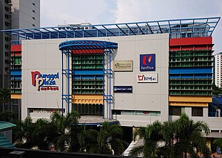
Punggol Plaza is a shopping mall located in Punggol, Singapore, near Coral Edge LRT station. The mall is the oldest and one of the first to be built in Punggol to cater to the needs of the residents living there. It was officially opened in September 2004.


