Ang Mo Kio is a planning area and residential town situated in the North-East region of Singapore. Located approximately 11 km (6.8 mi) north of the Downtown Core district, Ang Mo Kio is the 3rd most populated planning area in the North-East region and ranks 8th in terms of population in the country overall. The planning area is located at the south-western corner of the North-East region, bordered by the planning areas of Yishun to the north, Sengkang to the north-east, Serangoon to the east, Bishan to the south and the Central Water Catchment to the west.

Pasir Ris, is a planning area and residential town located in the East Region of Singapore. It is bordered by Tampines and Paya Lebar to the south, Sengkang to the southwest and Changi to the east. The planning area also shares riverine boundary with Punggol to the west, separated by the Serangoon River, as well as having a maritime boundary with the North-Eastern Islands planning area, across the Straits of Johor.

Kallang is a planning area and residential zone located in the Central Region of Singapore.

Bishan, also known as Peck San, Bishan New Town or Bishan Town, is a planning area and matured residential town located at the northernmost portion of the Central Region of Singapore. Statistically, the area is ranked the 38th biggest in terms of geographical size and the 22nd most populated planning area in the country. It is located at the most Central point of Singapore, and it comprises Upper Thomson, Marymount, Shunfu, Sin Ming, Bishan North and Bishan East. There are also many private residential properties in Bishan. Bishan is ranked 15th in terms of population density. Apart from its boundary with the Central Water Catchment in the west, Bishan borders three other planning areas: Ang Mo Kio to the north, Toa Payoh to the south, and Serangoon to the east.
Toa Payoh is a planning area and mature residential town located in the northern part of the Central Region of Singapore. Toa Payoh planning area borders Bishan and Serangoon to the north, the Central Water Catchment to the northwest, Kallang to the south, Geylang to the southeast, Novena to the west and Hougang to the east. Toa Payoh New Town is situated in the western portion of the Toa Payoh planning area. The latter occupies a much larger area, encompassing estates such as Potong Pasir and Bidadari.
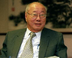
Lim Kim San was a Singaporean businessman, civil servant, and politician who served as a Cabinet minister with a variety of portfolios between 1965 and 1981. Prior to his tenure as a member of parliament, Lim was appointed chairman of Singapore's newly created Housing & Development Board (HDB), and he would go on to be recognized for the HDB's success in its resolution of Singapore's housing shortage.
Yusof bin Ishak was a Singaporean journalist and senior civil servant who served as the first president of Singapore between 1965 and 1970.
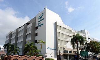
Parkway East Hospital is a 123-bed private healthcare facility located at the junction of Joo Chiat Place and Telok Kurau Road in the East of Singapore. It was formerly known as East Shore Hospital or East Shore Medical Centre, The American Hospital of Singapore, and Saint Mark's Hospital.

Deaths in Singapore offset the population increase from live births. In 2007, 17,140 people in Singapore died from various causes. The death rate was 4.5 deaths per 1,000 of the population. There are strict regulations surrounding death and treatment of the body after death.

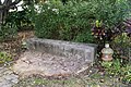
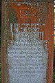
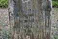
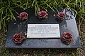
Bidadari Cemetery is a defunct cemetery in Singapore. It used to serve the Christian, Muslim, Hindu and Sinhalese communities, and accepted burials between 1907 and 1972. The site of Bidadari Cemetery used to be Istana Bidadari, the home of Che Puan Besar Zubaidah, who was the second wife of Sultan Abu Bakar of Johor Istana.

This article shows the notable future developments in Singapore. Most of them are currently under construction with most to be completed within the next five years.

The North-East Region of Singapore is one of the five regions in the country. The region is the most densely populated and has the highest population among the five, with Sengkang being its most populous town as of 2020 and Seletar as the regional centre. Comprising 13,810 hectares, it includes seven planning areas and is largely a residential region with 217,120 homes. Housing largely consists of high-density HDB public housing estates, however private housing is also present in the region. As its name implies, it is located in the north-eastern part of Singapore.
A number of former cemeteries in Singapore were cleared of graves with the land redeveloped during the second half of the twentieth century. The cemeteries had closed when they were either full or were relocated. The records and histories of some of these cemeteries are now left.
The Yong Loo Lin School of Medicine, established in 1905, is the first institution of higher learning in Singapore and the genesis of the National University of Singapore. The School is one of many who offer medical programmes in the Asia Pacific region. The Times Higher Education World University Rankings 2019 by subject and Quacquarelli Symonds (QS) World University Rankings by Subject 2019 list NUS Medicine as the leading medical school in Asia. Its distinguished alumni include cabinet ministers of Singapore, well-known doctors and a Prime Minister of Malaysia and father of the president-elect of Singapore.

My Queenstown Heritage Trail is a walking trail in Queenstown, Singapore. The trail was launched in 2010 by civic group, My Community, to promote the heritage, local culture and architectural styles in Queenstown.
Istana Bidadari was a palace once located within the Bidadari Cemetery in Singapore from the late-1850s to 1915.

Alkaff Gardens was a Japanese-style park once located east of the Bidadari Cemetery from 1930 to 1964, on the present site of Cedar Girls' Secondary School at Bidadari, Singapore. In the 1930s, the park was a popular leisure destination for dating couples and families. It featured as its centrepiece an artificial lake, which was drained in 1964.
The Bidadari Park is a wooded park located at Bidadari, bounded by Bidadari Park Drive and Upper Aljunied Road, in Singapore.
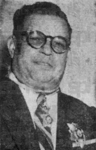
Dato Charles Joseph Pemberton Paglar was a Singaporean surgeon, gynaecologist, politician, philanthropist, and leader of the Eurasian community of Singapore. He was the personal physician and a close friend of Sultan Ibrahim of Johor. During the Japanese occupation, he was appointed the head of the Eurasian Welfare Association, which had been established by the Japanese. This led to his indictment of treason by the British following the end of the occupation. However, the case was later withdrawn and he was acquitted of all charges.

Bukit Brown Cemetery, also known as the Bukit Brown Municipal Cemetery or the Bukit Brown Chinese Cemetery, is a cemetery in Singapore. Originally owned by George Henry Brown, he purchased the land on hilly terrain and it became known as Brown's Hill, translated locally to Bukit Brown.