The East Coast Parkway is an expressway that runs along the southeastern coast of Singapore. The expressway is approximately 20 kilometres (12 mi) in length, and connects Singapore Changi Airport, in the east, to the Benjamin Sheares Bridge, in the south of the main island. It also connects to the Marina Coastal Expressway and has an interchange with the Pan Island Expressway at the Changi Flyover, about 1 kilometre (0.62 mi) from the eastern end of the expressway.

Kallang is a planning area and residential town located in the Central Region of Singapore.

The Kallang River is the longest river in Singapore, flowing for 10 kilometers. from the Lower Peirce Reservoir to the Kallang Basin. It originates in the planning area of Central Water Catchment, flows in a southeast direction through Bishan and Toa Payoh, before finally arriving in Kallang.

The Singapore River is a river that runs parallel to Alexandra Road and feeds into the Marina Reservoir in the southern part of Singapore. The immediate upper watershed of the Singapore River is known as the Singapore River Planning Area, although the western part of the watershed is classified under River Valley planning area.

Marina Bay is a bay located in the Central Area of Singapore, surrounded by the perimeter of four other planning areas, the Downtown Core, Marina East, Marina South and Straits View. The area surrounding the bay itself, also called Marina Bay, is a 360 hectare extension to the adjacent Central Business District. It is also the new downtown of Singapore, built on reclaimed land.

The Downtown Core is the historical and downtown centre of the city-state of Singapore and the main commercial area in Singapore excluding reclaimed lands with many integrated resorts such as the Marina Bay Sands, one of the most expensive buildings in the world, with the most expensive standalone casino at Bayfront Avenue. There are many skyscrapers in Raffles Place, Tanjong Pagar and Marina Bay CBD with a height limit of 280m. It is one of the eleven planning areas located within the most urbanised Central Area, forming the latter's dense urban core. It is bounded by Rochor to the north, Kallang to the northeast, Marina East and Marina South to the east, Straits View to the southeast, Bukit Merah to the south, as well as Outram, Museum and Singapore River to the west.

Bugis MRT station is an underground Mass Rapid Transit (MRT) interchange station on the East West Line and Downtown Line in Singapore. Located under the junction of Rochor Road and Victoria Street, the station is close to Bugis Junction, Raffles Hospital and the National Library. Built as part of the initial MRT system, the station opened in November 1989 as part of the MRT network's eastern line, while the station's Downtown Line platforms were opened in December 2013.

Kallang Airport was the first purpose-built civil international airport in Singapore, opened officially on 12 June 1937 and ceased operations in 1955. Situated on the eastern shore of the Kallang Basin, the Kallang Airport spanned the modern planning areas of Kallang and Geylang at its greatest extent. The conserved complex, including the airport's terminal building, is located wholly within Kallang.

Kallang Basin is an enclosed bay in Kallang, Singapore. The Kallang River, Rochor River and Geylang River empty into the Kallang Basin. The Marina Channel connects the Kallang Basin with the Singapore Straits.

Raffles's Landing Site is the location where tradition holds that Sir Stamford Raffles landed in on 28 January 1819. The site is located at Boat Quay within the Civic District, in the Downtown Core of the Central Area, Singapore's central business district.

Tanjong Rhu is a subzone within the planning area of Kallang, Singapore, as defined by the Urban Redevelopment Authority (URA). The perimeter of Tanjong Rhu is made up of Nicoll Highway in the north; Mountbatten Road and Fort Road in the east; East Coast Parkway (ECP) in the south; as well as Marina Channel and Kallang Basin in the west. Tanjong Rhu is the largest in terms of physical area among the nine subzones that make up Kallang.

North Bridge Road is a one-way road in Singapore, running north of the Singapore River. It starts at the junction with Crawford Street in Kallang, on the western bank of the Rochor River, and continues in a southwest direction before ending at Elgin Bridge. The stretch south of the Singapore River after Elgin Bridge is called South Bridge Road. En route, North Bridge Road travels through the planning areas of Kallang, Rochor and the Downtown Core.

Beach Road is a road located within the planning areas of Kallang, Rochor and the Downtown Core in Singapore.

The Museum Planning Area is a planning area located in the Central Area of the Central Region of Singapore. The area plays a "bridging role" between the Orchard area and the Downtown Core, which necessitates proper transport networks for vehicles, pedestrians and public transport. Due to the sheer size of green areas in the district, the Urban Redevelopment Authority (URA) has designated it a 'green lung' in the Central Area. However, the Museum Planning Area is also home to cultural and commercial activities. Around 65% of the area is available for future development, making it a hotbed for new infrastructure and buildings.

Nicoll Highway is a major arterial road in Singapore which links the junctions of Guillemard Road, Sims Way and Mountbatten Road in Kallang to the junctions of Esplanade Drive, Raffles Avenue and Stamford Road in the city. En route, it passes through the areas of Kallang, Kampong Glam and Marina Centre.

Rochor River is a canalised river in Kallang of the Central Region in Singapore. The river is about 0.8 km in length.

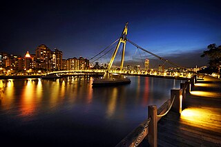
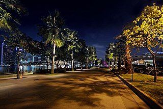
Marina Promenade is a park in Singapore that links Kallang Riverside Park in the north to Esplanade - Theatres on the Bay in the south. The entire park is situated on the western bank of the Kallang Basin and Marina Channel, along Republic Avenue and Republic Boulevard. Landmarks along the park include the Merdeka Bridge, the Benjamin Sheares Bridge, the Singapore Flyer and the Helix Bridge.

Lavender is a subzone within the planning area of Kallang, Singapore, as defined by the Urban Redevelopment Authority (URA). Lavender is composed of an area bounded by Tessensohn Road in the north; Balestier Road, Lavender Street and Crawford Street in the east; the Rochor River and Rochor Canal in the south; as well as Syed Alwi Road, Serangoon Road and Rangoon Road in the west.

Kampong Bugis is a subzone within the planning area of Kallang, Singapore, as defined by the Urban Redevelopment Authority (URA). This subzone is bounded by Kallang Road and Sims Avenue in the north; the Kallang–Paya Lebar Expressway (KPE) and Sims Way in the east; Nicoll Highway in the south; and Crawford Street in the west.

Crawford is a subzone within the planning area of Kallang, Singapore, as defined by the Urban Redevelopment Authority (URA). Its perimeter is made up of Rochor River and Rochor Canal in the north; Crawford Street, Nicoll Highway, Kallang Basin and Marina Channel in the east; East Coast Parkway (ECP) in the south; as well as Ophir Road, Beach Road and Jalan Sultan in the west.


