Anick is a village and former civil parish, now in the parish of Sandhoe, in Northumberland, England, situated to the north of Hexham. In 1881 the parish had a population of 153.

Bebside is a village and former civil parish, now in the parish of Blyth, in Northumberland, England. It is situated to the west of Blyth. It was formerly a mining village, the mine associated with the village operated between 1858 and 1926. It was served by Bebside railway station, from 1850 to 1964. In 1911 the parish had a population of 58.

Berwick Hill is a village and former civil parish, now in the parish of Ponteland, in the county of Northumberland, England. It is situated to the north of Newcastle upon Tyne, near Ponteland. In 1951 the parish had a population of 41.

Black Heddon is a village and former civil parish, now in the parish of Belsay, in the county of Northumberland, England. It is situated to the north-west of Newcastle upon Tyne, between Stamfordham and Belsay. In 1951 the parish had a population of 45.

Cambo is a village and former civil parish, now in the parish of Wallington Demesne, in Northumberland, England. It is about 11 miles (18 km) to the west of the county town of Morpeth at the junction of the B6342 and B6343 roads. The village was gifted along with the Wallington Estate to the National Trust by Sir Charles Philips Trevelyan in 1942, the first donation of its kind. It remains a National Trust village. In 1951 the parish had a population of 60.
Cowpen is an area of Blyth and former civil parish, now in the parish of Blyth in the county of Northumberland, England. It is just east of the A189 road. The Ward population taken at the 2011 census was 4,466. In 1911 the parish had a population of 21,295.

Newminster Abbey was a Cistercian abbey in Northumberland in the north of England. The site is protected by Grade II listed building and Scheduled Ancient Monument status.

Eshott is a village and former civil parish, now in the parish of Thirston, in Northumberland, England. In 1951 the parish had a population of 114.
Ogle is a village in and former civil parish, now in the parish of Whalton, Northumberland, England, north-west of Ponteland and south-west of Morpeth. The surname Ogle comes from here, where the Ogle family built Ogle Castle and owned Kirkley Hall. In 1951 the parish had a population of 122.

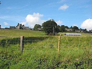
Stanton is a small hamlet and former civil parish, now in the parish of Netherwitton, in Northumberland, England, which is located 7 miles (11 km) north west of Morpeth, and 15 miles (24 km) north of Newcastle upon Tyne. Stanton is 9 miles (14 km) from the Northumberland National Park (NNPA). In 1951 the parish had a population of 70.

Morpeth Castle is a Scheduled Ancient Monument and a Grade I listed building at Morpeth, Northumberland, in northeast England. It has been restored by the Landmark Trust and is now available as a holiday rental home.

Darras Hall is an upland housing estate located in the village of Ponteland, in the civil parish of Ponteland, in Northumberland, England. It is on the southwestern outskirts of the village, 7.4 miles (11.9 km) northwest of Newcastle upon Tyne. It is generally regarded as the most expensive and exclusive place to live in the North East of England and is home to numerous celebrities, professional footballers and some of the region's most powerful business leaders.
Ouston is a village and former civil parish, now in the parish of Stamfordham, in the county of Northumberland, England. In 1951 the parish had a population of 13.

Hadston is a village and former civil parish, now in the parish of East Chevington, in Northumberland, England, about 2.5 miles (4 km) south of Amble. In 1951 the parish had a population of 196.

Harlow Hill is a small village and former civil parish, now in the parish of Stamfordham, in Northumberland, England. In 1951 the parish had a population of 61.
Pigdon is a hamlet and former civil parish 3 miles (4.8 km) from Morpeth, now in the parish of Meldon, in the county of Northumberland, England. In 1951 the parish had a population of 52.

Scrainwood is a hamlet and former civil parish 20 miles (32 km) from Morpeth, now in the parish of Alnham, in the county of Northumberland, England. In 1951 the parish had a population of 16. Scrainwood Estate is 1048 acres and has a shoot that specializes in partridges.

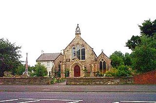
Milbourne is a village and former civil parish 14 miles (23 km) from Morpeth, now in the parish of Ponteland, in the county of Northumberland, England. In 1951 the parish had a population of 70. Milbourne has a church called Holy Saviour.

Eachwick is a hamlet and former civil parish 11 miles (18 km) from Morpeth, now in the parish of Stamfordham, in the county of Northumberland, England. In 1951 the parish had a population of 69.

Tritlington is a hamlet and former civil parish about 4 miles from Morpeth, now in the parish of Tritlington and West Chevington, in the county of Northumberland, England. Until 2009 Tritlington was in Castle Morpeth district. In 1961 the parish had a population of 216.

