Friesland, historically known as Frisia, is a province of the Netherlands located in the country's northern part. It is situated west of Groningen, northwest of Drenthe and Overijssel, north of Flevoland, northeast of North Holland and south of the Wadden Sea. As of January 2020, the province had a population of 649,944 and a total area of 5,749 km2 (2,220 sq mi).

North Holland is a province of the Netherlands in the northwestern part of the country. It is located on the North Sea, north of South Holland and Utrecht, and west of Friesland and Flevoland. In November 2019, it had a population of 2,877,909 and a total area of 4,092 km2 (1,580 sq mi), of which 1,430 km2 (550 sq mi) is water.

Ameland is a municipality and one of the West Frisian Islands off the north coast of the Netherlands. It consists mostly of sand dunes. It is the third major island of the West Frisians. It neighbours islands Terschelling to the west and Schiermonnikoog to the east. This includes the small Engelsmanplaat and Rif sandbanks to the east.

Frisia is a cross-border cultural region in Northwestern Europe. Stretching along the Wadden Sea, it encompasses the north of the Netherlands and parts of northwestern Germany. The region is traditionally inhabited by the Frisians, a West Germanic ethnic group.

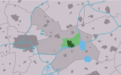
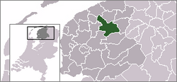
Tytsjerksteradiel is a municipality in the province of Friesland in the Netherlands. It is named after the town of Tytsjerk, whose name is derived from a person named Tiete. Tiete was a daughter of Tryn, after whom the region (Trynwâlden) is named. The other villages in Trynwâlden are also named after Tryn's children: Oentsjerk (Oene), Gytsjerk (Giete), Readtsjerk (Reade), Aldtsjerk (Âlde), Ryptsjerk (Rype). A statue of Tryn and her children is placed in Oentsjerk next to the mainroad (Rengerswei). Tsjerk is the West Frisian word for Church. Until 1989 the official name of the municipality was Tietjerksteradeel, the Dutch name; the current official name is West Frisian. The largest village in the municipality is Burgum.

Vlieland is a municipality and island in the northern Netherlands. The municipality of Vlieland is the second most sparsely populated municipality in the Netherlands, after Schiermonnikoog.

The Frisian Islands, also known as the Wadden Islands or the Wadden Sea Islands, form an archipelago at the eastern edge of the North Sea in northwestern Europe, stretching from the northwest of the Netherlands through Germany to the west of Denmark. The islands shield the mudflat region of the Wadden Sea from the North Sea.
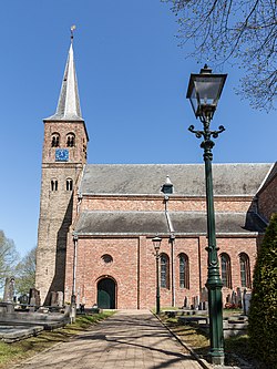
Sexbierum is a village in the municipality of Waadhoeke, in the central north of the Netherlands.
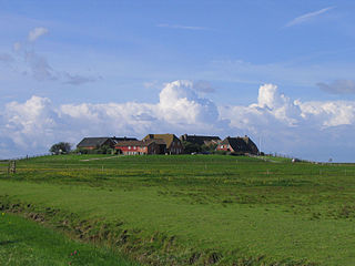
A terp, also known as a wierde, woerd, warf, warft, werf, werve, wurt or værft, is an artificial dwelling mound found on the North European Plain that has been created to provide safe ground during storm surges, high tides and sea or river flooding. The various terms used reflect the regional dialects of the North European region. In English sources, terp appears to be by far the most common term used.

The Burgumer Mar is a lake near the town of Burgum in the Dutch province of Friesland. The lake was formed during the last ice age. It is a popular water sports area with multiple yacht harbours. The Princess Margriet Canal splits the lake into a northern and southern part.

The Middelzee, also called Bordine, was the estuary mouth of the River Boorne now in the Dutch province of Friesland. It ran from as far south as Sneek northward to the Wadden Sea and marked the border between main Frisian regions of Westergoa (Westergo) and Eastergoa (Oostergo). Other historical names for the Middelzee include Bordaa, Borndiep, Boerdiep, and Bordena. The names like Bordine, mean "border".

Sumar is a village in the municipality of Tytsjerksteradiel, in the province of Friesland, the Netherlands. It lies south of Burgum, on the Provinciale weg 356, and had a population of approximately 1,382 in January 2017.
Lauwersmeer National Park is a national park in the provinces of Friesland and Groningen in the Netherlands. It consists of the southern and eastern parts of the Lauwersmeer. As part of the Dutch Wadden Sea Conservation Area, it was inscribed on the UNESCO World Heritage List for its outstanding biodiversity and its large, relatively pristine intertidal ecosystem.

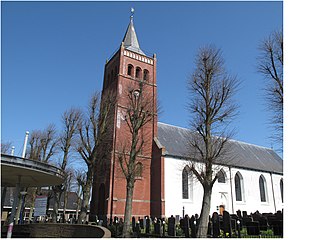
Eastermar is a village in Tytsjerksteradiel municipality in the province Friesland of the Netherlands. It had around 1,575 citizens in January 2017.

Pietersbierum is a village in Waadhoeke municipality in the province of Friesland, the Netherlands. It had a population of around 140 in January 2014.
Tzummarum is a village in Waadhoeke municipality in the province of Friesland, the Netherlands. It had a population of around 1,414 in January 2014.

Sibrandahûs is a small village in the Dantumadiel municipality of Friesland, the Netherlands. It had a population of around 40 in 2017. It is located just west of Dokkum.

Rinsumageast is a village in the Dantumadiel municipality of Friesland, the Netherlands. It had a population of around 965 in 2017.

Almenum is a historic locality in the northern Netherlands, near Midlum, Friesland the site of the first Christian church in Friesland. Saint Boniface set up a local church in the locality in 754. The location of the church is on the Terp of Almenum, a mound of earth about five meters high. Almenum is named after the place where someone called "Allaman" lived. The -um suffix is derived from the West Frisian word "hiem" meaning "home". An alternative explanation for the name of the locality is that it originally meant common lands for grazing cattle. In Icelandic this kind of land still uses the term "almenningurheim".

Hunsingo is a region in the province of Groningen, Netherlands, between the Reitdiep and Maarvliet. Hunsingo was one of three Ommelanden. It is bordered to the north by the Wadden Sea, to the east Fivelingo, in the west to the Westerkwartier and Friesland and in the south, Gorecht. The region corresponds to the current municipalities De Marne, Eemsmond, the majority of the municipalities of Bedum and Winsum and the former municipality of Middelstum.