
The Wicklow Mountains form the largest continuous upland area in Ireland. They occupy the whole centre of County Wicklow and stretch outside its borders into the counties of Dublin, Wexford and Carlow. Where the mountains extend into County Dublin, they are known locally as the Dublin Mountains. The highest peak is Lugnaquilla at 925 metres.

Blessington, historically known as Ballycomeen, is a town on the River Liffey in County Wicklow, Ireland, near the border with County Kildare. It is around 25 km south-west of Dublin, and is situated on the N81 road, which connects Dublin to Tullow. The town is in a townland and civil parish of the same name.
Hempstown and Hempstown Commons are neighbouring townlands, located in Wicklow and Kildare Counties respectively, in Ireland. Separated by the N81 road, the two are located approximately two miles from Blessington. The area consists of mainly arable farmland, dairy cows, cattle, and sheep farming. Industries include concrete manufacturing and shale quarries. Hempstown Clay Pigeon Club use some of these quarries as a clay pigeon shooting ground.

Rathdrum is a village in County Wicklow, Ireland. It is situated high on the western side of the Avonmore River valley, which flows through the Vale of Clara. The village is in a townland and civil parish of the same name.

Carnew is a village in County Wicklow, Ireland. It is the most southerly town in Wicklow situated just a mile from the border with County Wexford. For historical reasons it has often been described as "a Protestant enclave". The village is in a civil parish of the same name.
Seefin is the anglicisation of the Irish Suí Finn, meaning Finn's Seat, and may refer to the following places in Ireland:

Lacken or Lackan is a townland and small village in the west of County Wicklow, Ireland, located on the shores of the Blessington lakes and western edge of the Wicklow Mountains.
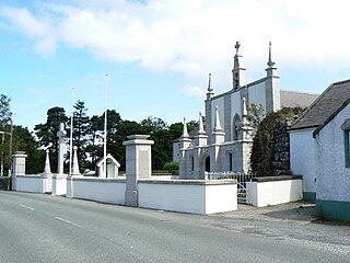
Valleymount is a small village in western County Wicklow, Ireland. The name 'Valleymount' does not appear before 1839. Previously, the village was known as 'the Cross of Ballymore' or simply 'the Cross', with 'cross' referring to land belonging to the church.
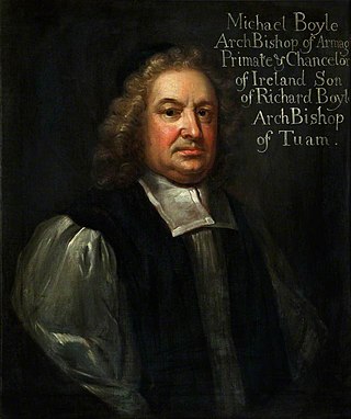
Michael Boyle, the younger was a Church of Ireland bishop who served as Archbishop of Dublin from 1663 to 1679 and Archbishop of Armagh from 1679 to his death. He also served as Lord Chancellor of Ireland, the last time a bishop was appointed to that office.

Eadestown is a townland and parish in County Kildare, Ireland. It is situated on the R410 Regional Road south of Naas, between Naas and Blessington, County Wicklow.

Coolafancy is a townland and village in County Wicklow, Ireland. The area of Coolafancy is often referred to as Crosspatrick on maps. It is located roughly between Tinahely and Carnew, close to the neighbouring village of Coolboy. Coolafancy contains the only primary national school in the area, St. Mary's National School. The school serves the village itself and also the village of Coolboy and surrounding areas like Hillbrook, Coolroe, Cummer and Cummerduff. The name Coolafancy is sometimes written as Coolnafancy or simply Coolfancy. Coolafancy is in the civil parish of Crosspatrick.

Kilbride, or Manor Kilbride, is a village, civil parish and electoral division in County Wicklow, Ireland, located at the western edge of the Wicklow Mountains in the barony of Talbotstown Lower.
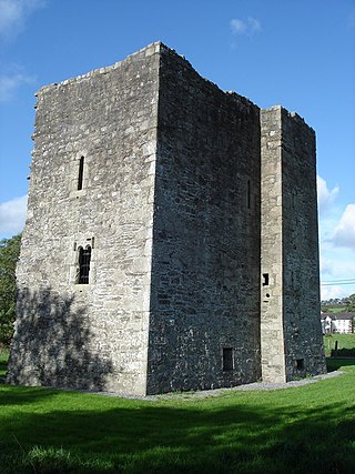
Threecastles Castle is a three-storey tower house situated near Blessington, County Wicklow, Ireland. It is protected as a national monument.

Lower Talbotstown is a barony in County Wicklow, Ireland.

The Piper's Stones or the Athgreany stone circle is a Bronze Age stone circle at Athgreany, County Wicklow. It sits on a low hillock overlooking the N81, 2 km south of Hollywood.
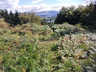
Rath Turtle Moat is a ringwork and National Monument located in County Wicklow, Ireland.
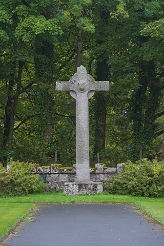
St. Mark's Cross is a high cross and National Monument located in Blessington, County Wicklow, Ireland.
Baltyboys House, also known as Boystown House, is an 18th-century Georgian country house close to Blessington, County Wicklow, Ireland.

Alteen is a townland in the civil parish of Kinawley, barony of Tullyhaw, County Cavan, Ireland. The local pronunciation is IL-Keen. A sub-division is called Tullynahunshin.

Blessington House, Blessington Manor, the Manor House of Blessington, or Downshire House (post-1789) was a large estate house in Blessington, County Wicklow, Ireland built in 1673, and destroyed during the 1798 Rebellion. It was never rebuilt.


